|
|
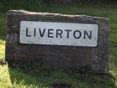
Liverton
Historical and geographical information
|
|
Dates
are in red.
Hyperlinks
to other pages are in dark
blue.
Headlines
of the history of the Liverton are in brown.
References
and citations are in turquoise.
Contextual
history is in purple.
This
webpage about the Liverton has the following section headings:
- The Farndales of Liverton
- Liverton, an overview
- Timeline of Liverton
- Links,
texts and books
The Farndales of Liverton
The
Liverton 1 Line were the
descendants of Rychards ffarnedayle (FAR00075)
(born 3 February 1604). Rychards moved his
family to Liverton from Skelton. The Liverton 2 Line were the
descendants of Nicholas Farndale (FAR00082)(6
July 1634 to 28 February 1693/4). A Liverton Family, Nicholas had
four children from his first marriage and two from his second.
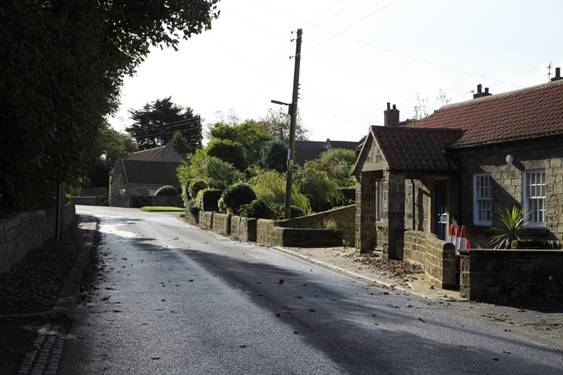
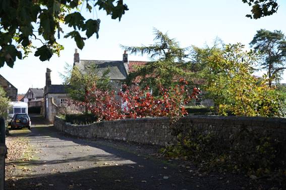
Liverton
Liverton is a village
in the borough of Redcar and Cleveland and the ceremonial
county of North Yorkshire, England. It is located 140 meters above
sea level and is located on the edge of the North Yorkshire Moors.
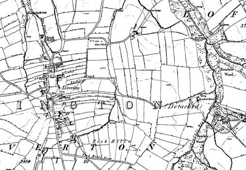
The Victoria County History – Yorkshire, A History of the
County of York North Riding: Volume 2 Parishes: Liverton, 1923: Liverton
(Liureton (eleventh century); Liverton,
Leverton (thirteenth and fourteenth centuries) is a parochial
chapelry ecclesiastically dependent on Easington and a township under the
Loftus Urban District Council. Its area is 2,457 acres of land, of which 678
acres are arable, 1,011 acres permanent grass, 205 acres woods and plantations
and 4 acres covered by water. The subsoil is inferior oolite and Oxford clay,
the soil clay and gravel, the crops raised being chiefly wheat, barley, beans and oats. The iron mines, which belong to Viscount
Downe and are leased to the Cargo Fleet Iron Co. Ltd., were opened by 1874 and
large quantities of ironstone are now sent to Middlesbrough for smelting. The
village of Liverton is built on a by-road which runs from Loftus south to the
moors. In the fields some distance to the north is the old chapel, now called
the church of St. Michael. By the beck is Park House, a farm to which a park is
attached. This may represent the capital messuage of the manor mentioned in the
14th century and the park of Halikeldale referred to
in the 13th century and later. Liverton has a Wesleyan chapel and a public
elementary school.
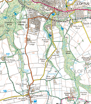
Liverton Mines is a
separate village, about 2km north of Liverton, on the outskirts of Loftus.
Liverton Timeline
1086
Liverton Village is named
in the doomsday book and was previously named Liureton.
In 1086 7 carucates in Liverton were soke of the 'manor' of Loftus; they were
afterwards under the overlordship of the lords of Loftus.
Topographical
Dictionaries, A Topographical Dictionary of England, 1848: This place, which at the time of
the Domesday survey was a barren and unprofitable waste, was granted by the
Conqueror to Robert de Brus, lord of Skelton, from whose descendants it passed,
through the family of Thweng, to the Latimers, Willoughbys, and others.
Twelfth
century
The village can date its
roots back to the 12th century, with evidence of this seen from the font, arch and doorway of St Michaels church. There is further
evidence of a medieval settlement in area.
The Parish Church of St
Michaels dates back to the 12th century. The
font, arch and doorway are from that time. Alterations over the years have kept
the church in good state and retained the original structure. The church was
restored at the beginning of the 20th century and the plaster was removed
from the Chancel arch.

St Michaels Church
1180
The Victoria County History – Yorkshire, A History of the
County of York North Riding: Volume 2 Parishes: Liverton, 1923: Robert
de Liverton in about 1180 granted to Whitby Abbey tenements in 'Holmesclive,' Waytail (Waytehil) and 'Hutcroft' here. In
another grant to the abbey he mentions the footpath
from Gerrick (Grenerig), 'Scalebec,'
'Luskeldesic' or 'Luscheldesic'
stretching from the coast road to 'Dunscinghales' or
'Duncilghales' and from the cultivated land to 'Scortebuttes,' and the road and land of 'Stuntheridighe' to the footpath from Loftus.
Thirteenth
century
The Victoria County History – Yorkshire, A History of the
County of York North Riding: Volume 2 Parishes: Liverton, 1923: The
13th-century names 'Ravensike,' 'Trebersike'
and 'Scortlandes' occur.
1720
Tickhill
House Farm and Cottages (Middle House and Haygate
Cottage) - dating back to 1720, List Entry Number 1136629
1800
Shrubberies
Cottage and Farm - dating back to 1800, list Entry Number 1139678.
1848
Topographical Dictionaries, A Topographical Dictionary of England,
1848: The chapelry
comprises 2,393 acres, of which a very considerable portion is high moorland.
The village is situated about midway between the sea and the road from Whitby
to Guisborough, and consists chiefly of houses
irregularly scattered along the edge of a common.
1857
1866
The
separate village of Liverton Mines had an ironstone pit outside the village,
located in the Cleveland Ironstone belt. The pit was opened in 1866 and closed
in 1923.
1870
In 1870-72, John Marius Wilson's Imperial Gazetteer of England and
Wales described Liverton like this: LIVERTON, a township-chapelry in
Easington parish, N. R Yorkshire; 6¼ miles E of Guisbrough
town and r. station. Post town, Redcar. Acres, 2,400. Real property, £1,216.
Pop., 186. Houses, 38. The manor belongs to Viscount Downe. The living is a p.
curacy, annexed to the rectory of Easington, in the diocese of York. The church
is partly Norman.
1962
There is a village Inn
called The Waterwheel Inn. Located on the edge of the village, the pub reopened
in 1962 and is a traditional building with beams on show and built from
sandstone.
2016
Links, texts and books