Ancient Routes across the moors
Exploring
the ancient routes across the moors around Farndale
|
Return to the Home Page of the Farndale Family
Website |
The story of one family’s journey through two
thousand years of British History |
The 83 family lines into which the family is divided.
Meet the whole family and how the wider family is related |
Members of the historical family ordered by date of
birth |
Links to other pages with historical research and
related material |
The story of the Bakers of Highfields, the Chapmans,
and other related families |
Hyperlinks to other pages are in dark blue.
Headlines of the history of Brotton are in brown.
References and citations are in turquoise.
Contextual history is in purple.
Medieval routes
across the North York Moors
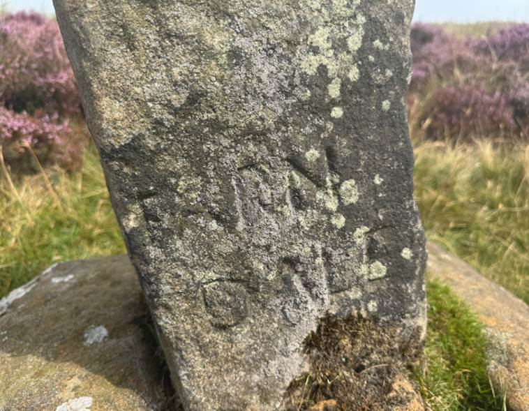
Farndale on the Cockan Cross on Waingate
Raymond Hayes
undertook a survey of the roads tracks and pannier trods
across the North York Moors for the National Park in 1988, and in doing so
revealed the extent of routes of medieval times and earlier across the moors
above Farndale. To follow these old trackways, especially the ridgeways,
gives a unique insight into the toils and difficulties of travel in the middle
ages. They quickly become muddy and, in winter, snowbound. There were few guide
stones until after 1711 when the Justices at Northallerton ordered Guide Posts
to be erected at crossways throughout the North Riding.
The
oldest routes across the moors were almost certainly ridgeways following the
high ground between the dales, such as Blakey Rigg and Rudland Rigg. They
usually kept on firm ground avoiding bogs or rocky ground. On slopes they
tended to form hollow-ways. These were narrow and in winter the sides
collapsed, blocking the track, or they were blocked by snow. Hence the tendency
was to try to avoid bad sections by using alternative ridges, so forming
parallel hollow-ways as found on the Thurkilisti on Skiplam Ridge or north of Spaunton and Lastingham.
Not
until Roman times was a well paved Causeway constructed: Wade's Causeway, part
of which remain between Stape and Lease Rigg.
(Old Roads and Pannierways in North East Yorkshire, Raymond H Hayes MBE, FSA, 1988, page 7).
Besides
the Roman road, Wade’s Causeway (see below), many other routes must have been
used, though probably were never paved. Packhorses, oxen and donkeys were the
main means of transport, and the trackways over the moors – the Hambleton
Street, Magna Via, Thurchilisti and others, would all
be in use. Every moorland ridge had its trackway, similar to the present turf
roads, hollow tracks marked by cairns and burial mounds of the pre-Roman era. (A History of Helmsley Rievaulx and District, editor, J McDonnell, 1963, page 47).
We
have several references to roads in the Ryedale Charters. (Old Roads and Pannierways in
North East Yorkshire, Raymond H Hayes
MBE, FSA, 1988, page 8, Appendix B).
Fish,
salt, lime and coal were carried along these tracks from early medieval times
till right into the nineteenth century, and were joined at various periods by
many other commodities such as alum (from Guisborough to West Riding) and
contraband silks and spirits not to mention the cattle and sheep of the
Scottish drovers. (A History of Helmsley Rievaulx and District,
editor, J McDonnell, 1963, page 69).
Bridging
the uncultivated wild between England’s villages and little towns ran the roads
trodden by growing numbers of men and horses. The metalled highways with which
Rome had spanned the country had long become a ghostly network, their paved
surfaces defaced, their causeways broken by quarrying, and their course
deflected to serve local needs. The Medieval road did not run straight from
city to city. It meandered round field, park and pale, respecting a thousand
local ‘liberties’ and quirks of history. It was not surfaced for wheeled
traffic or swift travelling. It was merely a grassy track way for horses,
carts, cattle and sheep. It was not so much a road as a route over which
travellers had a right to pass. The proprietors along its
course were under an obligation to keep it open. No one might raise a fence
across it, or dung heaps, or use it for quarrying stone and gravel. Such
encroachments were subject to fines. In winter, the soft roads became quagmires,
in summer, a maze of hard baked hoof folds. So much of the countryside was
waste, it was easy to make a detour across adjoining land. This created a
multiplicity of tracks and made it easy to lose the way. (The
Medieval Foundation of England, 1967, Arthur Bryant, page
184).
Medieval
roads were often distinguished as strata regalis or regalis via,
or royal roads; magna via, a great road; and via communa,
public roads and village streets.
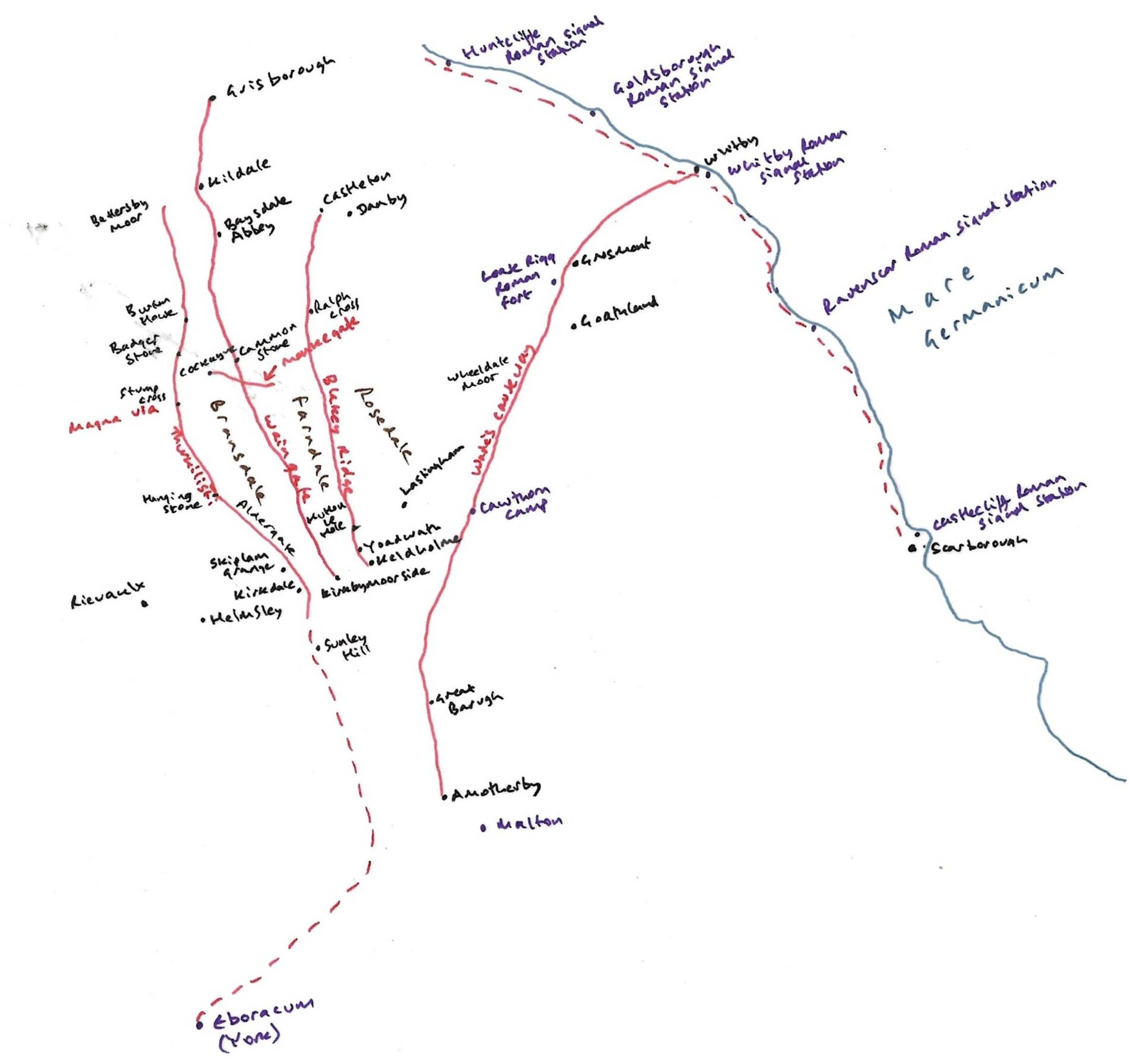
Map showing the
ancient routes of Thurkilisti, waingate, monkegate and Blakey Ridge as well as the Roman road known
as Wade’s Causeway.
Walter Espec’s
second grant of land to Rievaulx in 1145 specifically mentions four important
trackways on the moors in the course of its description of the boundaries of
the grant. These are: sperragate; the Magna Via or
great road over Roppa Moor, Thurkilisti, coming from
the direction of Welburn and connecting with this Great Road far up Bilsdale
East Side; and another, less surely identifiable Magna Via on Bilsdale West
side. (A History of
Helmsley Rievaulx and District, editor,
J McDonnell, 1963, page 72).
The age of long journeys,
650 to 800 CE
For Northumbrian aristocracy, the
century and a half from c 650 to 800 was an age of journeys. When they came of
age, Wilfred and Biscop travelled abroad. They were followed in 690 by
Willibrod, and in the eighth century by other missionaries. A century later
Alcuin made visits to and eventually departed for the continent. The papal
Legatine Mission visited Northumbria and Mercia in 786.. Travel was an apprenticeship for life and the prelude to a
monastery’s foundation. Those who underwent monastic preparation abroad had
the opportunity to observe leaders in different parts of Europe, and so found
themselves in demand as royal advisers at home (Journeys from Jarrow, Richard Morris, 2004
Jarrow Lecture, page 11 to 12).
Horses must have been important.
Wearmouth-Jarrow was an aristocratic house, and not only is it likely that
horses were kept and bred for local travel, but the horses of visitors and
couriers would require feeding and stabling, in turn requiring buildings,
paddocks for grazing, and accommodation for ostlers. (Morris, page 16).
Waingate
The ancient route
across Rudland Rigg, known as waingate, once
ran from the market place in Kirkbymoorside to Battersby and Stokesley. It was
also a pilgrimage route which linked Rievaulx, Kirkdale and Kirkbymoorside to Baysdale Abbey and Guisborough Priory to the north.
The lane leading
north from Fadmore was called waingate
from Anglo Saxon Waen Way or Waggon road. It leads into the limestone hills at Boonhill, 800 feet, where at SE668909 part of a bronze
founders hoard was ploughed up at different times between 1966 and 1975. There
were five broken socketed bronze axes and pieces of sword and spear, all dating
to about 700 to 1,000 BCE. (Old Roads and Pannierways in North East Yorkshire, Raymond H Hayes MBE, FSA, 1988 page 46).
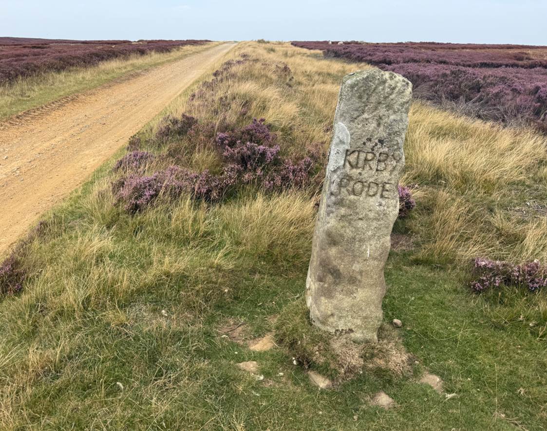
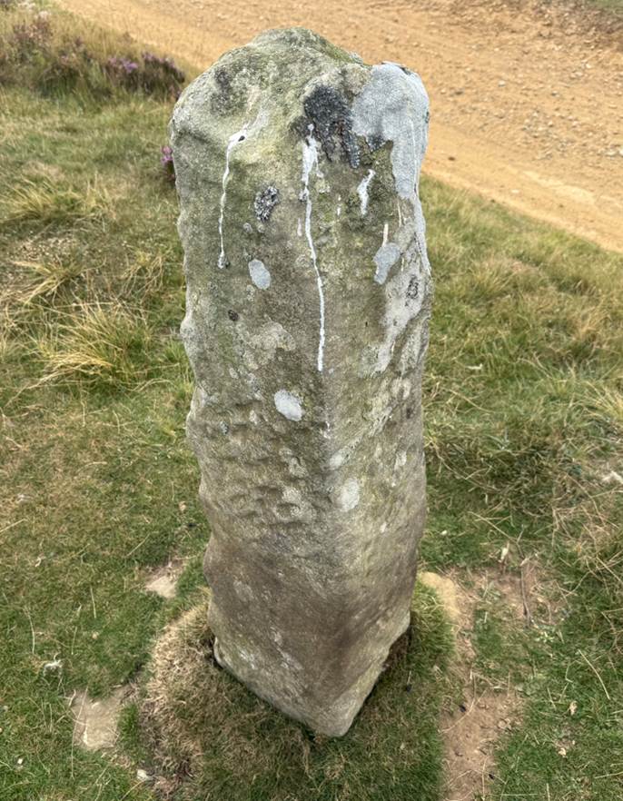
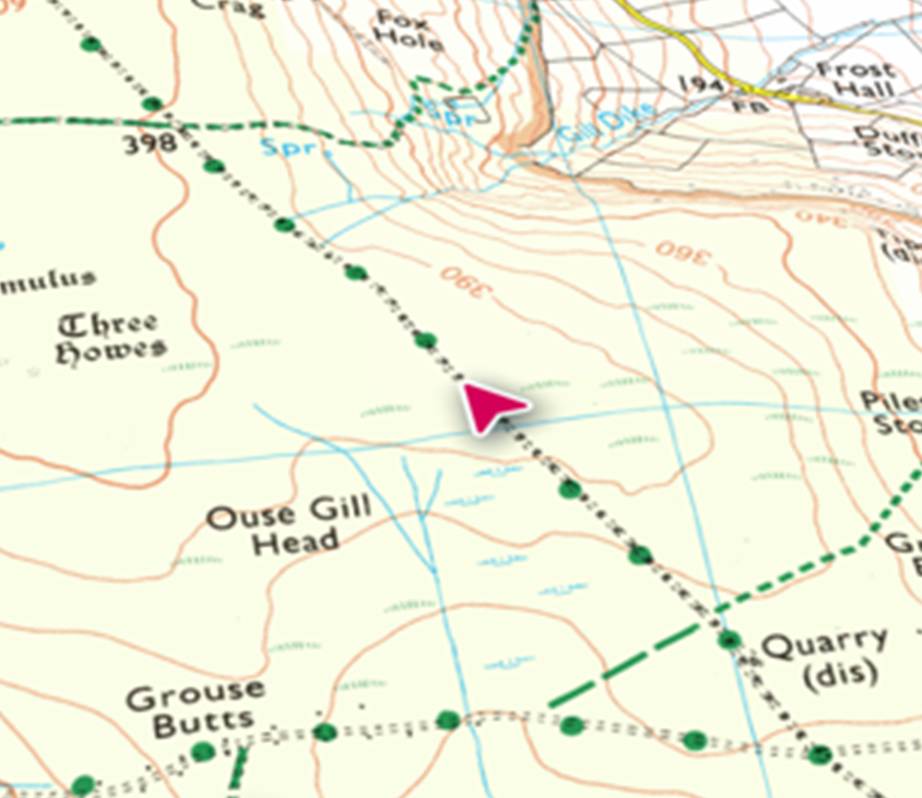
Waingate, the ancient
track along Rudland Rigg - Kirby Rode
On
the northern reaches of the escarpment of Rudland Rigg is the Cammon Stone (SE
62611 99966)(from cam maen or bank stone), a standing
stone that sits just beside the main track. The stone is about a metre and a
half tall and leans towards the west. The southern views from the stone look
down along Bransdale, the axis of the stone is also aligned in this direction,
which is probably no coincidence. There are a number
of faded letters carved onto the western face of the stone. Antiquarians had
speculated as to whether these letters were Phoenician in origin, but they are
actually Hebrew and spell out the word halleluiah. They are thought to be the
work of the Reverend W Strickland, Vicar of Ingleby. Strickland is thought to
be responsible for carving a number of inscriptions in this area. There is a
second stone, a large flat slab. No one knows whether this slab ever stood
upright.
On Rudland Ridge
stands a very weathered stone monolith, the cammon
stone, a Celtic name meaning ‘crokked stone on the
bank’. It bears a Hebrew inscription which was something of a puzzle until it
was noticed that a Bransdale mill bore a long inscription in Greek, Latin and
Hebrew carved by a vicar of Ingleby Greehow in 1820.
As he would pass the cammon stone it is very likely
that he was responsible for the Hebrew Hallelujah.
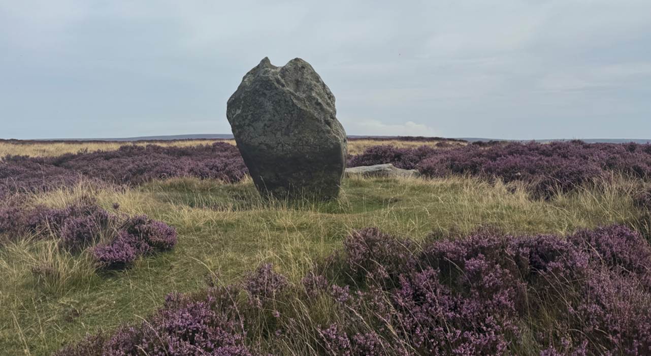
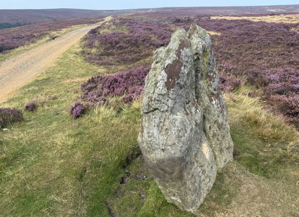
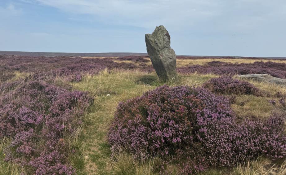
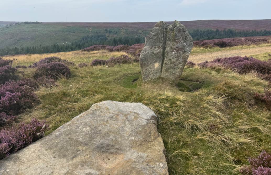
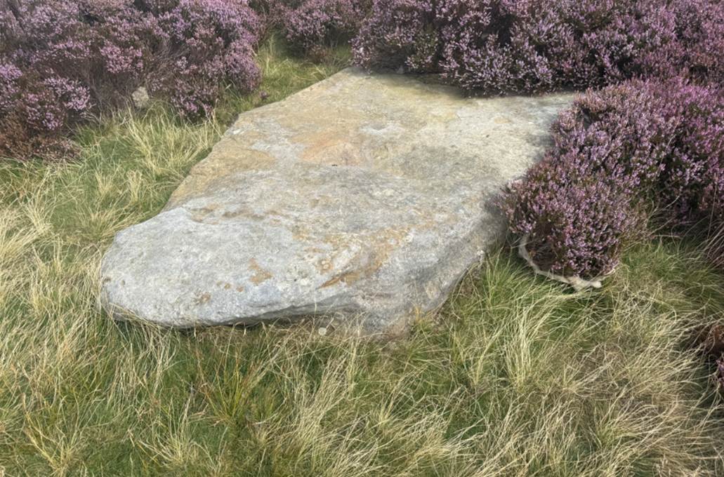
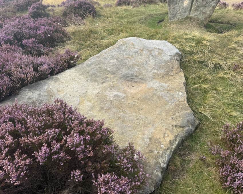
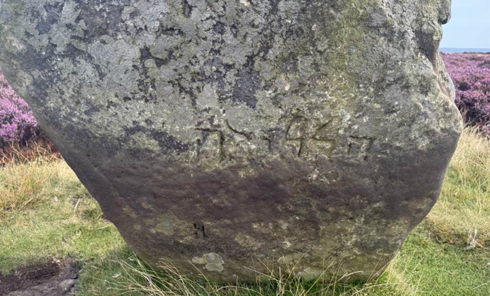
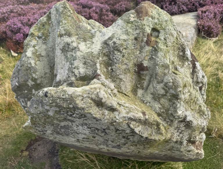
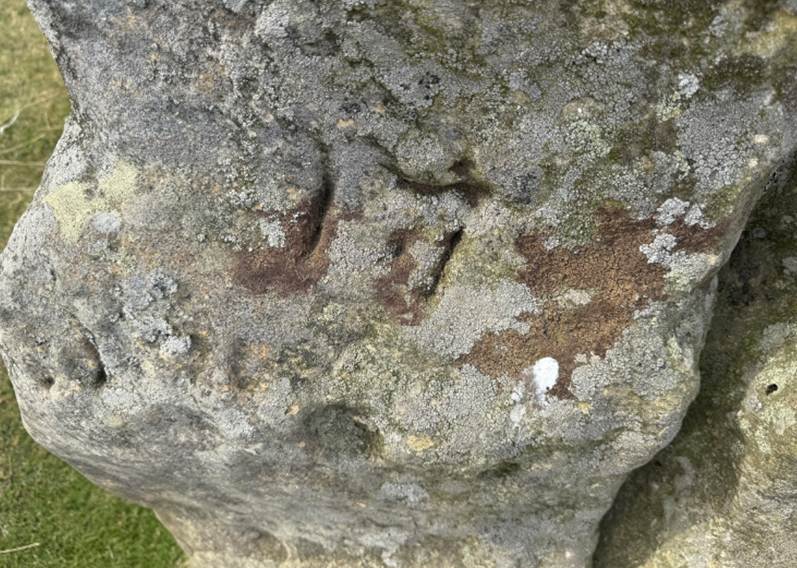
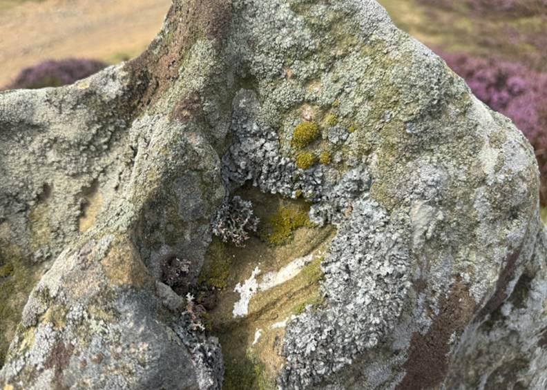
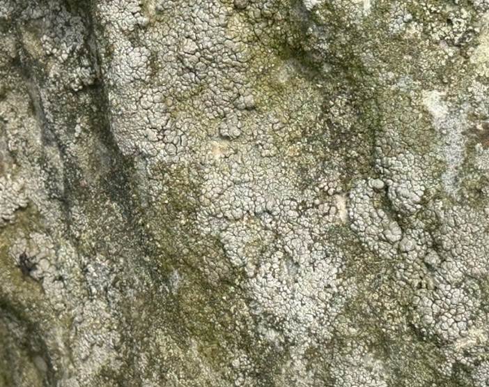
Cammon Stone,
August 2025
Cockan Cross (SE 632991)
is an inscribed shaft in a socket stone.
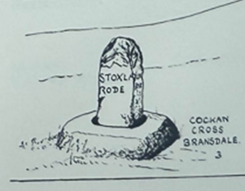
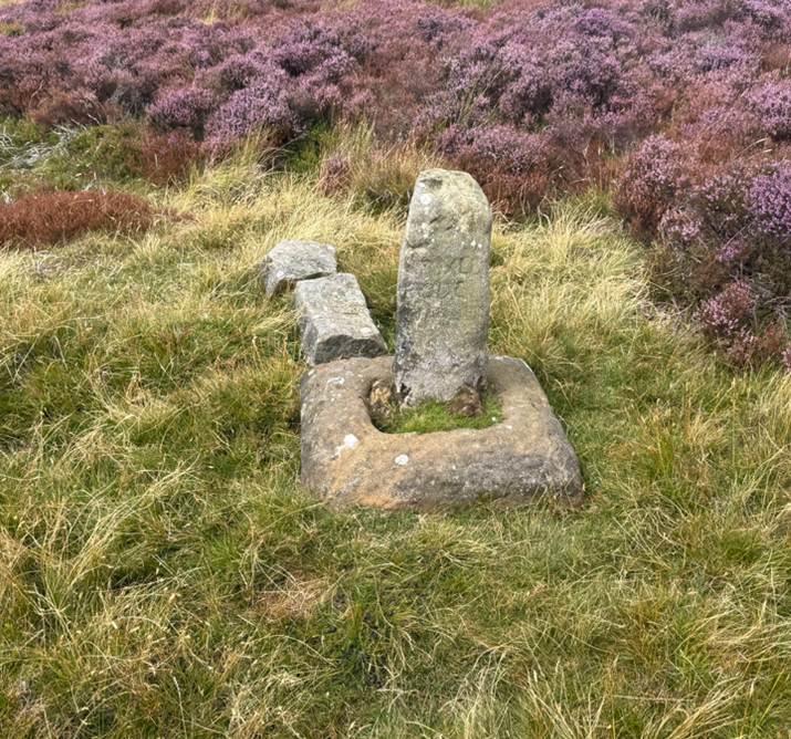
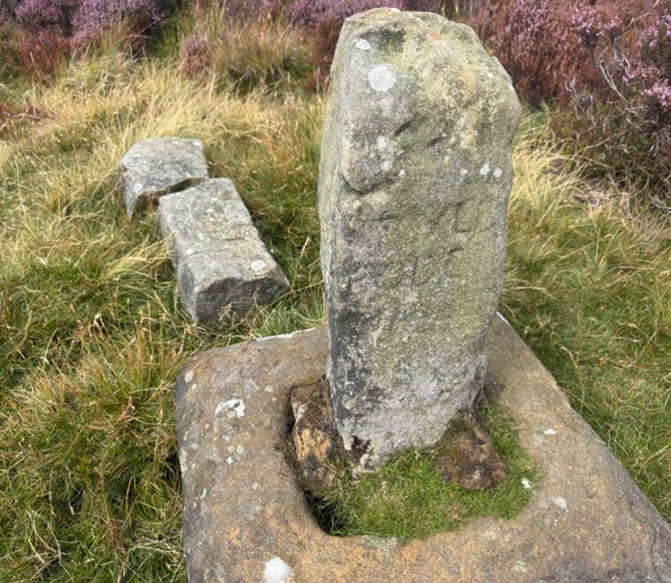
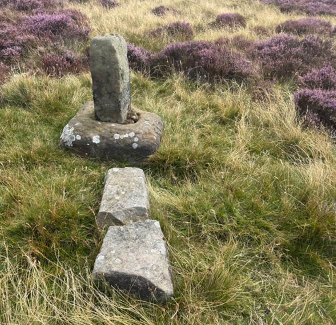
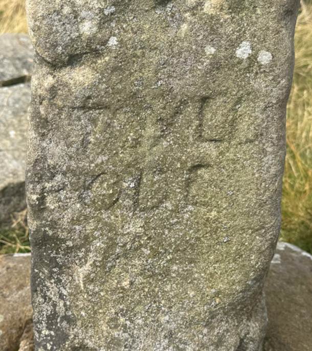
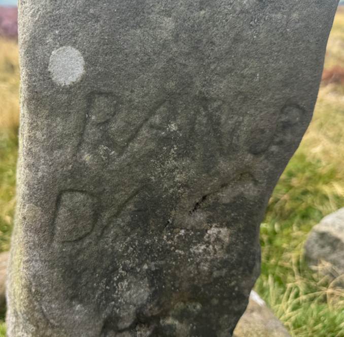
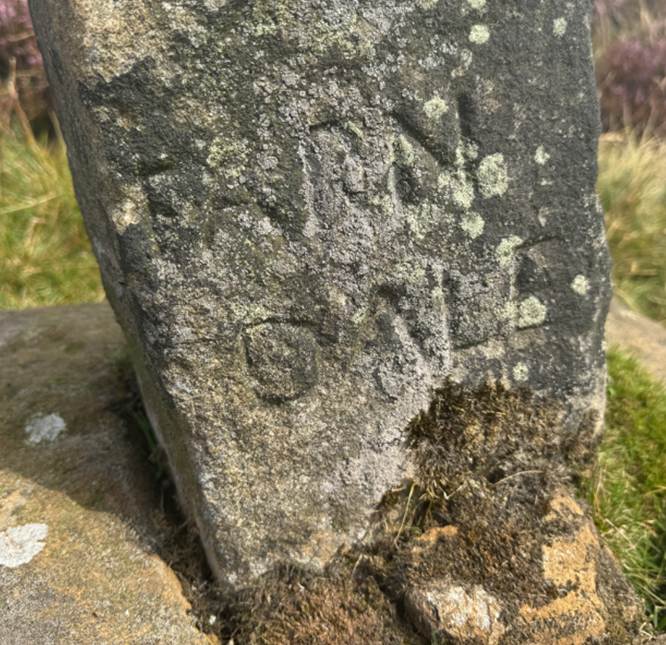
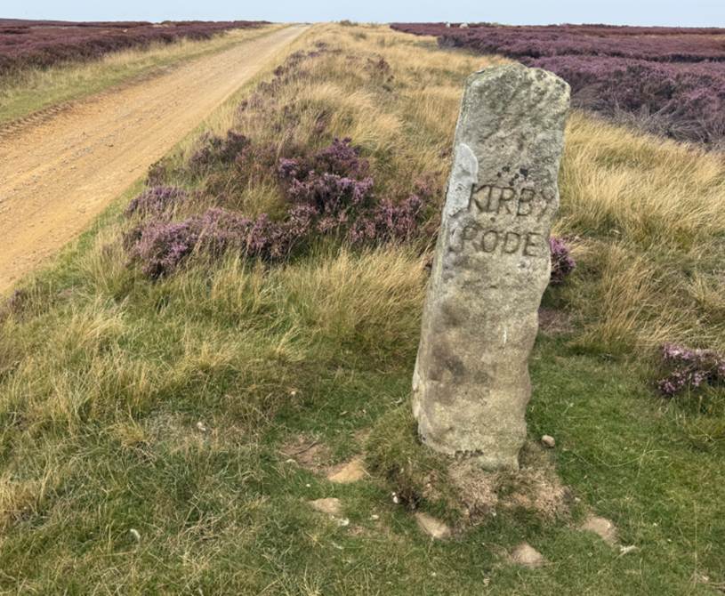
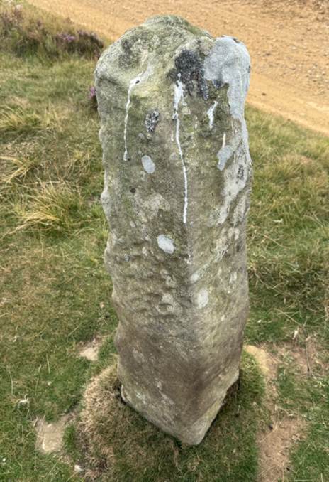
There is another
cross at SE 637980) inscribed Kirby Rode.
Thurkilisti
Waingate ran parallel to
an ancient route known as Thurkilisti which ran between Welburn
(immediately south of Kirkdale) to Cleveland via Skiplam Moor to Bilsdale east.
Walter Espec who granted the land for Rievaulx Abbey, provided an enlarged area
to the monastery in 1145 and referred to the boundary of this grant of lands
with reference to Thurkilisti running from Welburn to Bilsdale Eastside. (Family,
Faith and Fortification: Yorkshire 1066-1250, Sarah Speight, 1993 page 70).
Thurkilsti or Thurkil’s Hill Road is one of the four important trackways
over the moors near Helmsley mentioned in Walter Espec’s second grant of land
to Rievaulx Abbey in 1145 AD. It still remains in part in its medieval state. (Old Roads and Pannierways in
North East Yorkshire, Raymond H Hayes
MBE, FSA, 1988, page 41).
“Thurkil’s hill road” (sti or sty meant a ladder, hence a steep path) has been traced as
running approximately north-north-west from Welburn, via Wethercote
(Skiplam), converging on the Roppa Moor Magna Via
from the east side of Bonfield Gill, to join it at Stump Cross two miles south
of Badger Stone. (A History of Helmsley Rievaulx and District,
editor, J McDonnell, 1963, page 72).
The transport system of the later medieval
period reflected the foundation of routes from much earlier. Green paths ran
from compact villages to flatts of arable, meadows, woods, commons,
mills, watering places and other usable assets. Longer-distance routes were
superimposed on the local system within the cultivated area but in the commons
followed more natural routes, and even shortcut through fields when crops had
been lifted. Many sloping hill paths were called 'sties', like Holthorpesti at Hovingham or Hasty in Bilsdale and the
great Thurkilsti that ran from Welburn to
Cleveland. Parishes had routes for tithe movement to a mother church. Rigg routes rather
than valleys provided ways whereby packhorses could avoid the soft ground. (Life in Ryedale in the 14th century, J H Rushton, Ryedale Historian,
Volume 8, 1976, page 19).
It is possible that Mesolithic hunters made tracks
through the forests on the high ground, as the valley bottoms were wet and
boggy and remained so until monks drained them from the twelfth century. It is
likely that one such ancient route was a route that came to be called Thurchilesti, an ancient route from Welburn, over
Skiplam Moor, to Bilsdale east, and Cleveland. Waingate
along Rudland Rigg may have been another.
When Walter Espec gave a second tranche of land to
Rievaulx in 1145, the description of the land continued: and thence between
the plain of Tilleston and the edge of the wood as
far as a certain ditch opposite where Depedala and Lithlebec meet, and thence the whole valley of Lithlebec as far as Raudepade,
and thence by the great road to the fork of the roads, and thence by the road
on the right above Smidhesdala to the heap of stones
which is called Bacbeler, and thence by the way back
above Thriplesdala to the great road which comes
from Thurchilesti and by that road as far as the mese
divides they tend towards Cleveland above the hill of the river, and below
the hill by the stream which is called Willemsbeck
and is divided between me and John Engel, as far as the aforesaid water which
runs through Bildesdale. And furthermore I grant them
all their easements in the manors [sic] and in the royal forest of Helmeslake, namely material and wood for their own uses
… (Rievaulx
Cartulary).
J C Akinson commented that Thurkersti
is named in the last document but one in the Cartularium
in such terms as to prove that it is as much at home on Skiplam Moor as here,
just on the confines of the limits of Cleveland. In the document referred to,
six loads of turves are granted to Lucy, William Fowler' daughter, year by
year, in mora nostra de Skipnum super Thurkirsti. Thurkelsti, then, is the name of a "sti " or " sty ",
that is to say, of a pathway or "gate," or roadway, of very
considerable length, the two points just under mention being certainly six
miles apart, or nearly, — if not more.
There is a roadway leading over Skiplam Moor in a north-westerly
direction, passing close by Wither Cote, which, for a mile and a half to two
miles from that point, is called Aldergate, and then
onwards Rollgate. This roadway, old enough to have
the old North English term "gate" applied to it, is continuous with
the probable "via de Thurchilesti," from
which comes the "magna via" crossing Tripsdale,
as noted above. From the Tripsdale vicinity this road
passes on to the foot of Hasty Bank, where it is joined by the direct road past
Chop Yat through Bilsdale to Helmsley, both being merged in the high-road
through Broughton to Stokesley. From Skiplam Moor, in the other direction, this
old road proceeds past Skiplam into the high road leading to Kirkby Moorside,
and there can hardly be any doubt that the Turchilesti
of this document is simply the name of the ancient tracked route from Kirkby
Moorside into Cleveland ; a conclusion which derives no little force from the
fact that in No. LV. The vicinity of a part of the divim
of Welburn to Turchilsti adverted to.
(Cartulary
of Rievaulx,
Edited by J C Atkinson, 1889, page 19).
Its southern end is doubtful but it could have begun
at York then come via Greystoke or Henderskelfe
Castle (now Castle Howard). It definitely passes Thurkle
Wood south west of Sunley Cote and Sunley Hill (SE682827) referred to as Sunnolf’s Haugr (Howe) in the
12th century Rievaulx Charters.
At Welburn Hall the line follows a footpath still
marked by hunting gates to Kirkdale road which it crosses at SE 680855.
It follows the modern lane called Skiplam Road past
Lund Court and Skiplam Grange, one of the most important Rievaulx farms to
which the last abbot retired. Roman coins were found in the vicinity, though
Parker says they were from a Quarry near Westercoate.
Rising gradually to 800 feet on the limestone ridge, it is called Aldergate. At SE 643901 it is marked by a tumulus; nearby
is another in Pinderdale Wood in which jet ornaments
were found.
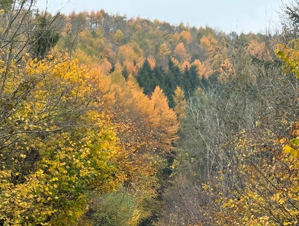
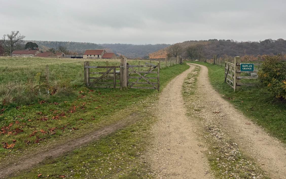
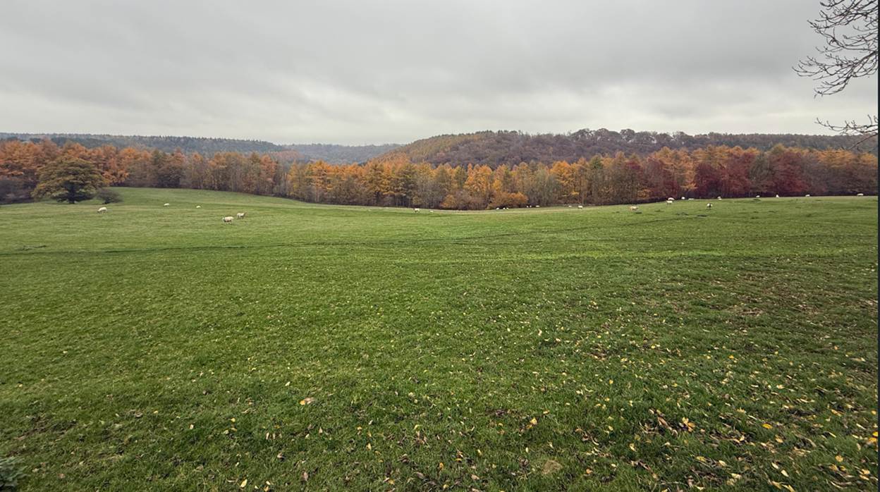
The Hodge Beck Valley adjacent to Skiplam Grange Thirkilsti
likely passed along the high ground passing through Skiplam Grange
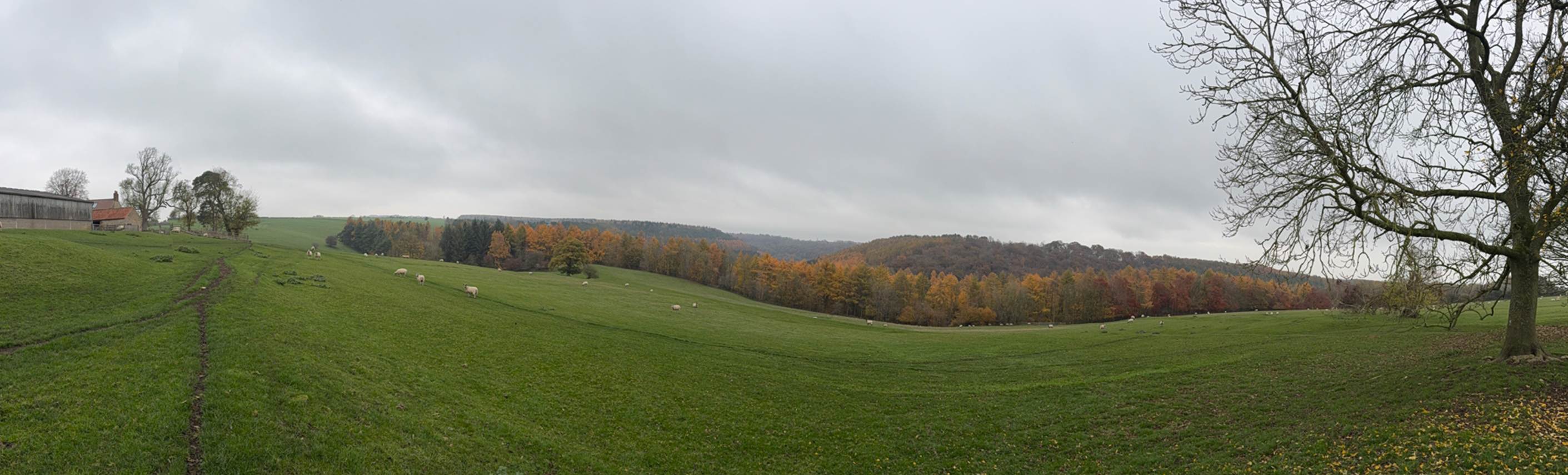
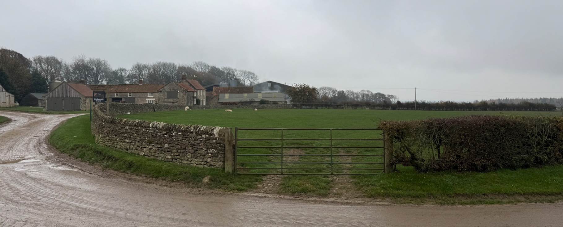
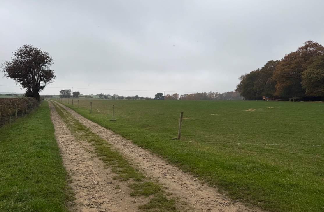
Westercoate Farm
The track leading towards Aldergate Bank
From the top of Skiplam Nab it descends Roll or Rowlgate Bank onto the Hag Common, moorland until ploughed
out recently. Before this ploughing the Thirkilisti
at SE 627913 was a raised track some 2 feet wide and 3 feet high, very like a
Roman Rd. Here several tracks diverge, the present one keeps on the dry ridge,
but the earlier one is lost in a bog. In this bog at SC 626922 stands a very
weathered guide stone. On its east side is written: This is the way to
Stokesley; southside, The way to Kirby; north, This to Gis Bo, and West, This
is the way to Bilsdale. At SC 624923, a few 100 metres northwest is the Hanging
stone, probably formerly the Lawton Stone. Many hollow-ways turn
east-north-east at the guide stone, some making towards Mitchell Hagg to a very
large slab heap at SC624923 with footings of a dwelling on the east side.
The Thurkilisti continues due north on Bransdale Ridge
with the boundary stones and a series of cairns, marked tumuli on the maps.
At Stump Cross (SE 607982), only the massive base and
a piece of a shaft remain.
A short distance to the north west the Thurkilisti was
joined by the Magna Via, ‘the great road coming from the Thirkilisti)
as it was called in 1145 AD. … Very little trace of the line of the Magna Via
remains.
A mile north-north-west is Crookstaff
Hill and at NZ 605004 is the Badger Stone, a natural rock which is mentioned in
Espec’s Charter of 1145 AD.
The Thurkilisti swings northeast to Jenny Bradley on
the Rudland Rigg road. This stone, Jenny Bradley (NZ 611022 at 1,397 feet OD)
is a squat shaft in a base stone, with the 1888 boundary stone alongside her.
The road follows closely the western edge of the
Cleveland Hills, passing the Botton, or Burton Howes (NZ 608033), Bronze Age
burial mounds of turf, excavated by R S Close,
though previously disturbed. Professor GW Dimbleby described the results of his
pollen analysis of them in The
Ancient Forest of Blackamore. It
is difficult to realise these mounds of turf were raised in clearings of a
dense forest.
The descent to Battersby Bank follows zigzags from NZ
599062. It is joined by several footpaths. The local name for this bank is
Turkey Nab. Mr R B Turton was one of the first to make the deduction that it is
derived from Thurkilisti Nab. He names three Thurkylls,
one in the Anglo-Saxon Chronicle in 915 AD; another Thirkyll,
a jarl who landed in 1069 and plundered York, and Thorkyll
de Cliveland, who is mentioned in the Whitby
Cartulary.
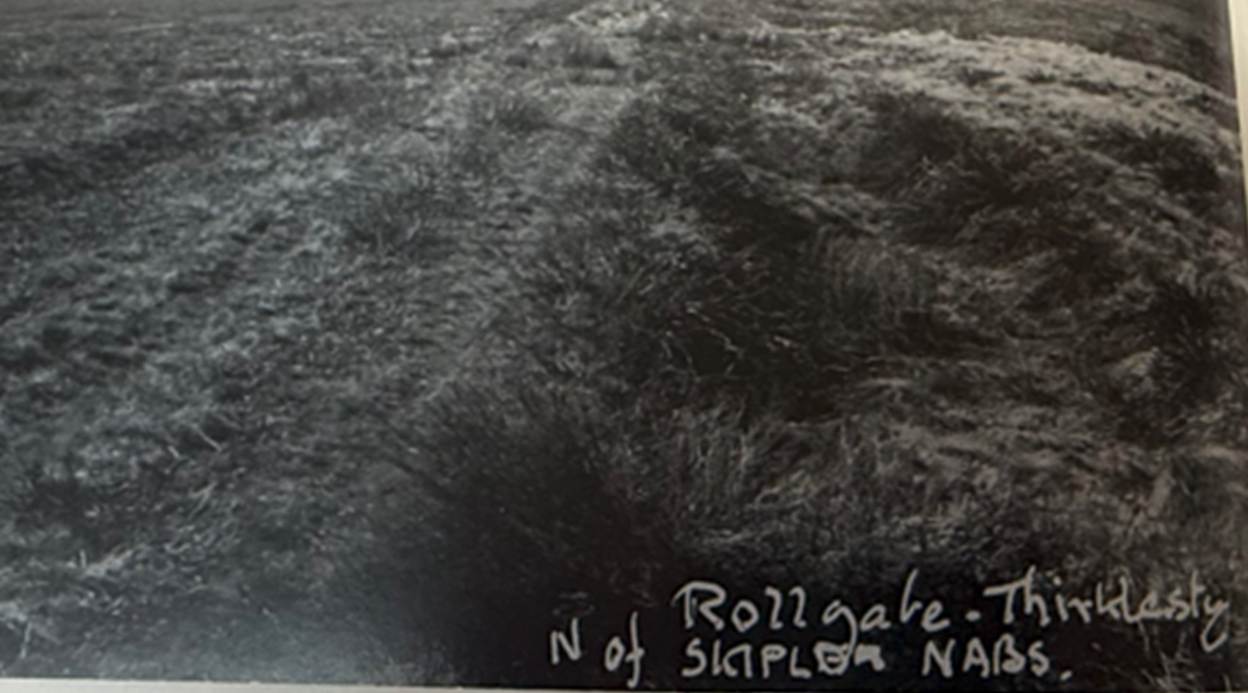
Thurkilisti on Skiplam Moor, c 1955
(Old Roads
and Pannierways in North
East Yorkshire, Raymond H Hayes MBE,
FSA, 1988, page 41 to 43).
Thurkil may have been an earl involved in the early rebellion
against William the Conqueror, before the Conqueror established control over
the northern lands after the Harrying
of the North.
After the Battle of Hastings, in 1068 Edwin and Morcar rose in revolt, supported by Gospatric, Earl of
Northumbria. Early
in 1069, Edgar the Ætheling revolted and attacked
York. Although William returned to York and built another castle, Edgar
remained free, and in the autumn he joined up with King Sweyn. The Danish king
had brought a large fleet to England and attacked not only York but Exeter and
Shrewsbury. York was captured by the combined forces of Edgar and Sweyn. Edgar
was proclaimed king by his supporters. William responded swiftly, ignoring a
continental revolt in Maine, and symbolically wore his crown in the ruins of
York on Christmas Day 1069.
A.D. 1069. This year died Aldred, Archbishop of York;
and he is there buried, at his see. He died on the day of Protus and
Hyacinthus, having held the see with much dignity ten years wanting only
fifteen weeks. Soon after this came from Denmark three of the sons of King Sweyne with two hundred and forty ships, together with Earl
Esborn and Earl Thurkill, into the Humber; where they were met by the
child Edgar, and Earl Waltheof, and Merle-Sweyne, and Earl Gospatric with the
Northumbrians, and all the landsmen; riding and marching full merrily with an
immense army: and so all unanimously advanced to York; where they stormed and
demolished the castle, and won innumerable treasures therein; slew there many
hundreds of Frenchmen, and led many with them to the ships; but, ere that the
shipmen came thither, the Frenchmen had burned the city, and also the holy
minster of St. Peter had they entirely plundered, and destroyed with fire. When
the king heard this, then went he northward with all the force that he could collect,
despoiling and laying waste the shire withal; whilst the fleet lay all the
winter in the Humber, where the king could not come at them. The king was in
York on Christmas Day, and so all the winter on land, and came to Winchester at
Easter. Bishop Egelric, who was at Peterborough, was
this year betrayed, and led to Westminster; and his brother Egelwine
was outlawed. This year also died Brand, Abbot of Peterborough, on the fifth
before the calends of December. (The Anglo Saxon Chronicle, 1069).
The Blakey Ridge
Route
Blakey Ridge, sometimes Blakehow,
blakehou and the more de Blackow means the Black Hill.
This important ridge road runs from its junction with
the modern A170 at Keldholme, 166 feet above sea level to 1400 feet at Ralph
Cross and on to Castleton.
The route from Keldholm
passed an old horse ford at Yoadwath by a water corn
mill. The area is thought to have been known as Haverbegam
in a record of about 1200, and may have belonged to Keldholm
Priory.
The steep Yoadwath Bank
climbed to join the alternative modern road to Hutton passing on the edge of Douthwaitedale.
The road passes through the village of Hutton-le-Hole
and by the Ryedale Folk Museum. Here there were formerly three fords where the
thirsty horses could drink, and two inns for the equally dry carters. Just west
of Barmoor at SE 698907, at the foot of Hutton Nab,
there are three burial mounds
where a cremation urn of mid bronze age was found.
The Lion Inn at Blakey stands at 1,300 feet and must
have been a welcome site to wayfarers in the past, as it is at present to
anyone caught in the severe blizzards of the moorland winters. … The first mention of Blakey occurs in the
Charter of Guisborough Priory in 1200. It is called Blakenhow
or Blakey How, which simply means Black Howe, referring to the large tumulus
that stands behind the inn, with a boundary stone on top. It has a deep hollow
in the centre. No record of its excavation exists, but it could well be of the
same age as Loose Howe on the opposite side of Rosedale, which is certainly mid
Bronze Age, about 12,000 to 14,000 BC. The hollow on top was used for
cockfighting in the 19th century or earlier.
Fred Johnson, landlord of the inn with his father from
1915 to 1939, said it had a Roman sign, and that they hung a bunch of green
leaves or a Bush outside after brewing. This was certainly a very old custom.
Later owners had a sign by the road stating it dated back to 1553. I have not
found any evidence this, though there is a reference in Dugdale stating that
Edward III gave 1 toft and 10 acres of land in the moor of Blakeshow
in Farndale to the crutched Friars for the building of an oratory, with other edifices
for habitation, AD 1348. But Whittaker thinks this could be on the site at the
present Farndale Church, at the foot of Blakey Gill in Farndale.
The Ridge Road now rises to 1,400 feet at Young
Ralph's Cross, NZ 678023, Crucem Radulphi, AD 1200,
probably from the Old Norse ‘Ralpa’, meaning a heap
of stones. The cross may be much more recent than its counterpart, Old Ralph,
which stands 300 yards to the West at NZ 676020, at just over 1,400 feet, the
highest point on the Ridge.
The road which winds southeast to Rosedale from
Ralph’s Cross via White Cross and Loose Howe is mentioned as a road by 1233
in the Guisborough Charter.
(Old Roads and Pannierways in
North East Yorkshire, Raymond H Hayes MBE, FSA, 1988, page 11 to 15, 36).
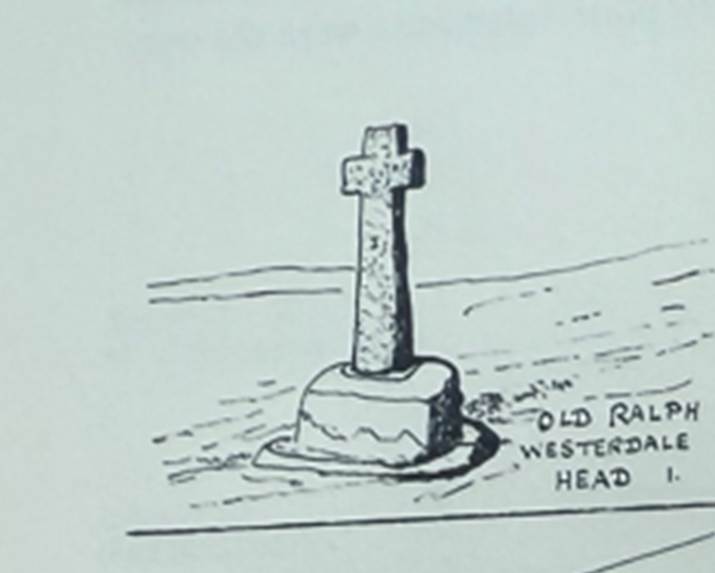
Old Ralph’s Cross (NZ 676020) is a cross with a shaft
in socket, just under 2 metres high. Young Ralph’s Cross (NZ 677022) was
probably erected in the eighteenth century.
Monkegate
In the fourteenth century, the track
up to Rudland Ridge from Monket House was a route known as Monckgate, which linked Farndale with Bransdale. Monket suggests a
link with monks, but in the absence of monastic associations with the dale it
is more likely to derive from Mened-cet fromn the Welsh Mynydd-coed
meaning forest hill.
The road up Monket Bank
links the two dales and was used as a church way. It starts opposite Monket House (SC 661972), called Munkgate
in the 14th century, climbing steeply up a deep hollow-way from 675 feet to
1,212 feet up the side of the shale slips of the Monket
House crags, up Penny Hill. Always rough, by 1985 it was very deeply rutted,
some 6 to 14 inches deep in parts. Only tractors could use it, and even they
had to detour onto the moor to avoid the worst places. It crosses Ousegill Head and the Rudland Rigg track southwards from Cockan Cross, marked by piles of stones. On the east side
of Bransdale the track divides. A deep hollow-way goes straight down to Smout
House, but the main track descended more gradually, northwest, by some intakes
to Cow Sike House where it joined the Bransdale East Road to Cockan Kirk.
This was the route used by bearers carrying the corpse of one of
the Greystokes of Shotten Hill, Farndale, to Cockan Kirk in Bransdale, described to the writer by an old
lady living in Scarborough, who attended the funeral in the 1870s. She also
remembered an Aconley of Frost Hall carried over the rigg by a higher route
that came over below Cockan Cross. These are genuine
corpse roads, like that over Danby Rigg described by Canon Atkinson.
(Old Roads and Pannierways
in North East Yorkshire, Raymond H Hayes
MBE, FSA, 1988, page 47).
Wade’s Causeway
Not until Roman times was a well paved Causeway
constructed: Wade's Causeway, part of which remain between Stape and Lease Rigg. (Old Roads and Pannierways in
North East Yorkshire, Raymond H Hayes
MBE, FSA, 1988, page 7).
Following
the ridgeway on the western edge of the Yorkshire Wolds to Malton a large camp
was set up at Orchard Field, Malton, followed by an 8 acre walled fort in the
time of Trajan (98 to 117 AD). About this time a military road was laid down
northwards over the Vale of Pickering, by a series of low holmes
in the marshes, to Cawthorn, 4 miles northwest of Pickering, where a series of
four exercise camps were built during two separate occupations. The road was
continued over wild and desolate moorland to Wheeldale
and Lease Rigg above Grosmont, where another camp was
made. From here it crossed the Esk to a point not yet
determined on the coast, possibly Sandsend near Whitby, where there was a
landing beach,. This is the only authentic Roman road yet identified north of
the Vale of Pickering, where a portion of it, excavated by the Ministry of
Works, can be seen north of Stape. (A
History of Helmsley Rievaulx and District,
editor, J McDonnell, 1963, page 47).
Raymond Hayes described Wade’s causeway as the only
certain Roman Road in North East Yorkshire. It was taken by a report by
Raymond Hayes and J G Rutter in 1964 to run from Amotherby
(west of Malton) to the Roman camp at Cawthorn across the moors to Lease Rigg
(which descends from the moors to Grosmont) (Wade’s
Causeway,
RH Hayes and JG Rutter, Scarborough and District Archaeological Society
Research Report No. 4, 1964, page 7). It
most likely connected York via Malton with the fourth century coastal signal
stations around Whitby. It crossed the Vale of Pickering through Great
Barugh and Wrelton and climbed towards Cawthorn.
There is a field at Cawthorn called Little Street Close, and the Saxon word
street often marks the existence of a Roman road.
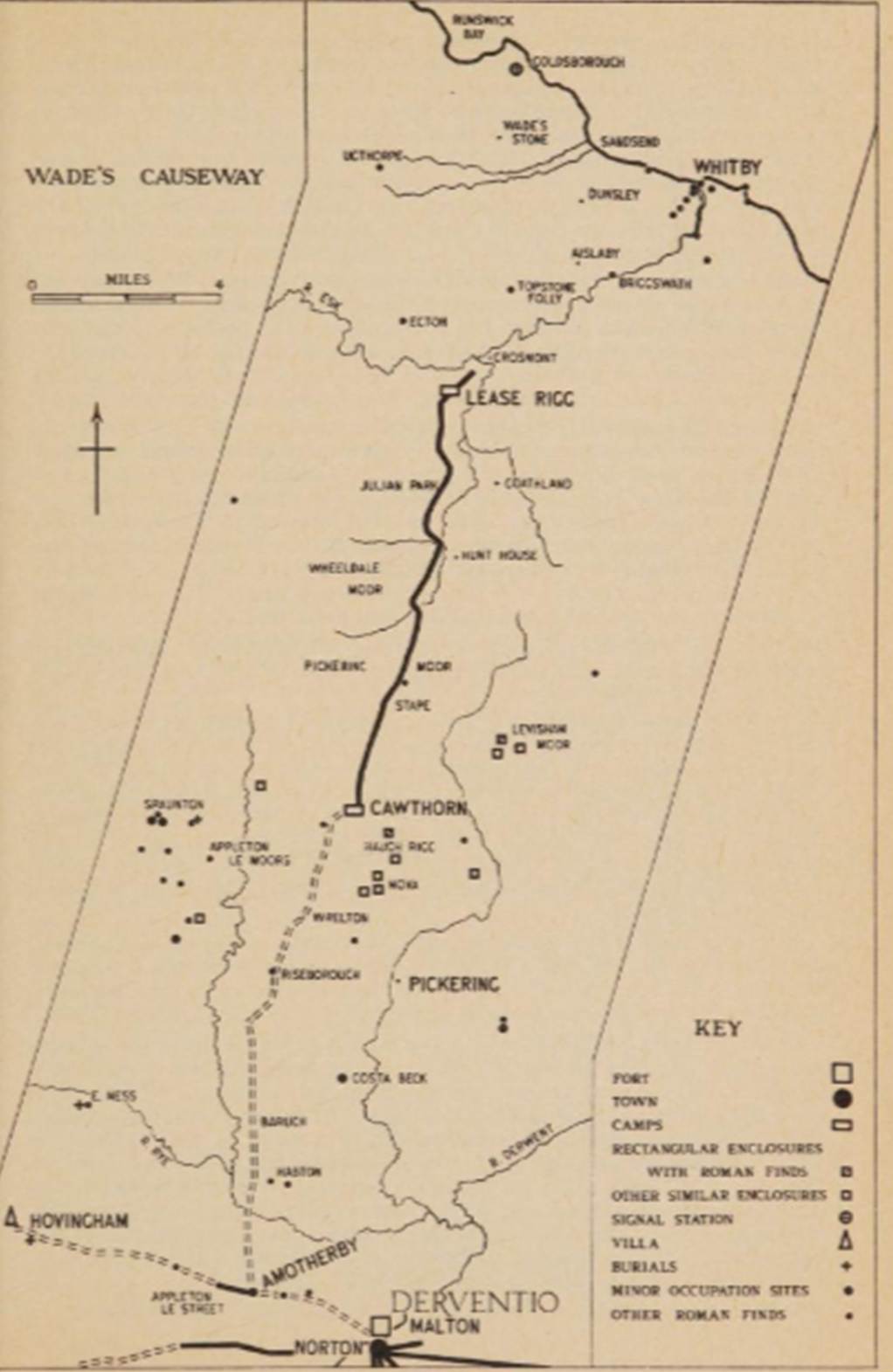
Wade’s causeway and Roman sites and finds in its
neighbourhood
The conclusion on Wade’s causeway was that it could be
an early military road of AD 80 to 120 when it fell into disuse.
(Old Roads and Pannierways
in North East Yorkshire, Raymond H Hayes
MBE, FSA, 1988, page 29 to 30).
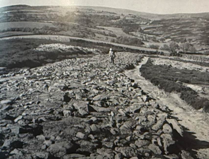
Roman Road at Goathland (from Raymond
Hayes’ 1988 book)
It is now believed that the route may have had
neolithic origins. Legend suggested that it was constructed by a Germanic
mythical figure, Wade.
The linear monument on Wheeldale
Moor is first recorded as ‘Wade’s Causeway – a Roman Way’ on a map of 1720. It
then features in most antiquarian accounts of the area as part of a Roman road,
traced for various distances along a route from Amotherby,
near Malton, in the south towards the coast north of Whitby, a distance of some
33 to 35 miles. More recent work, however, has suggested that it could be
medieval, or that it might not be a road at all, but a much modified Neolithic
or early Bronze Age boundary feature.
Various theories have been put forward to explain the
purpose of this road. The key suggested associations are the Roman military
complex at Cawthorn Camps on the south side of the moors, the Roman fort at
Malton, the Roman fort on Lease Rigg between the valleys of the rivers Esk and Murk Esk, a putative
early Roman fort near or north of Whitby, and the late 4th-century ‘signal
stations’ on the Yorkshire coast.
The name Wade’s Causeway, as the site is also known,
derives from a local legend that the ‘road’ linked the home of a giant called
Wade who lived at Mulgrave Castle with that of his wife, Bel, who lived at
Pickering Castle.
(History of Wheeldale Roman Road,
English Heritage).
There is now evidence that before the Roman occupation there was a sizeable
Iron Age population in the North Yorkshire Moors in and to the north of the Esk Valley and extending south east to Levisham
Moor. This was probably a sept or clan of the Brigantes, and the building of a
fort at Eston Nab in the Iron Age (palisade c 500 BC and later rampart and
ditch) seems to suggest some turbulence within the tribe.
At all events, Roman policy seems to have been one of pacification. Hayes
and Rutter (Wade’s Causeway, RH Hayes and JG Rutter, Scarborough and District Archaeological Society
Research Report No. 4, 1964, page 89) have shown that the Ninth Legion at Malton
carried this out by constructing the military road from Malton to Lease Rigg
near Grosmont starting the work early in the
occupation about AD 80. In this one move they took command of the Lower Esk, thereby effectively seizing strategic control of the
territory of the presumed Brigantian clan.
That this policy, coupled with economic advancements, was successful in
pacifying the area is indicated by the virtual abandonment of the road after a
single generation, in about AD 120, and by the apparent abandonment of the
Eston fort in Roman times. The effect of this pacification is clearly to be
seen in the upland farms at Crag Bank and Pale End. The mixed farming
settlements originated in pre-Roman times but there was no ‘harrying of the
north’ by the Romans, and life continued uninterrupted during their occupation.
This continuity can be seen on other Iron Age/Romano-British settlements in
Yorkshire.
(Romano British Settlements at Crag Bank and Lounsdale,
near Kildale, RS Close, RH Hayes and DA Spratt, Yorkshire Archaeological Journal,
Volume 47, 1975, page 61).
The Itinerary of Antoninus Augustus lists fifteen routes in Britain among
its empire-wide network of 225 roads (G Parthey and M. Pinder (editors), Itinerarium Antonini Augusti et Hierosolymitanum, Berlin, 1848). It is likely that the main route from Rome to Egypt represented an
imperial progress made by the young emperor Caracalla in A. D. 214/15, three
years after he had succeeded his father, Septimius Severus, who had died at Eburacum (York). The Itinerary (road-book) takes its name
from Caracalla's official adoptive, name, Antoninus. The document was later
brought up-to-date, but only in parts, towards the end of the third century, in
the time of the emperor Diocletian (A.D. 284-305).
Route I (conventionally so labelled in Britain) ran ' from the frontier,
from the waif, as it claims, to a place called Praetorium/Pratorium,
praetor's headquarters', 'commander's centre'. This name is found several times
in the continental part of the Itinerary, and is a description of function
rather than a place-name. The one in Britain is normally located at the Roman
military base and town at Brough-on-Humber. The road passed through eight
intermediate stations, in most cases also towns, in the English counties,
Northumberland, Durham and Yorkshire. These towns are named, and distances are
given in Roman numerals between them, as well as an overall total given at the
beginning of the route. The road's general direction is not in doubt; it is
down the Rede Valley to the Tyne, then south across the interfluves of Tyne,
Wear and Tees, before following the Swale and Ure to York and then swinging eastward to the Yorkshire Derwent
and, probably, south again across the Wolds to the Humber.
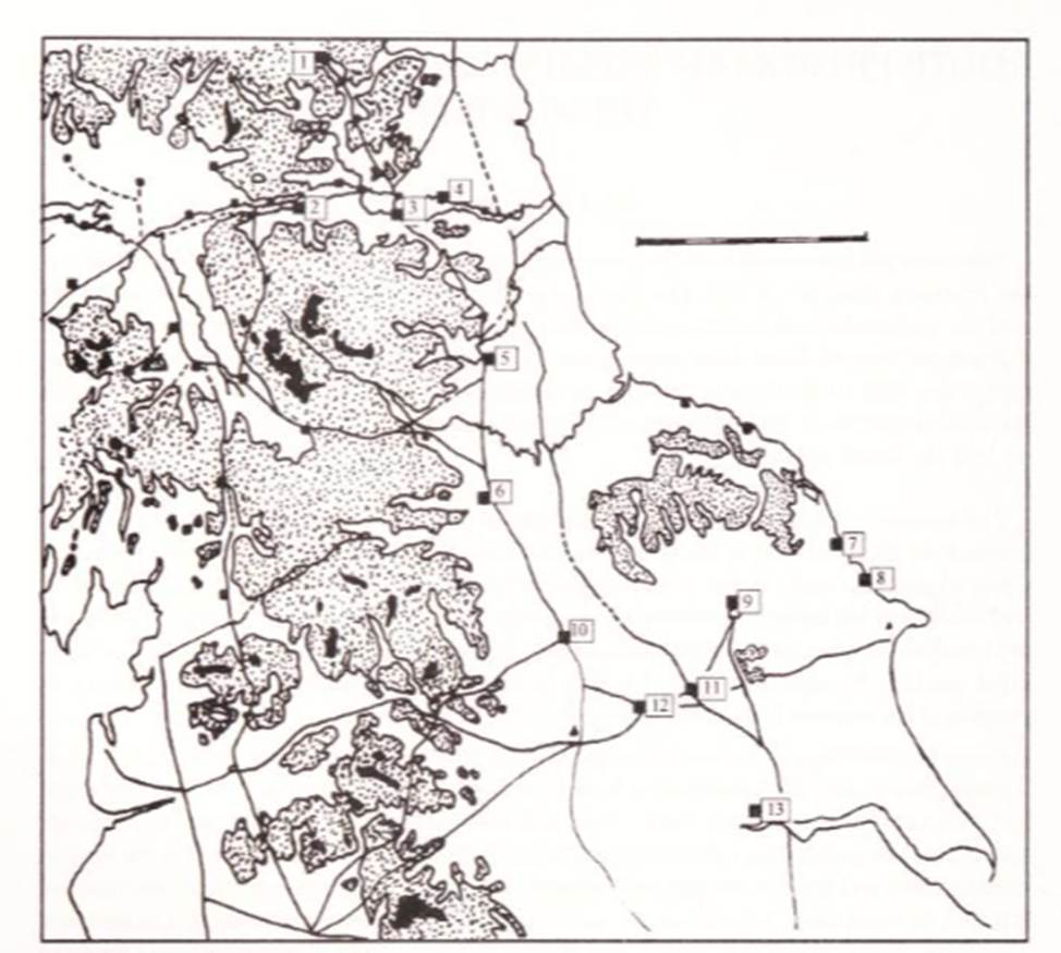
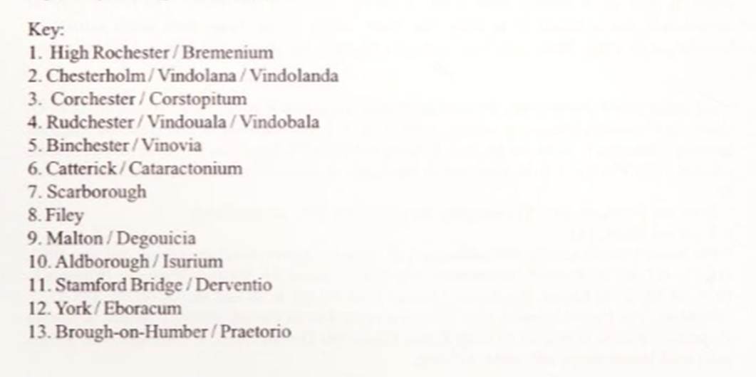
The situation east and south of Eburacum is
rather different. There are only three stations, but the location of each is
disputed. Derventio is represented by the Iter as
seven miles (VII) from Eburacum, Delgouicia
as 1 3 miles (XIII) from Derventio, and Praetono as 25 from Delgouicia
(XXV). The most common way of placing them on the map has been to locate Derventio at Malton (on the River Derwent and a major Roman
site, certainly a road-hub), Delgouicia as either at
Millington or Wetwang (near or on one or other Roman
road from Malton to the Humber) and Praetorio
(Brough, an important Roman naval-station and township on the Humber).
(Route 1 in Roman Britian: From the frontier to the Humber, JGF Hind, Yorkshire Archaeological Journal,
Volume 79, 2007, page 55).
There is a detailed description of Wade’s Causeway in the Roads of Roman
Britain Gazetteer for Roman Road Margary Number 81b, Amotherby to Whitby, Wade’s Causeway.
Hambleton Street
Of all the ancient trackways running roughly north and
south across the moors, the most notable and for long the dominant road across
the area was Hambleton Street. It
was referred to as a regalis via in the Rievaulx Cartulary. It was
further to the west and ran from the Tees at Yarm, across the moor top at
Scarth Nick, to Osmotherley and then across the
western escarpment of the Hambleton Hills to Boltby
Bank and Sutton Bank. There it forked with a branch to York via Coxwold and Crayke and another older branch to Malton via Hovingham.
This was a Bronze Age route and the Bishops of Durham used it to travel to York
in medieval times. (A
History of Helmsley Rievaulx and District, editor, J McDonnell, 1963, page 69 to 70).
You are obliged to cross the moors they call Black
Hambleton, over which the road runs in narrow hollows that admit a south
country chaise (Cart) with some difficulty, that I reckon this part of the
journey made a hazard of my neck. The going down into Cleveland is beyond all
description, terrible, you go through such steep, rough, narrow, rock
precipices, that I would sincerely advise you to go a hundred miles to escape
it. (Rural Economy of Yorkshire, Arthur Young, 1771).
Linkfoot Lane
Linkfoot Lane, leaving Helmsley via Bondgate and heading
through Beadlam and Kirkdale for Kirkbymoorside,
still marks the general route followed in medieval times (and indeed earlier;
note the string of Saxon ‘tons’) by the road eastwards from Helmsley towards
Pickering and the coast. (A History of Helmsley Rievaulx and District,
editor, J McDonnell, 1963, page 70).
Bibliography
Old Roads and Pannierways in
North East Yorkshire,
Raymond H Hayes MBE, FSA, 1988. The British Library has a copy
(YA.2000.b.3130).
Life in Ryedale in the 14th century, J H Rushton, Ryedale Historian, Volume 8, 1976, page 19.
The Medieval Foundation of England, 1967, Arthur Bryant, page 184
Cartulary of Rievaulx, Edited by J C Atkinson, 1889, page 19.
Family, Faith and Fortification: Yorkshire 1066-1250, Sarah Speight, 1993 page 70.
History of Wheeldale Roman Road, English
Heritage.
Wade’s Causeway, RH Hayes and JG Rutter, Scarborough and District Archaeological Society Research Report No. 4, 1964, page 7.
Journeys from Jarrow, Richard Morris, 2004 Jarrow Lecture.