Buck Rush Farm, Kilton
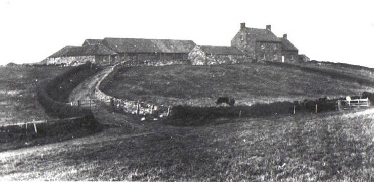
Buck Rush Farm about 1912, part of Kilton Lodge Farm under Charles Farndale.
|
Return to the Home Page of the Farndale Family
Website |
The story of one family’s journey through two
thousand years of British History |
The 83 family lines into which the family is divided.
Meet the whole family and how the wider family is related |
Members of the historical family ordered by date of
birth |
Links to other pages with historical research and
related material |
The story of the Bakers of Highfields, the Chapmans, and
other related families |


Dates are in red.
Hyperlinks to
other pages are in dark
blue.
Headlines are in brown.
References and
citations are in turquoise.
Contextual
history is in purple.
There are no medieval earthworks at the present site of Buck Rush
Farm, but there are some to the east. There are also the remains of a possible
house platform. (Robert Daniels. 1990. Kilton: A
Survey of Moorland
Fringe Township in Medieval Rural Settlement in North
East England. Architectural and Archaeological Society of Durham and
Northumberland Research Report No 2, edited by B E Vyner, page 35).
There is a
medieval farmstead east of Buck Rush Farm (Medieval
farmstead 420m east of Buck Rush Farm,
Historic England National Heritage List 1020322
listed 20 July 2001, NZ 696165).
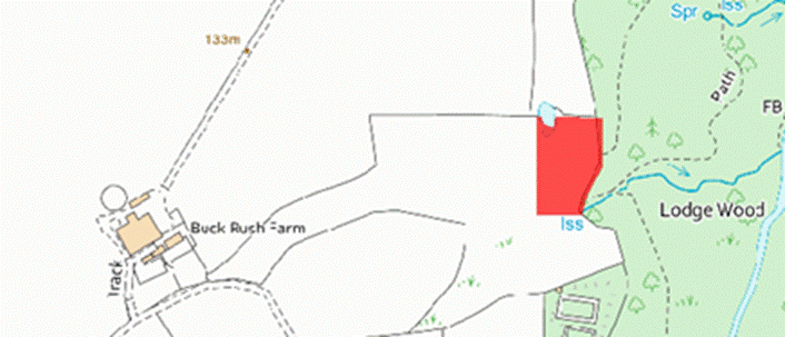
The estate map of
1767 provides shows the site occupied by the lodge, a complex of three
buildings with an enclosure, the boundary of which crosses ridge and furrow
excavations. There is a rectangular enclosure containing a plantation to the
north of the buildings. This is probably a post medieval hunting lodge with
direct access to the woods. The 1856 Ordnance Survey map describes the woods as
Lodge Woods. The 1767 map also had also shown a farmstead at Buck Rush, to the
west of the lodge. In 1767 this comprised two buildings, and a kiln field to
the southeast may suggest that their construction provided lime for mortar as
well as for the fields. Between 1845 and 1857 Buck Rush developed into a
courtyard farm and the buildings from the mid eighteenth century disappeared.
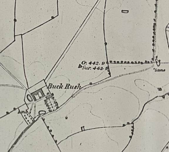
Buck Rush 1853
The present farmstead at Buck Rush comprises a late 19th century
stone farmhouse with a courtyard arrangement dated from the mid nineteenth
century. (Robert
Daniels. 1990. Kilton: A Survey of Moorland Fringe Township in Medieval
Rural Settlement in North East England.
Architectural and Archaeological Society of Durham and Northumberland Research
Report No 2, edited by B E Vyner, page 55).
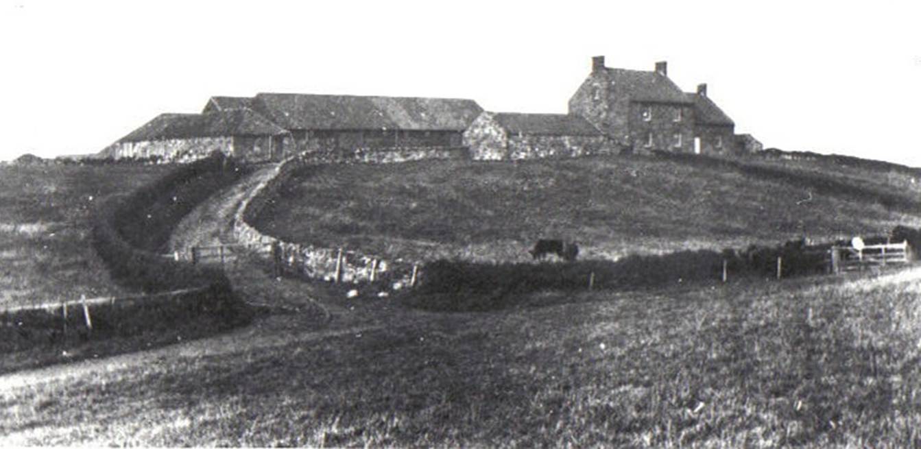
Buck
Rush Farm about 1912, part of Kilton Lodge Farm under Charles Farndale.
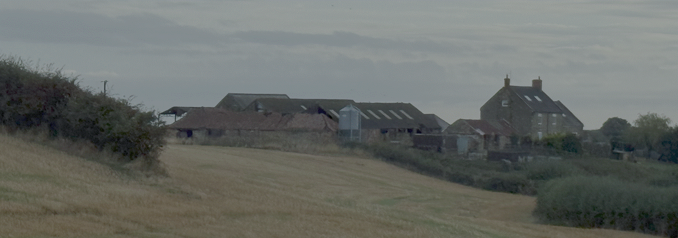
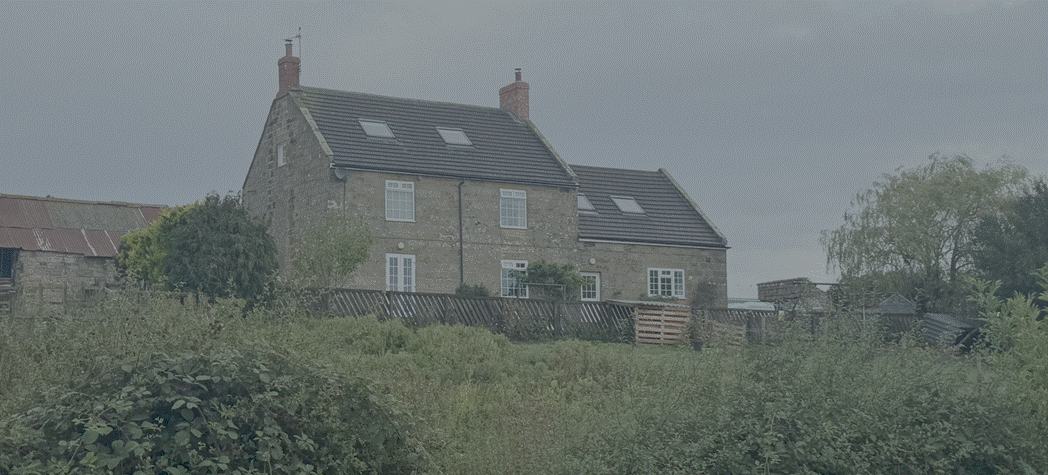
Buck
Rush Farm, 2026