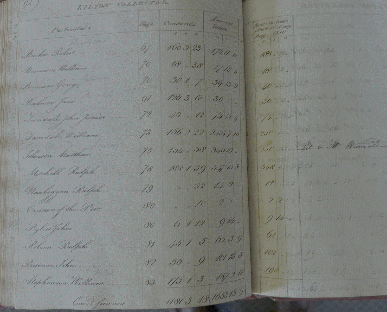
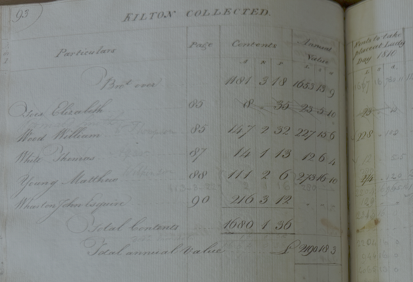
The Tenants of Kilton in 1809
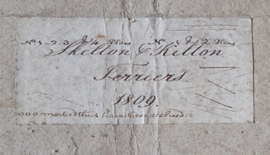
Evidence from the Terrier and Rent Books of 1809 and 1810 which
provide a snapshot of the tenants of the Kilton part of the estate
|
Return to the Home Page of the Farndale Family
Website |
The story of one family’s journey through two
thousand years of British History |
The 83 family lines into which the family is divided.
Meet the whole family and how the wider family is related |
Members of the historical family ordered by date of
birth |
Links to other pages with historical research and
related material |
The story of the Bakers of Highfields, the Chapmans, and
other related families |

The Skelton and Kilton Terrier in 1809 provided a
detailed record of the tenanted farmland in 1809. A terrier is a record
of field names, with reference number, land use, acreage, value per acre and
rent. The Kilton Terrier included records of the landholdings of William
Bennison, George Bennison, William Farndale,
Robert Solley, Robert Barker, Ralph Newbiggin, William Stephenson, Ralph
Mitchell, John
Farndale, and William Wood. For each tenant the entry in the Skelton and Gilling Rent book for 1810 is also
shown.
The darker ink extracts
on the left are the 1809 Terrier extracts and the lighter ink extracts on the
right are the 1810 rent book extracts.
To interpret the abbreviations a, r and p, an acre
was the primary unit of land area. A rood was a quarter of an acre. A perch
was a 160th of an acre or a 40th of a rood.
Robert
Barker
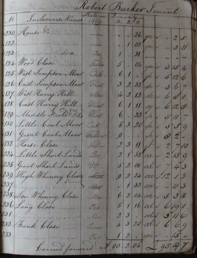
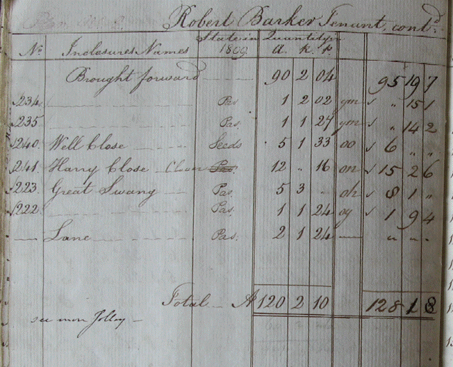
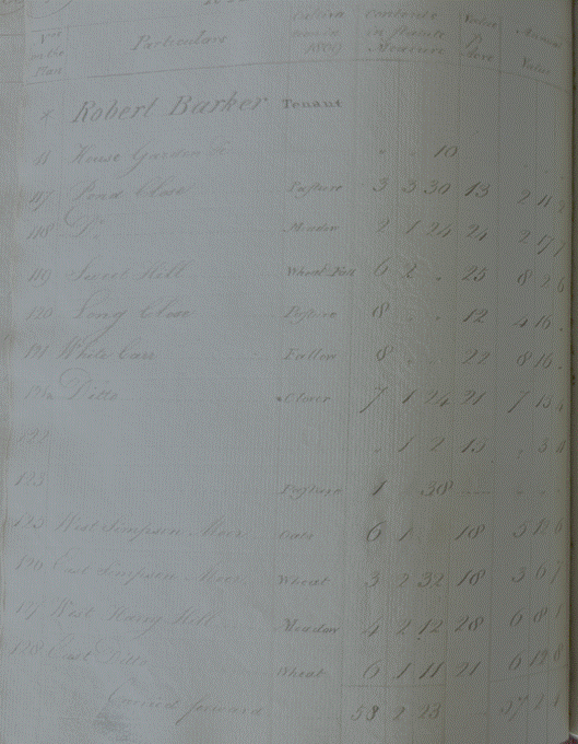
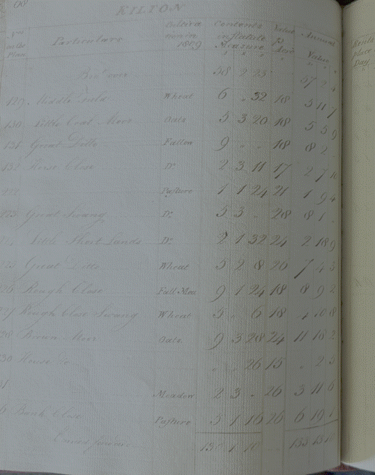
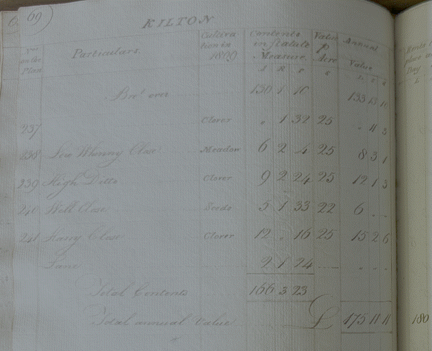
Robert Barker had
90 acres in 1809, but 166 acres by 1810 when he paid an annual rent of £175 11s
11d (£8,142 equivalent in 2026).
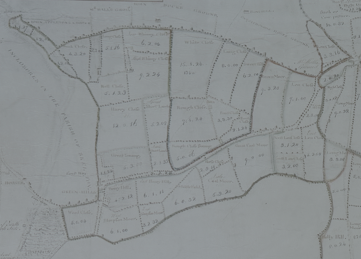
He held land to
the west of Kilton in the area shown in this extract from the 1767 estate map:
William
Bennison
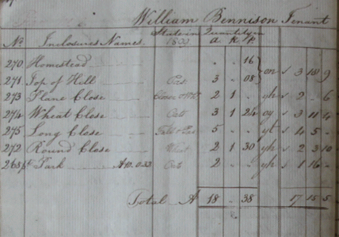
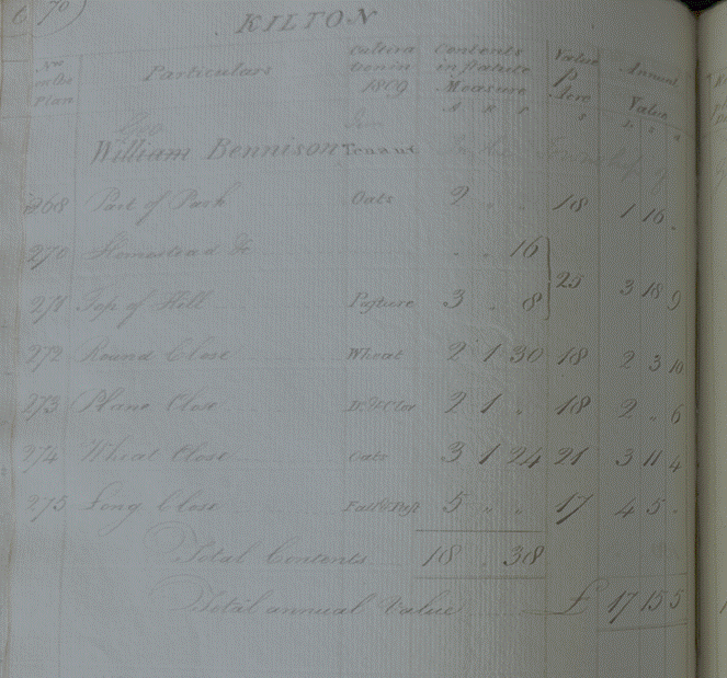
William Barker
had 18 acres and paid an annual rent of £17 15s 5d (£790 equivalent in 2026).
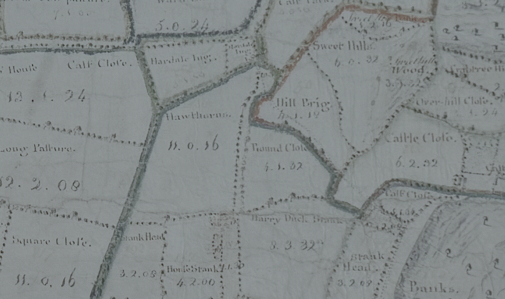
He seems to have
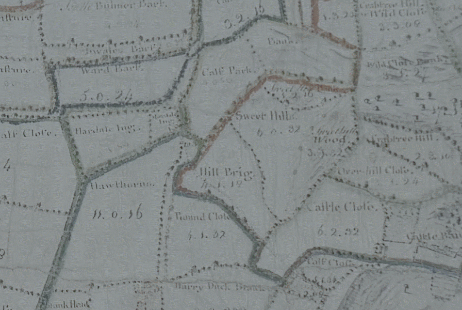
held land to the south of Kilton village where Round Cllose is shown in the
1767 estate map:
George
Bennison
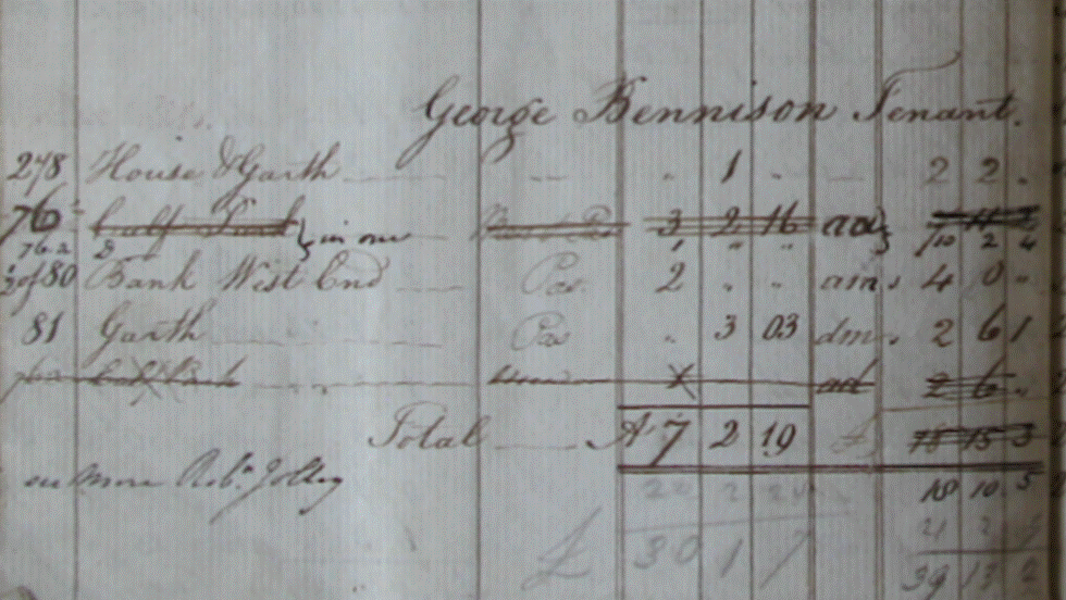
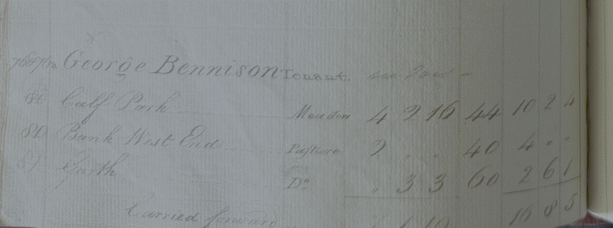
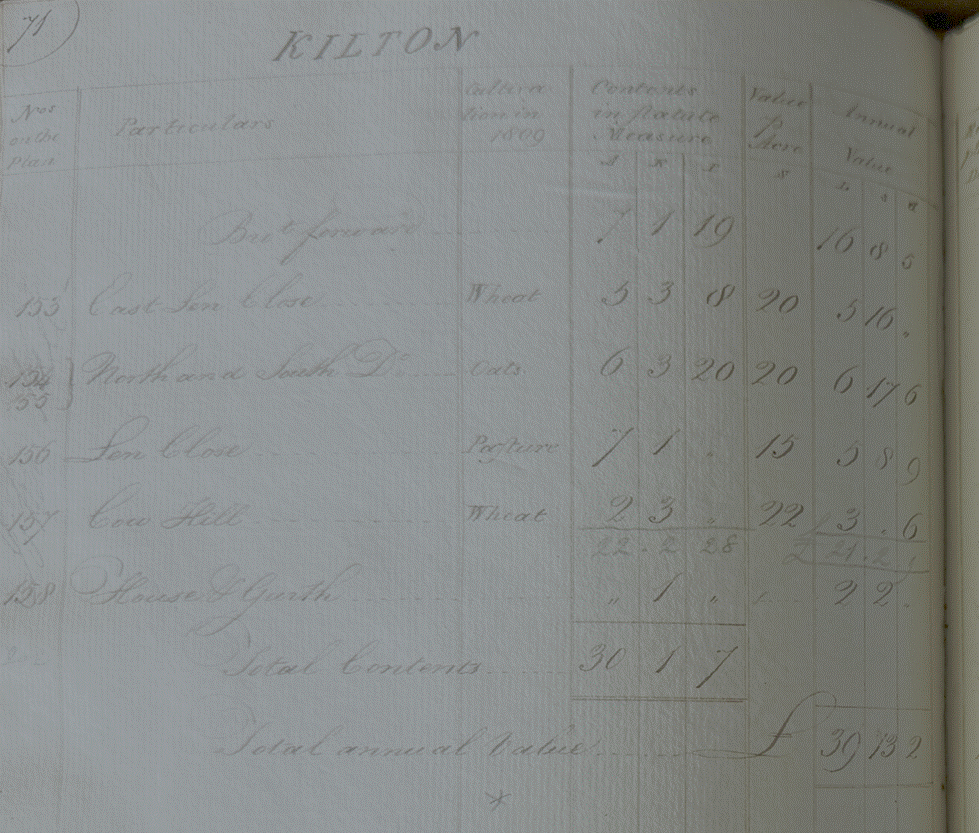
George Bennison
had 30 acres and paid an annual rent of £39 13s 2d (£1,815 equivalent in 2026).
Jane Bulmer,
widow
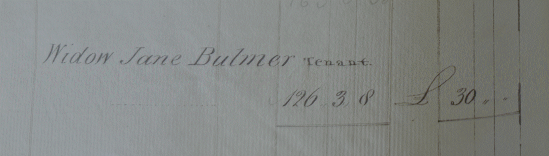
Jane Bulmer was a
widow who had 126 acres and paid an annual rent of £30 (£1,395 equivalent in
2026).
John
Farndale (Junior) (see FAR00167)
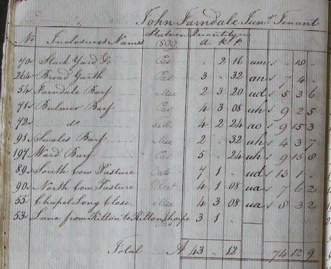
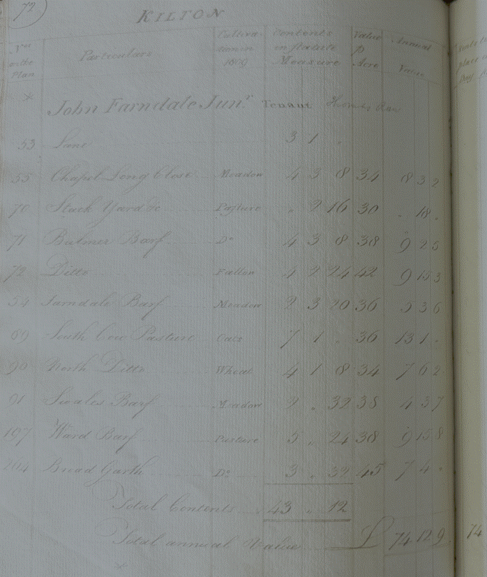
John Farndale
Junior had 43 acres and paid an annual rent of £74 12s 9d (£3,443 equivalent in
2026).
|
No |
Enclosure Name |
State in 1809 |
Quantity in acres, roods and perches |
|
|
|
70 |
Stack Yard &c |
Pasture |
2 roods, 16 perches |
um |
£0 10s 0d |
|
264 |
Broad Garth |
Pasture |
3 acres, 32 perches |
an |
£7 4s 0d |
|
54 |
Farndale Barf |
Llea? Mea? |
2 acres, 3 roods, 20
perches |
ud |
£5 3s 6d |
|
71 |
Bulmer Barf |
Paddock |
4 acres, 3 roods, 8 perches |
uh |
£9 2s 5d |
|
72 |
ditto |
Fall |
4 acres, 2 roods, 24 perches |
ao |
£9 15s
3d |
|
95 |
Swales Barf |
Llea? Mea? |
2 acres, 32 perches |
uh |
£4 3s 7d |
|
197 |
Ward Barf |
Pasture |
5 acres, 24 perches |
uh |
£9 15s
8d |
|
89 |
South Cow Pasture |
Oats |
7 acres, 1 rood. |
ud |
£13 1s 0d |
|
90 |
North Cow Pasture |
Wheat |
4 acres, 1 rood, 8 perches |
ua |
£7 6s 2d |
|
55 |
Chapel Long Close |
Llea? Mea? |
4 acres, 3 roods, 8 perches |
ua |
£8 3s 2d |
|
53 |
Lane from Kilton to
Kilton Thorpe |
Pasture |
3 acres, 1 rood. |
- |
|
|
Total |
|
|
43 acres, 12 perches |
|
£74 12s
9d |
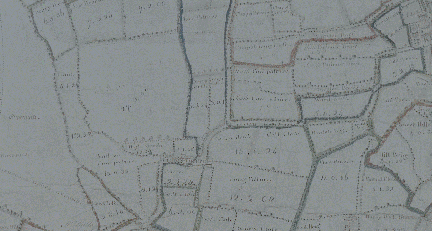
He seems to have
held land to the immediate west of Kilton village as shown in the 1767 estate
plan:
William
Farndale (see FAR00183)
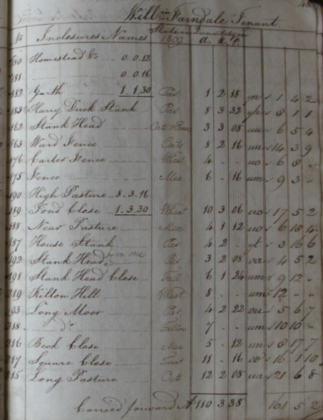
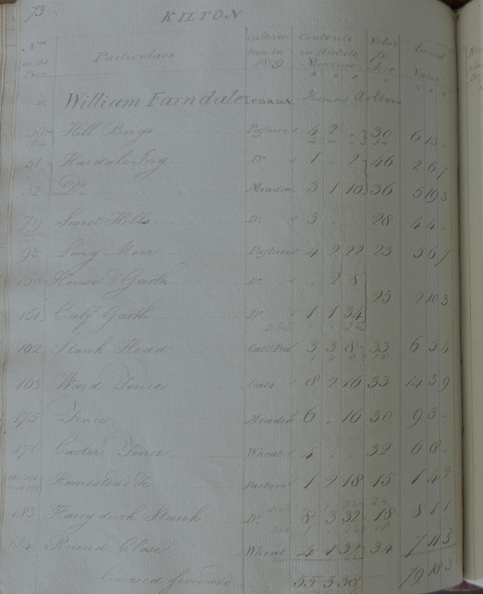
|
No |
Enclosure Name |
State in 1809 |
Quantity in a, r and p |
|
Annual Rent |
|
180 |
Homestead &c |
|
12 perches |
|
|
|
181 |
Homestead &c |
|
16 perches |
|
|
|
182 |
Garth |
Pad |
1 acre, 2 roods, 18 perches |
yn |
£1 4s 2d |
|
183 |
Harry Duck Stank |
Pad |
8 acres, 3 roods, 32 perches |
yh |
£8 1s 1d |
|
162 |
Stank Head |
Oats Beans |
3 acres, 3 roods, 8 perches |
uu |
£6 5s 4d |
|
163 |
Ward Fence |
Oats |
8 acres, 2 roods, 16 perches |
uu |
£14 3s 9d |
|
176 |
Carter Fence |
Wheat |
4 acres. |
uo |
£6 8s |
|
175 |
Fence |
Llea? Mea? |
6 acres, 16 perches |
um |
£9 3s |
|
190 |
High Pasture |
|
8 acres, 3 roods, 16 perches |
|
|
|
189 |
Pond Close |
Wheat |
10 acres, 3 roods, 6 perches |
uo |
£17 5s 2d |
|
188 |
Near Pasture |
Llea? Mea? |
4 acres, 1 rood, 12 perches |
uo |
£6 10s 4d |
|
187 |
House Stank |
Pasture |
4 acres, 2 roods. |
yt |
£3 16s 6d |
|
192 |
Stank Head |
Pasture |
3 acres, 2 roods, 8 perches |
oa |
£4 5s 2d |
|
191 |
Stank Head Close |
Fall |
6 acres, 1 roods, 24 perches |
um |
£9 12s |
|
219 |
Kilton Hill |
Wheat |
8 acres. |
um |
£12 |
|
93 |
Long Moor |
Pasture |
4 acres, 2 roods, 22 perches |
ou |
£5 6s 7d |
|
218 |
Ditto |
Fallow |
7 acres. |
um |
£10 10s |
|
216 |
Beck Close |
Llea? Mea? |
5 acres, 12 perches |
un |
£8 17s 7d |
|
217 |
Square Close |
Tweat?? |
11 acres, 16 perches |
oo |
£16 1s 10d |
|
215 |
Long Pasture |
Oats |
12 acres, 2 roods, 8 perches |
ua |
£21 6s 8d |
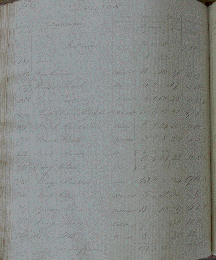
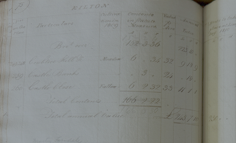
William Farndale
had 110 acres in 1809 but 166 acres by 1810 when he paid an annual rent of £245
7s 10d (£11,398 equivalent in 2026).
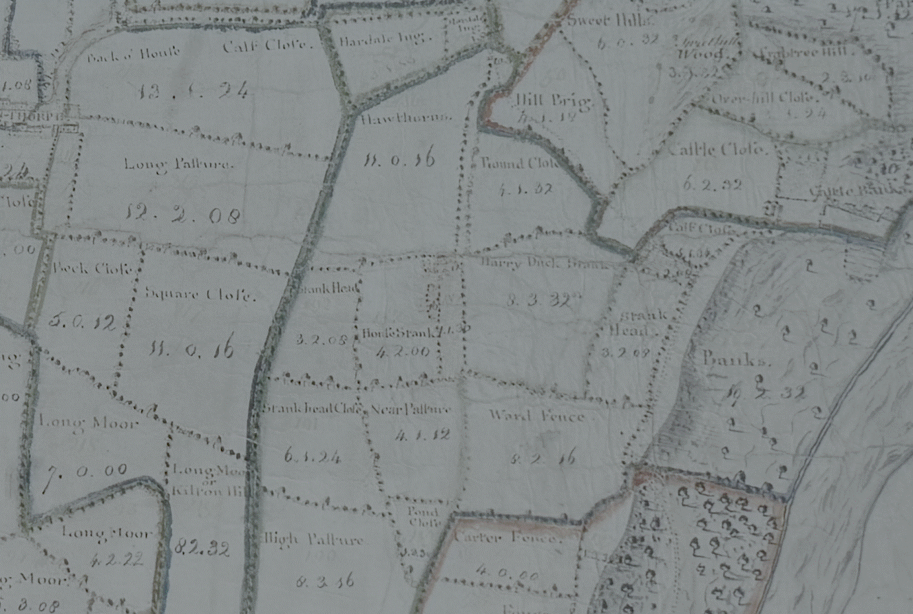
He held land
immediately to the south of Kilton village as shown on the 1767 estate map:
Matthew Johnson
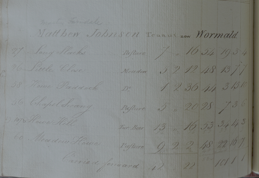
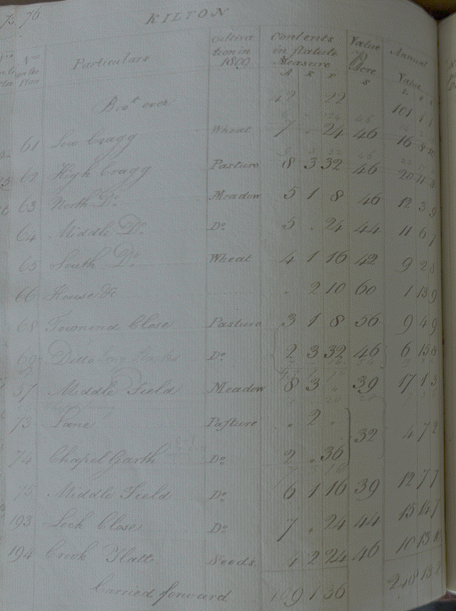
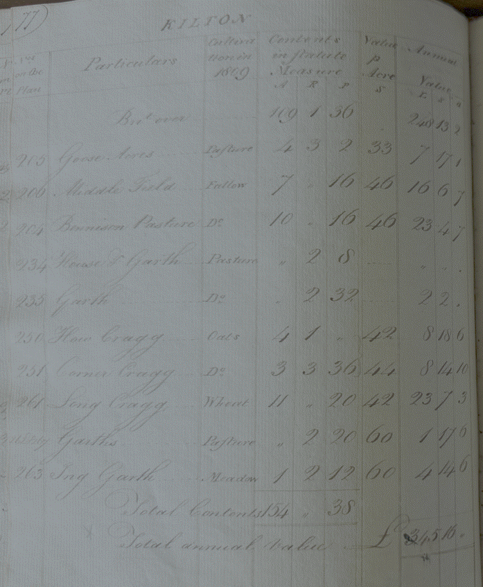
Matthew Johnson
had 154 acres and paid an annual rent of £345 16s (£16,050 equivalent in 2026).
He seems to have
held land to the west of Kilton village as shown on the 1767 estate map:
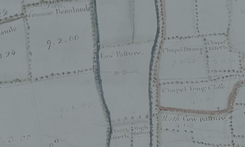
Robert Jolley
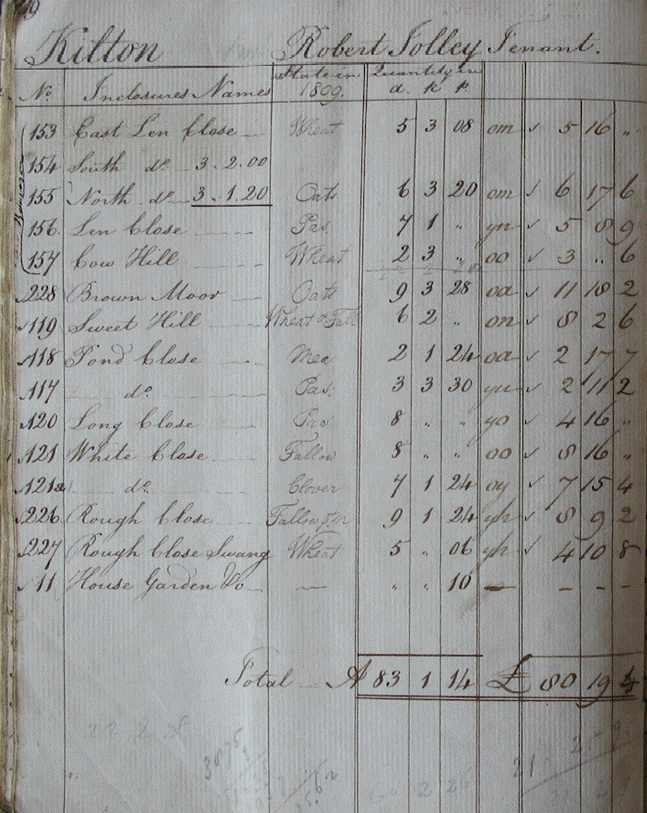
Robert Jolley did
not appear in the 1810 rent books, but in 1809 had 83 acres and paid an annual
rent of £80 19s 4d (£3,722
equivalent in 2026).
He seems to have
held land to the south of Kilton village as shown in the 1767 estate map:
Ralph Mitchell
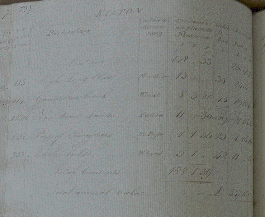
Ralph Mitchell
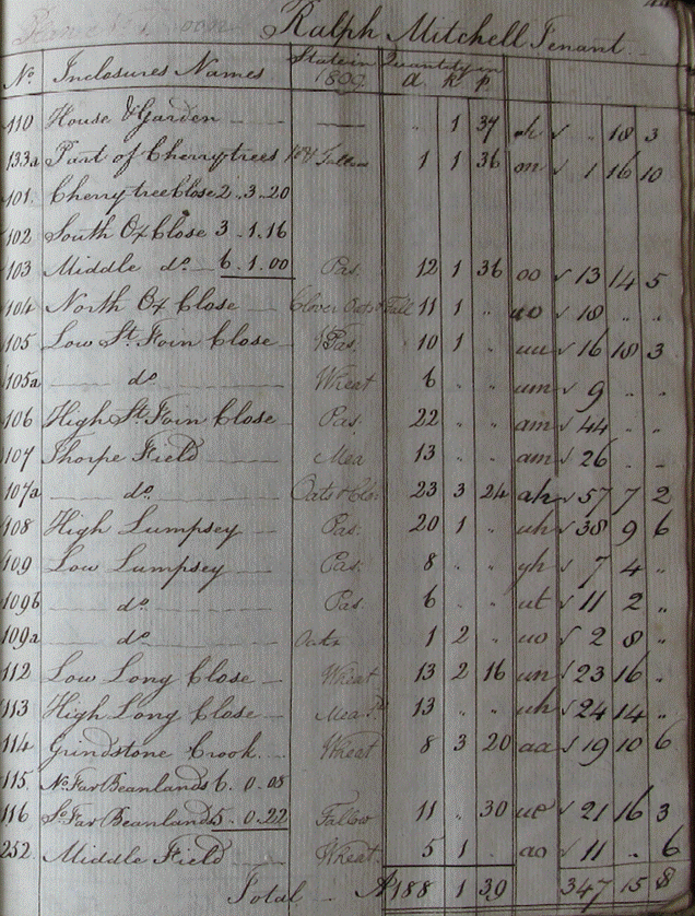
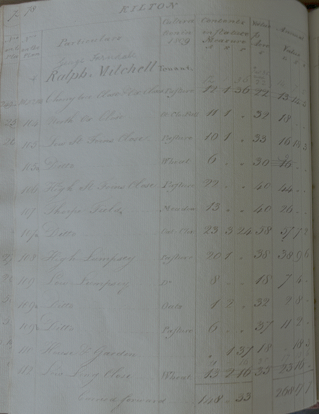
had 188 acres and paid an annual rent of £347 15s 8d (£16,145
equivalent in 2026).
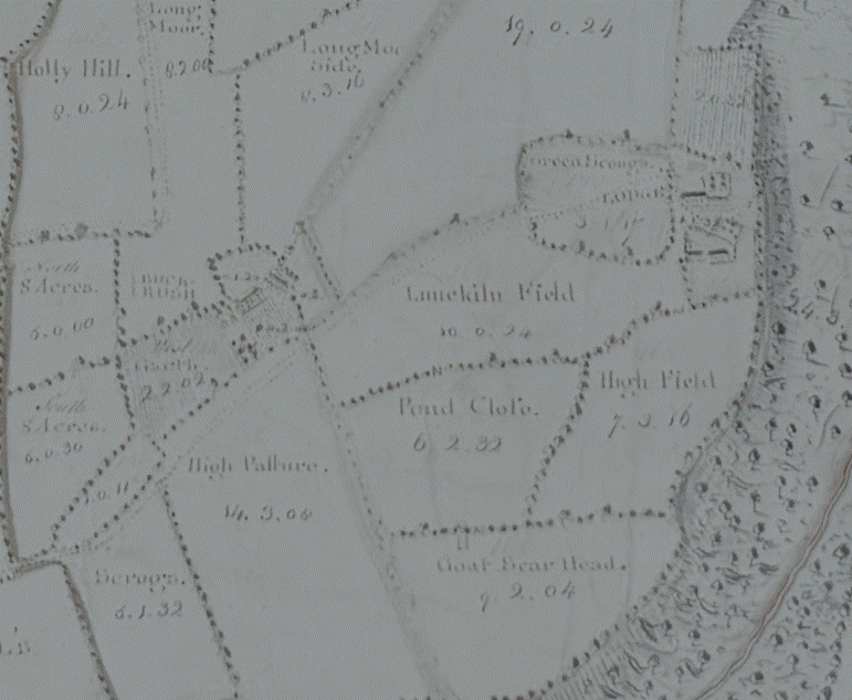
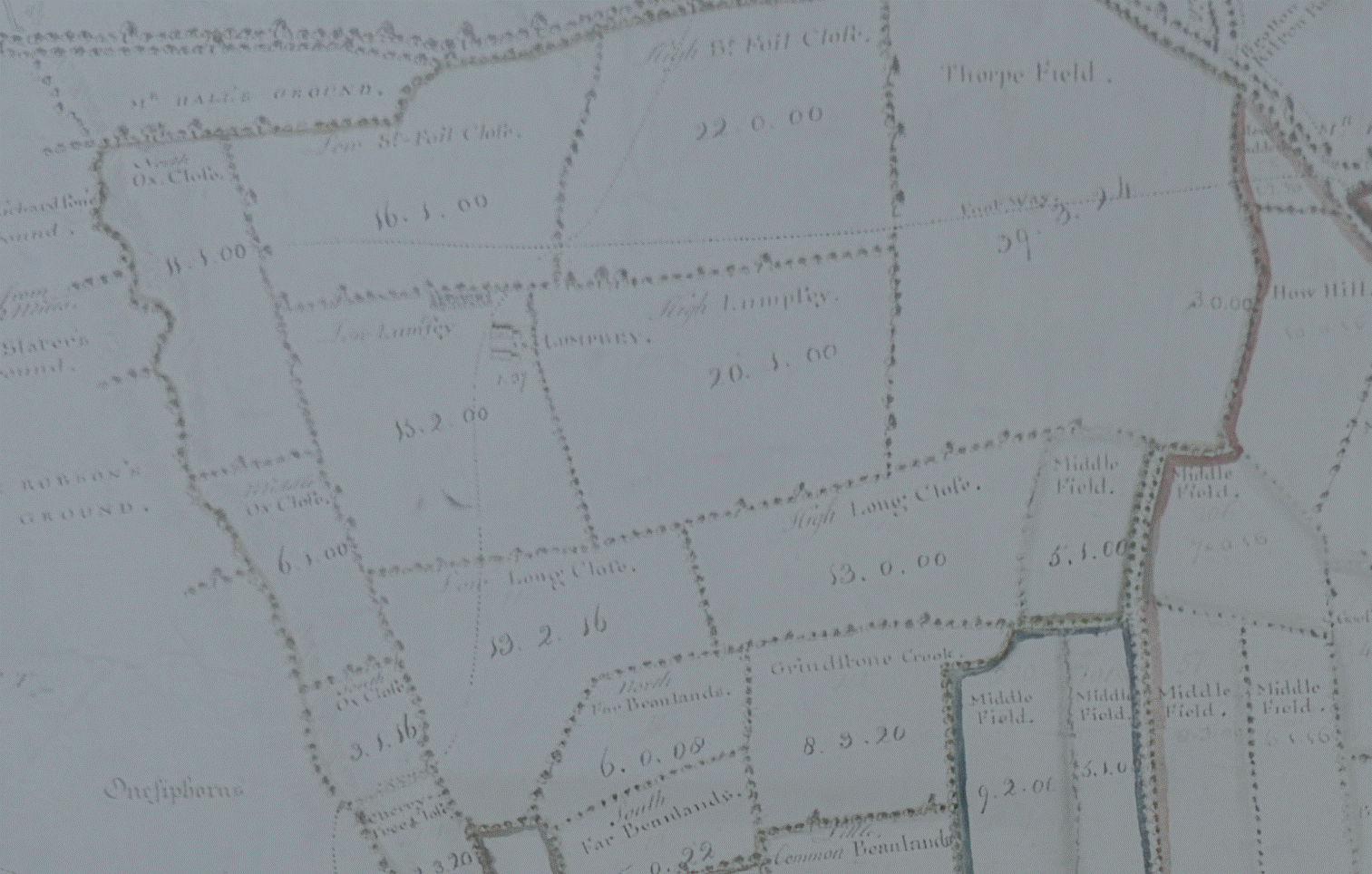
He held land
around Lumpsey, as shown in the 1767 estate map:
Ralph and later
Joseph Newbiggen
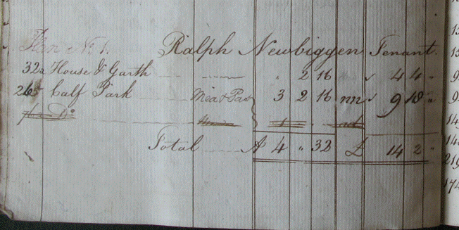
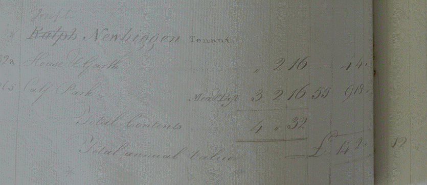
Ralph Newbiggen had
4 acres and paid an annual rent of £14 2s (£650 equivalent in 2026). His
tenancy seems to have passed to Joseph Newbeggin, who may have been his son.
Overseers of
the Poor (Matthew Farndale (see FAR00225))
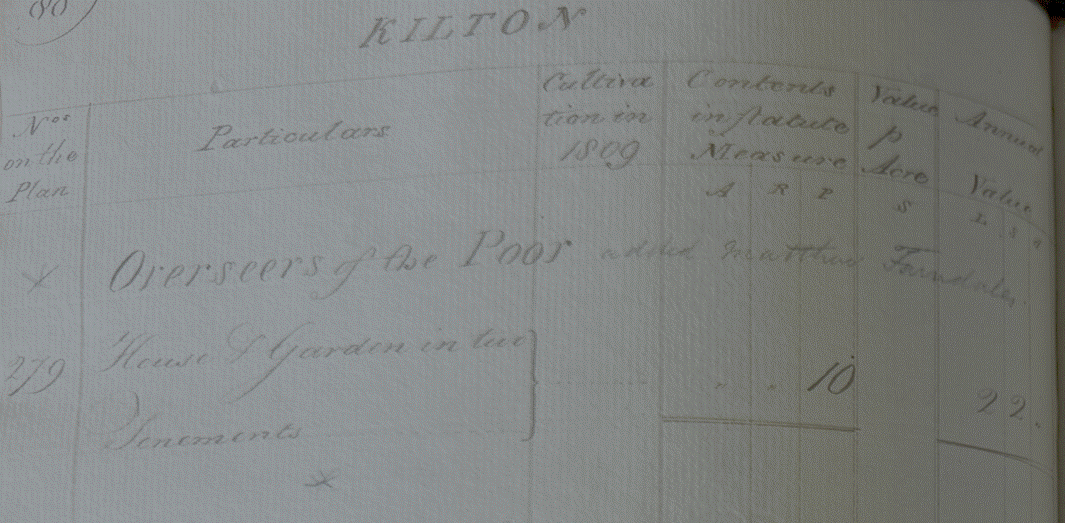
The Overseers of
the Poor (represented by Matthew Farndale) had 10 perches of land for which
they paid an annual rent of £2 2s (£90 equivalent in 2026).
John Pybus
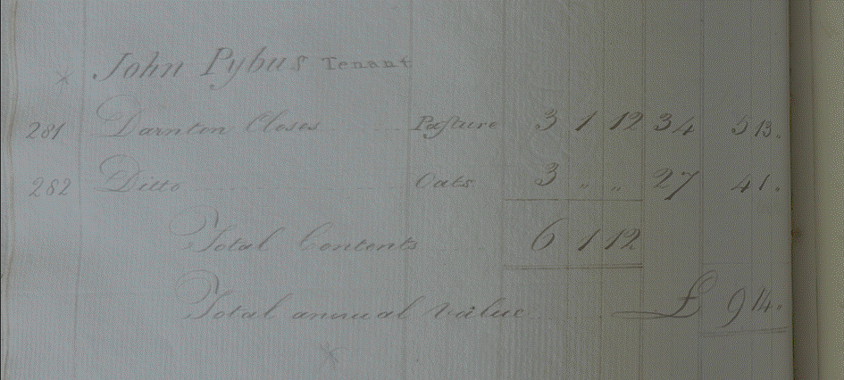
Jphn Pybus had 6
acres for which he paid an annual rent of £9 14s (£420 equivalent in 2026).
John Farndale (FAR00167) was
marrid to Jane Pybus.
Ralph (later
Thomas) Robson
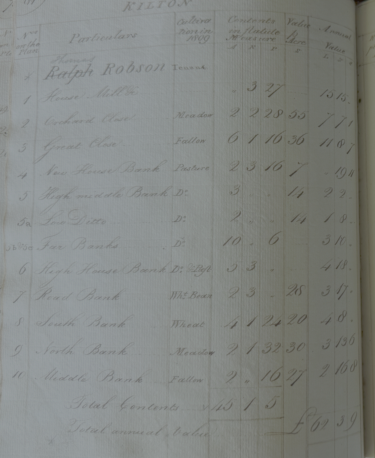
Ralph Robson held
6 acres of land for which he paid an annual rent of £9 14s (£420 equivalent in
2026). His tenancy seems t have passed to Thomas Robson, who may have been his
son.
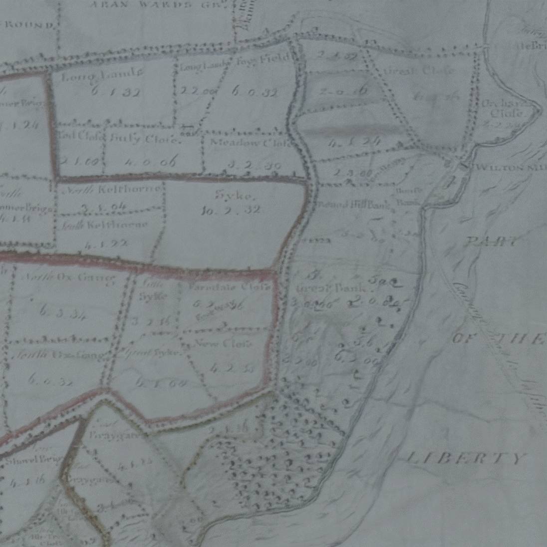
He held land
around the mill as shown in the 1767 map:
John Redman
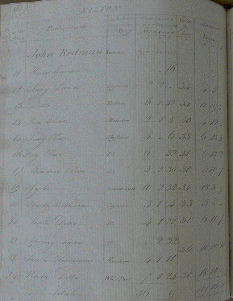
John Redman held
56 acres for which he paid an annual rent of £101 16s 5d (£4,700 equivalent in
2026).
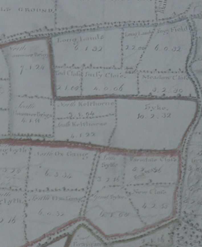
He seems to have
held land around Syke and Cragg Hill as shown in the 1767 estate map:
William
Stephenson
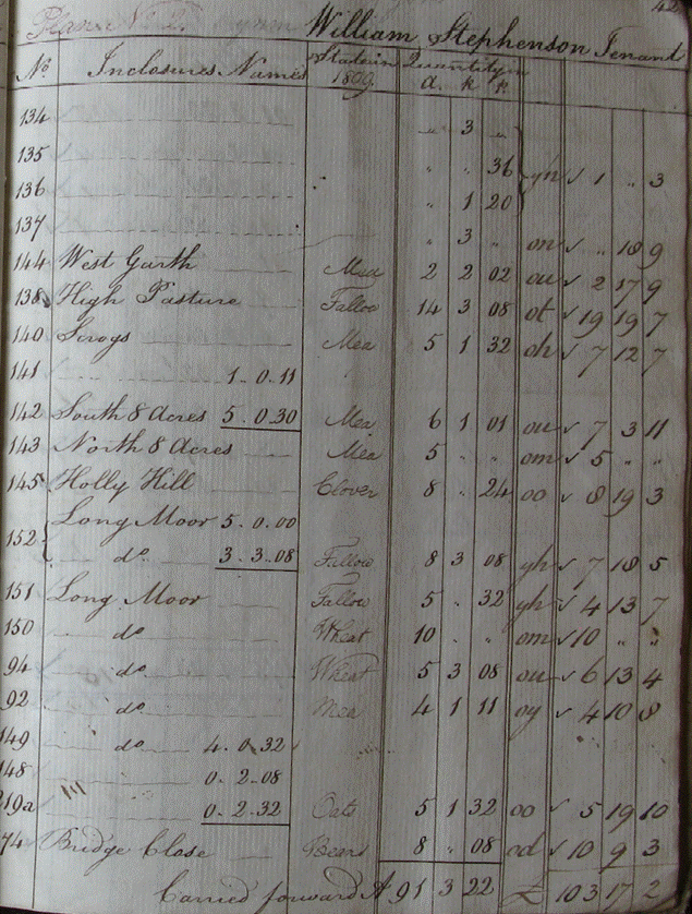
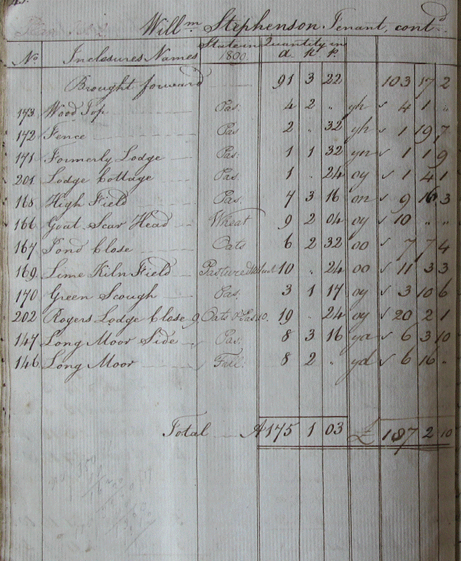
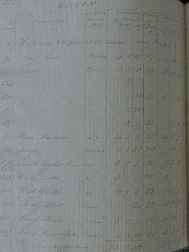
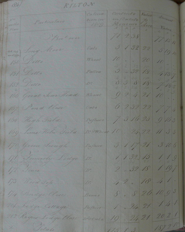
William Stephenson
held 175 acrtes of land, for which he paid an annual rent of £187 2s 10d
(£8,700 equivalent in 2026).
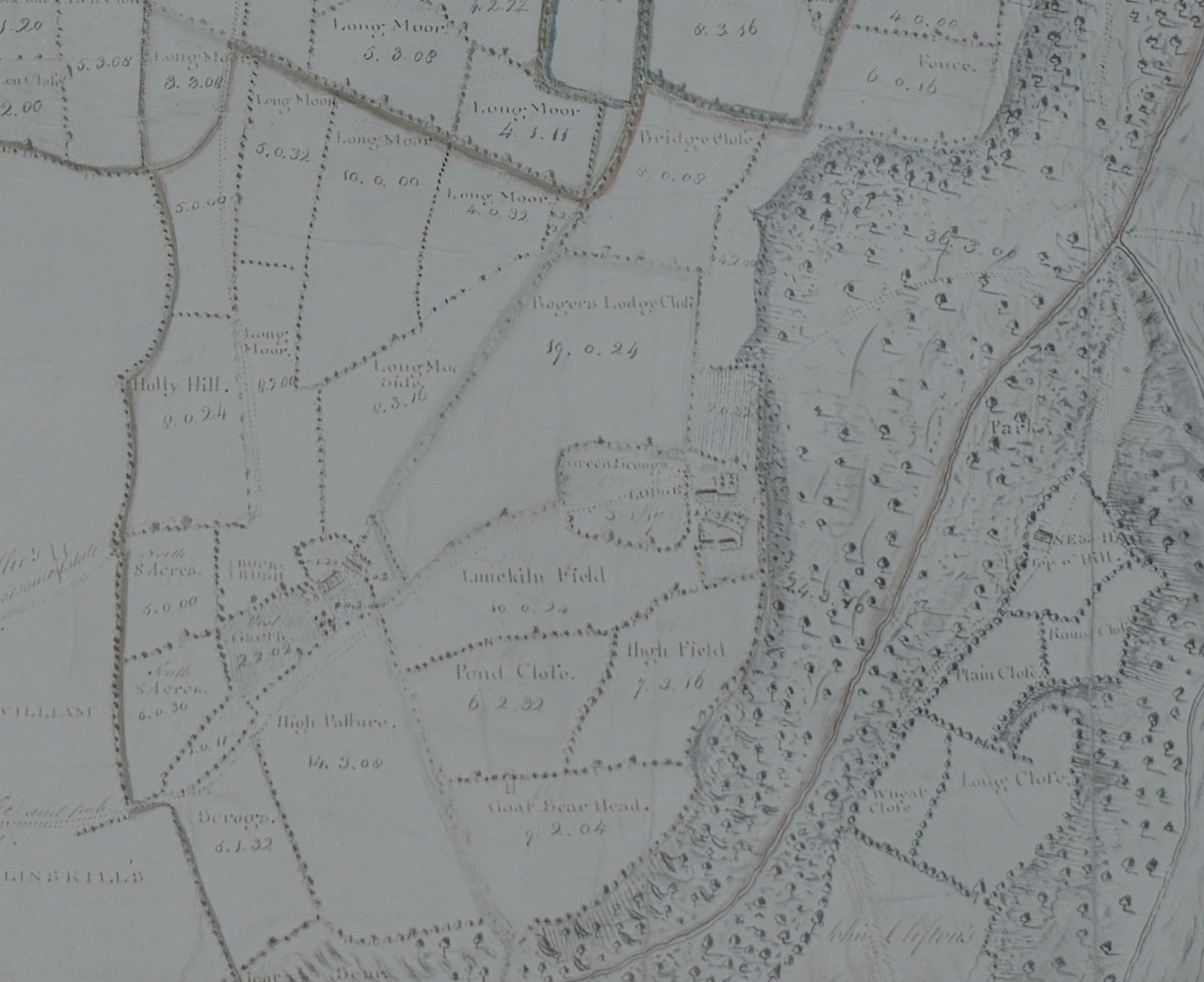
He held land to
the south of Kilton as shown in the 1767 map:
Elizabeth Toes
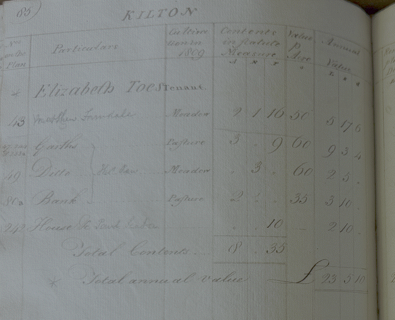
Elizabeth Toes
held 8 acres for which she paid an annual rent of £23 5s 10d (£1,070 equivalent
in 2026).
William Wood
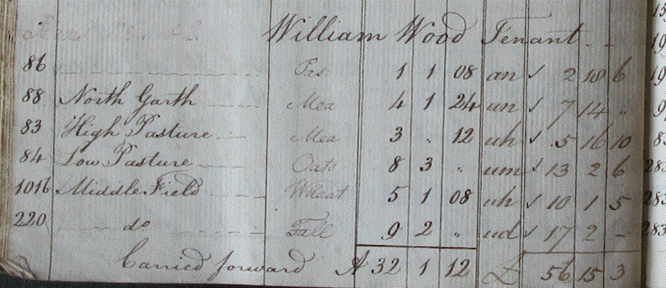
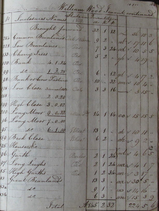
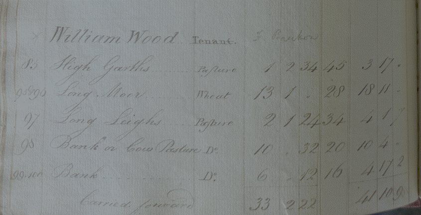
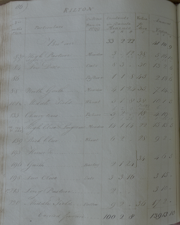
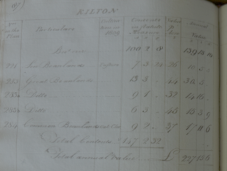
William Wood held
147 acres for which he paid an annual rent of £227 15s 6d (£10,560 equivalent
in 2026).
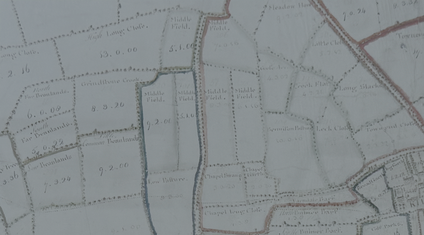
He held land to
the west of Kilton as shown in the 1767 map:
Thomas White
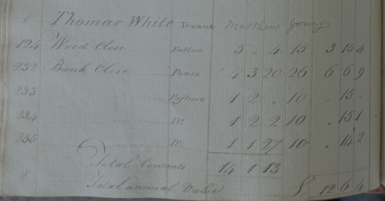
Thomas White held
14 acres for which he paid an annual rent of £12 6s 4d (£560 equivalent in
2026).
Matthew Young
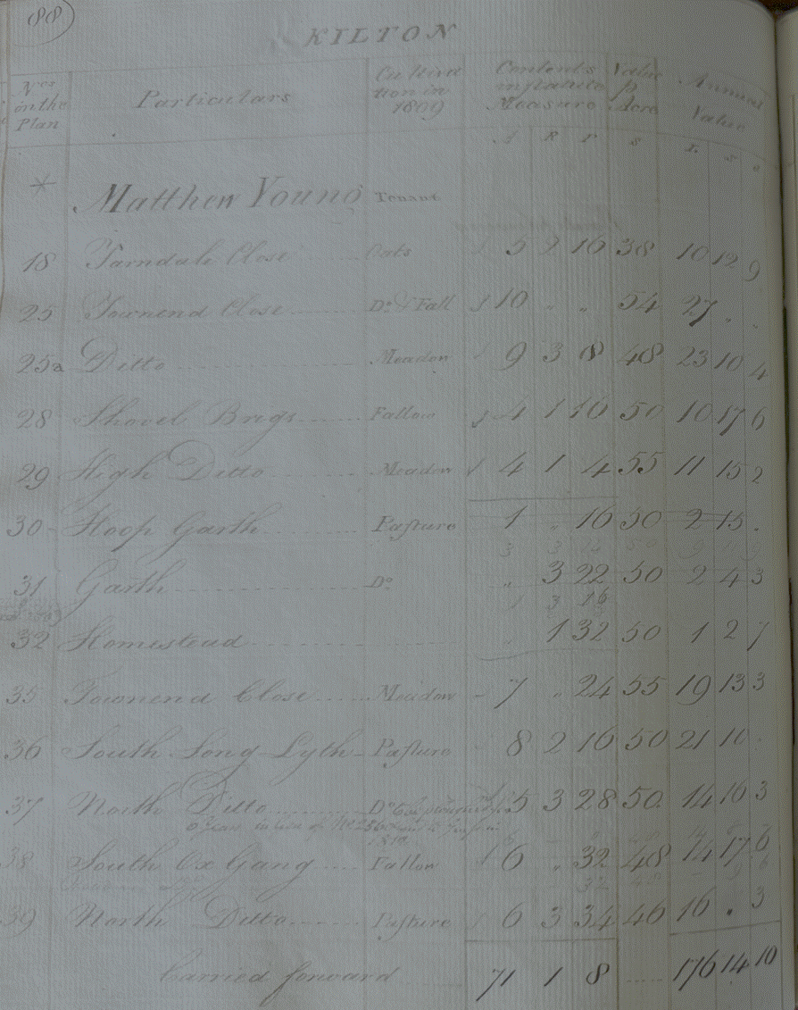
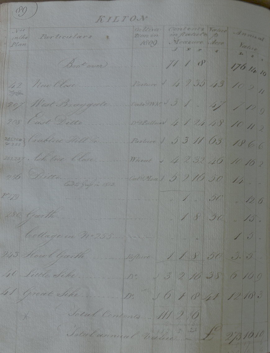
Matthew Young
held 11 acres for which he paid an annual rent of £273 16s 10d (£12,700
equivalent in 2026).
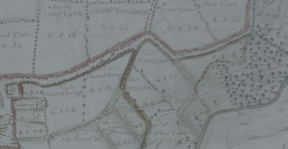
He held land to
the east of Kilton along Braygate as shown in the 1767 map:
John Wharton
Esq himself, the landowner held the following acreage directly
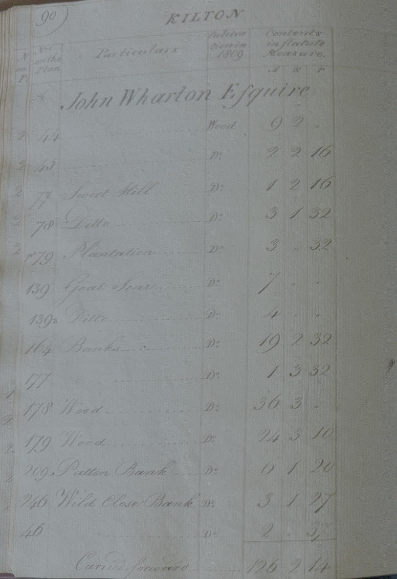
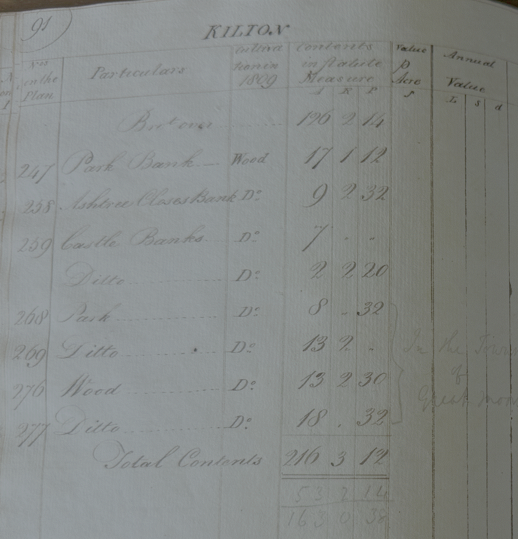
The Landlord,
John Wharton, held 216 acres of land at Kilton directly.
The totals were
recorded in the rent book