The vicinity of Farndale in the Bronze Age (1,800 BCE to 700 BCE)
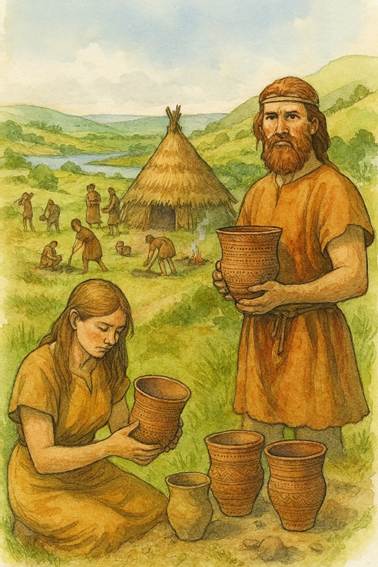
Beaker Folk
The Age of Bronze was
a new chapter in the human story when individuals controlling trade and wealth
gained increasing power.
FAR00001E
|
Return to the Home Page of the Farndale Family
Website |
The story of one family’s journey through two
thousand years of British History |
The 83 family lines into which the family is divided.
Meet the whole family and how the wider family is related |
Members of the historical family ordered by date of
birth |
Links to other pages with historical research and
related material |
The story of the Bakers of Highfields, the Chapmans,
and other related families |

Hyperlinks to other pages are in dark blue.
Headlines are in brown.
References and citations are in turquoise.
Context and local history are in purple.
BCE - Before the common or current
era. The contemporary equivalent of BC.
CE - Common or current era. The contemporary
equivalent of AD.
Go back to Neolithic
Yorkshire.
Context – the Age of
Bronze
It
was thought at first that the Beaker folk were a race of warlike invaders, a
race apart, but evidence from the Helmsley district shows that they were
intermingled with the late or secondary Neolithic people (A
History of Helmsley Rievaulx and District,
editor, J McDonnell, 1963, page 16).
Their traditions were likely, nevertheless, to have been brought with
immigrants from the Continent, who settled in the region.
Metal implements did not appear in Yorkshire in any quantity
until Copper Age 2, when the copper and gold is likely to be mostly of Irish
origin. A model for the Bronze Age in Britain has been suggested as:
·
The earliest metal implements were of copper (supplied
from Irish and German sources) unalloyed with tin, made in Hawkes’ Copper
Age 1 (c 1,850 to 1,750 BCE)(A Scheme for the British Bronze Age,
CFC Hawkes, 1960, Antiquities Journal, Volume 49),
contemporary with late Neolithic cultures and particularly the Beaker Cultures.
· The Copper
Age 2 (c 1,750 to c 1,600 BCE) included thick butted axes found in East
Yorkshire and the Pennines.
· The
‘Migdale’ industry flourished in Professor Hawkes’ Early Bronze Age 1 (c
1,600 to 1,500 BCE). The industrial tradition of metal working using a true
bronze of copper alloyed with tin was named after the Migdale hoard from
Sutherland. ‘Migdale’ axes are widely distributed in Yorkshire with a
concentration on the Wolds, a number in Holderness; and a scatter from the limestone
hills of North-east Yorkshire, the Howardian Hills, the Vale of York.
· During
the next phase of the Early Bronze Age 2 (c 1,500 to 1,400 BCE), the
‘Migdale’ industry continued and developed its flat axe into an axe with slight
flanges. During this phase the ‘Migdale’ industry had a competitor for the
supply of bronze implements, the ‘Arreton’ Industry, named by Mr. Britton after
the hoard of bronze implements from Arreton Down, Isle of Wight. In
Yorkshire the ‘Arreton’ axes are not as numerous as the ‘Migdale’ axes.
· Middle
Bronze Age (1,400 BCE to 900 BCE), though there is a suggestion
that in the area of the North Yorkshire Moors this period started by 1700 BCE (Bronze
Age Round Barrows and Adjacent Earthworks on the Hambleton Hills,
Raymond A Varley, Yorkshire Archaeological Journal, Volume 51, 1979, page 144).
·
Late Bronze Age (900 BCE to 700 BCE).
(Early Bronze Axes from Yorkshire, T G Manby, Yorkshire
Archaeological Journal, Volume 41, 1966, page 346).
During the Neolithic period flint was being worked on increasing
scale, with an evolving industry mining and honing flint at scale. Flint axes
were needed in greater numbers from a dwindling resource to build houses, shape
canoes and for other purposes.
The Neolithic-Beaker
overlap (2,000 to 1,500 BCE)
2,500 BCE
Ireland became a centre of early bronze industry and travelling
bronze smiths and tinkers left traces across the north of England (A History of
Helmsley Rievaulx and District, editor, J McDonnell, 1963, page 43). The earliest use of
metal was introduced to Britain in about 2,500 BCE. The hills around Country
Kerry in Ireland were rich in copper ore and this resource was used across
Britain after the indigenous Irish population learnt about the use of copper from
travellers from Continental Europe. This led to a mining industry in Ireland.
The first copper had been mined in the Balkans from about 4,000 BCE and by
about 3,000 BCE the new industry reached southern Europe and then in about
2,500 BCE through northwest Europe, with prospectors looking for new sources of
ore in Ireland, with the earliest example at the Ross Island Copper Mine.
Copper was then exported to western Britain. Indeed archaeological
sites at Kilmartin and at the entrance to the Great Glen in western Scotland,
on the trade routes from Ireland, show signs of their growing importance as the Copper Age turned to the Bronze Age where graves for
single elite burials and trade of luxury goods such as jet from Whitby (for
instance a jet necklace from Argyll dating to about 2,150 BCE) evidence growing
opportunities, connection and wealth.
Smelting copper ore required
crushing out the ore and then bellows were used to achieve very high
temperatures. The people who brought this new technology also introduced a new
culture.
The Amesbury Archer dates to about 2,000 BCE and is the earliest Beaker Folk site,
associated with the first examples of metal (both copper and gold) in Britain.
The Amesbury Archer was a pioneer who was born in the Alps of central Europe.
The artefacts at the site included a cushion stone used to give the finishing
touches to metal, suggesting experienced metal workers were arriving in
Britain.
The Beaker Folk also introduced metal such as gold and the
trappings of wealth. They introduced new cultural ideas including an increasing
perception of self. The possessions found in Beaker Folk burials included ideas
of identity and markers of individuals.
1,800 BCE
Yorkshire’s Copper Age 1 (first encounter with metal)
The Beaker Folk
The use of copper and bronze was probably introduced into
Yorkshire by the Beaker Folk, who arrived in the area via the Humber Estuary in about 1,800
BCE. They also came across the Wolds having crossed the
Pennines. Their name is derived from their tradition to bury beaker shaped urns
with their dead. Beaker Folk reached Malham Moor and occupied sites on the
Wolds. They cultivated wheat. They had first arrived in mainland Britain in about
2,000 BCE, but reached Yorkshire by about 1,800 BCE, bringing new metal working
skills and a new culture.
Beakers have been found in the Howardian Hills at Whitwell and
Gilling, and at West Lodge Gate and Amotherby near Malton. These beakers on the Howardian Hills mark
a westward movement of the Beaker using peoples from the great Beaker
settlement area of the Yorkshire wolds. This movement ultimately reached the
Hambleton Hills, where type ‘A’ beakers were found in a barrow at Boltby and a
handled beaker in the Slip Gill, Helmsley. (Beakers from the
Howardian Hills, North Riding, T G Manby, Yorkshire Archaeological Journal, Volume 39, 1958, page 397).
They seem to have been a drinking peoples, as many of the beakers
show traces of alcohol.
The Beaker People have traditionally been known for their
burial mounds, from which most of the Beakers have been recovered. Occupation sites
are known, one was excavated at Beacon Hill, Yorkshire (Excavations at
Beacon Hill, Flamborough Head, East Yorkshire, J Moore, Yorkshire
Archaeological Journal, Volume 41, 1964, pages 191 to 202), where Beaker occupation dated from the Middle Neolithic
Phase.
The Beaker People moved into the Pickering area, Ryedale near
Helmsley and on to the Hambleton Hills at Boltby. From the limestone hills near
Pickering, four Beakers are recorded: a Parimary Southern British S1 from
Monklands, Northern British/North Rhine Beaker near Pickering, Handled Southern
British 4(C) one mile north of Pickering and a European Bell Beaker from
Raindale. (Three Beakers from the Hambleton Hills, Raymond A Varley,
Yorkshire Archaeological Journal, Volume 45, 1973, page
171).
The people of the Bronze Age continued to hunt in
upland areas. There have been finds of their barbed and tanged flint
arrowheads. Gradually these were replaced with metal tools and weapons.
1,750 BCE
Yorkshire’s Copper Age 2
(scaling up)
Whilst the Beaker Folk had brought their metal working
skills by about 1,800 BCE, metal implements did not appear in Yorkshire in
any quantity until Copper Age 2, when the copper and gold is likely to be
mostly of Irish origin. There is evidence during the Bronze Age of metal
working and tin mining, leather and cloth manufacturer, pottery and salt
production. There was domestic trade and trade beyond the island’s shores. They
imported flat bronze axes from Ireland. They exported ornaments made of Whitby
jet. They traded in salt and had sea connections with Scandinavia.
The Ryedale Windy
Pits
Human
remains were first discovered in the Ryedale Windy Pits, in the nineteenth
Century by William Buckland, discoverer of the Kirkdale
Cave. There is evidence that at least one of the human remains had been
scalped suggesting ritual sacrifice.
The human remains from the Windypits are Late
Neolithic or Early Bronze Age burials due to their association with the Beaker
pottery and flint tools found in the chambers of the fissures.
Warm or cold air rises from the fissures and comes into contact
with the air outside the entrance. In winter a steamy vapour rises eerily in
puffs or jets from the holes.
|
|
|
Underground
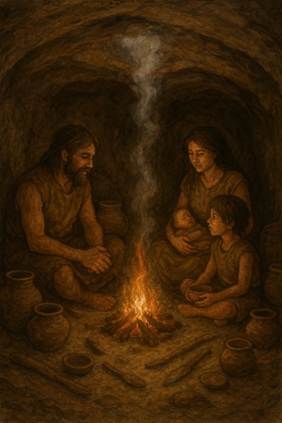
caves, only 15 km from Farndale, which were the home of the Bronze Age Beaker
Folk |
1,600 BCE
Yorkshire’s Early Bronze Age 1
(hardwearing tools)
Copper was a soft metal and barely more durable than
flint. However the Beaker Folk also knew of a more durable metal when copper
was alloyed with tin, found on the Cornish coast, to make bronze.
With bronze, in time, came new items such as swords.
The earlier items however were axes, able to do a better and faster job. They
also became items of status and prestige. These new objects were moving more
frequently across the British Isles, so that those able to control these trade
routes, grew in power and wealth. Specialist metal workers had new opportunities
to grow their wealth.
The Bronze Age was a time of changes in burial
rituals. Bodies were buried beneath circular mounds, round barrows, often
accompanied by bronze artefacts. There are many barrows in upland locations on
the Wolds and the Moors.
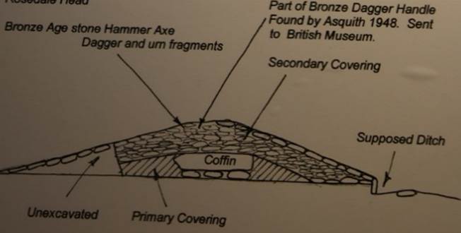
Sketch of a howe on Rosedale Head
The larger round barrows of the Bronze Age tend to
arise in ridgeways and high points, whilst groups of smaller cairns tend to lie
on spurs or slopes with a southerly aspect
(Early Man in North East Yorkshire, Dr Elgee, page 126). On the higher
moors, some of the very large tumuli can be seen crowing the ridges and summits
of the Cleveland Hills (A History of
Helmsley Rievaulx and District, editor, J
McDonnell, 1963, page 32).
Early Bronze Age burials were performed at Ferrybridge
Henge. There is a Street
House Long Barrow (later added to by an Anglo Saxon royal burial site) at
Loftus, where many later Farndales lived and are buried. There are barrows at Yearsley,
where another branch of the family later lived. There are barrows and tumuli
such as at Whinny Hill Farm near Kirkbymoorside and Keldholme and a road in the
centre of Kirkbymoorside, Howe End, circles the site of a howe, a large round mound
which contained several burial sites.
Round barrows of the early part of the Bronze Age are
the most conspicuous archaeological features of the North York Moors. The
scarcity on lower ground is due mainly to agricultural activity. Those on
higher ground have generally been found to contain cremations, while those on
lower ground in limestone areas contained both burnt and unburnt bodies. The
skeletons are most often accompanied by pottery (beakers, food vessels, collared
urns and accessory cups), and flints, and sometimes by jet ornaments, stone
battle axes and occasionally by bronze daggers. Collared urns and cremations
have also been found with stone embanked circles such as at Great Ayton moor.
In the area of Hesketh Hall (SE 500 870) are a number of barrows and earthworks, and a promontory
fort on Boltby Scar. The whole area is rich in flints; many arrowheads,
scrapers and flint hammers have been found. (Three Beakers from the Hambleton Hills, Raymond A Varley, Yorkshire
Archaeological Journal, Volume 45, 1973, page 169).
On the western edge of the Hambleton Hills, in North
Yorkshire, are a remarkable series of prehistoric earthworks: the Casten Dike
north and south, Cleave Dike, a promontory fort on Boltby Scar, Hesketh Dike, a
prehistoric track and many burial mounds. Nearly all the burial mounds were
excavated during the last century: some produced urns, beakers, flints and
personal ornaments. John Sanders excavated one of these barrows in 1910 and
recovered a large Collared Urn containing a cremation and bronze pins or studs. (Bronze Age Round Barrows and Adjacent Earthworks on
the Hambleton Hills, Raymond A Varley, Yorkshire Archaeological
Journal, Volume 51, 1979, page 141).
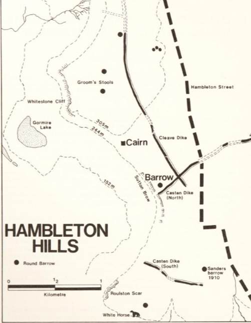
There are many burial mounds on the western edge of the
Hambleton Hills; nearly all were excavated during the eighteenth century. Canon
William Greenwell excavated at least two, a cairn and a round barrow on Sutton
Brow near Boltby Scar; no burials were found in the limestone constructed
cairn, but two bronze age Collared Urns containing cremated human bones and a
flint scraper were found in the round barrow. (Bronze Age Collared Urns from the Hambleton Hills, R A Varley, Yorkshire Archaeological Journal, Volume 54, 1982, page
23).
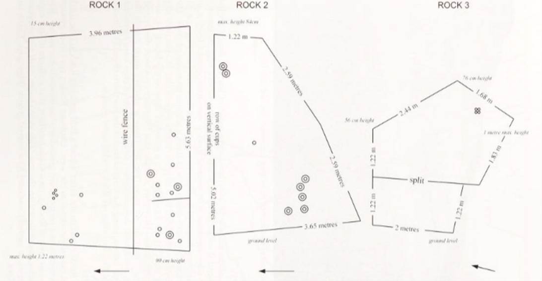
To the northwest of Farndale, at the northern extent
of the moors, at Wainstones, close to Bronze Age burial mounds at Cold Moor (NZ
552018) and Cringle Moor (NZ 537029), cupstones have been found on rocks at Wainstones
(NZ 558035). These are Bronze Age carved
rocks on three rocks, cup and ring markings, albeit corrupted with modern
graffiti. There are at least twenty cup-marks on Rock 1. Clearly visible
towards the north-east corner of Rock 2 are two pronounced cups. Earthfast Rock
3 rises from ground level at its western extremity to 1 metre above ground
level at its south-east corner. It is on this highest south-east area of Rock
3, on a sloping surface, that a cluster of four cups is to be found, one being less
distinct than the rest. This tight cluster, each cup approximately 5 cm in
diameter, is partially enclosed by a curved groove. Tees Archaeology’s
sites and monuments records for the area of former Cleveland County, to the
north and east, show the total number of cup-marked stones to be sixteen in
January 2002. Most, if not all, of these are portable stones associated with
Bronze Age burial mounds. Markings such as these are generally associated with
passing information and were often alongside important routes. (Recent discoveries of prehistoric rock motifs, the Wainstones
Site, Brian Smith, Yorkshire Archaeological Journal,
Volume 75, 2003, page
1).
Sites with small cairns with dykes around Farndale
include:
· Horn
Nab overlooking Farndale (SE 657963, see further below) – a group of 30 cairns,
possibly associated with the cross ridge earthworks.
· A group
of 3 or more (SE671931); 12 associated with old shallow ironworks (SE 672925),
a group of 20 of more (SE 675921); and another 18 to 20 (SE 677916) all on
Harland Moor.
· Two
groups of 80 and 30 to 40 on Spaunton Moor (SE 705932 to SE 702925).
(A History of
Helmsley Rievaulx and District, editor, J
McDonnell, 1963, page 402 to 403).
1,500 BCE
Yorkshire’s Early Bronze Age 2
(wealth)
This was the period when the Dover
Boat was built in Kent dating to about 1,520 BCE, the oldest surviving sea
going vessel in the world, originally about 20 metres long, a vessel that
carried cargo between Britain and Continental Europe, including bronze and
perhaps wool and fabrics. The Dover Boat was eventually damaged in such a way
to put it out of use. This seems to have represented an affinity with
landscape. Bronze Age folk felt that they were only borrowing resources, so
that one day they had to be returned to the earth. Similar practices have been
identified with many objects such as rapiers and other weapons.
By 1,500 BCE Britain was a rich, wealthy land, with
the emergence of a Bronze Age elite connected to the land. Ordinary people had
continued to farm the land as they had done for centuries, often with limited
permanency, sometimes adopting seasonal patterns to follow the flow of
resources. However with the growing elite classes, there was an increased
permanency of association with the land. Flag Fen Village (c 1,300 BCE), east
of Peterborough, is a Bronze Age site which was constructed about 3,500 years
ago and consists of more than 60,000 timbers arranged in five very long rows,
and comprises houses built to last a lifetime. These were the roundhouses which
housed an entire family with a central hearth and the smoke sifting out through
the thatched roof.
These communities may have been a relatively relaxed
society as the population was still low. In many areas there may not have been
significant violence, nor an underclass. Except at areas of flashpoint between
communities, excavated skeletons tend to suggest well nourished folk living
comfortable lives during the Bronze Age.
1,400 BCE
Yorkshire’s Middle
Bronze Age (permanent settlement)
Permanent dwellings led to the evolution of the first small
settlements, tiny hamlets, with organised field systems around them. This was a
period when people first started to live in the same house for a lifetime and
sometimes alongside neighbours who they knew over a lifetime. The Dartmoor Reaves
provide some of the best preserved landscapes of this period, with permanent
roundhouses and field systems. These were permanent places where folk spent
their lifetimes, adjacent to long term neighbouring roundhouses.
This was perhaps a time when marriages were arranged
between local communities to cement relationships and build alliances.
The population steadily grew to perhaps about 2
million.
The North York Moors might not, nowadays, seem the
best place to farm, but the climate was warmer in the past and the land more
fertile; there is evidence for many small field enclosures in Eskdale and Upper
Ryedale, marked by rubble walls and cairns of cleared stones. Those who farmed there
left their important dead in more than 200 burial mounds scattered over the
area. Population increase in Bronze Age Yorkshire seems
to have led to disputes over access to resources. This inevitably resulted in
the increased demarcation of the land. Lines of howes across the horizon, or
increased building of dykes warned neighbouring groups whose territory they
were entering. Some of these dykes probably major tribal boundaries, are huge,
with multiple banks. (The Little History
of Yorkshire, Ingrid Barton, 2024, page 20).
These early settlements didn’t last.
1,000 BCE
Forests were cleared at such a rate that around 1,000
BC Iron Age Britain was not, as was once romantically imagined, an unbroken
forest kingdom stretching from Cornwall to Inverness but rather a patchwork of
open fields, worked with rudimentary ploughs to harvest beans and grains,
dotted here and there with woodland copses giving cover for game, especially wild
pigs, and intensively worked to stoke forges and supply timbers for the
building of the circular huts and houses in which most of the population lived. (A History of Britain, At the Edge of the World,
3,000 BC to AD 1603, 2009, Simon Schama, page 26).
900 BCE
Yorkshire’s Late
Bronze Age
The Salcombe Wreck was a vessel which sank off the Devon coast laden with copper and
tin ingots mined across southern Europe in about 1,000 BCE evidencing the
extent of international metal trading in the Late Bronze Age. The exchange of
bronze had become an important source of wealth. The Llyn Fawr Hoard from Glamorgan (c 750 CE) reveals the scale of trade in bronze by
the Late Bronze Age, fuelled by demand from a high class elite, who couldn’t
get enough of it. Britain was known as the Tin Islands, with a rich
resource in tin from Cornwall, and also in sources of copper, by now mined at
scale as at the Great Orme Copper Mine in North Wales (2,000 to 600 BCE).
The boom in the export of bronze objects started to spin out of
control. There
is an In Our Time podcast on the Bronze Age collapse,
sudden, chaotic change around 1,200 BC, mainly in the eastern Mediterranean.
The impact over time started to reach and be repeated to the north. The
production of bronze started to surpass any practical purpose, since there were
only so many axes that people might need. Bronze had become a unit of exchange
which had fuelled the scale of mining at places such as Great Orme. It had
become a proto-currency, divorced from its practical use.
The Late Bronze Age (c 900 to 700 CE) was a period of
migration and of nomadic people moving over Europe. A hoard of eight axes and a
bronze bell and hammer were found at Keldholme Priory; a fine hooped spearhead
was found at Helmsley and a looped palstave or axe head and socketed axe
at Kirkbymoorside. (A History of
Helmsley Rievaulx and District,
editor, J McDonnell, 1963, page 43).
At the east end of the
Howardian Hills, near Welburn, a late Bronze Age cinerary urn (designed to hold
cremated ashes) was found (A Cinerary Urn from
Welburn, North Riding, T G Manby,
Yorkshire Archaeological Journal, Volume 39, 1958, page
395).
800 BCE
By 800 BCE Britain was heading for economic meltdown. Bronze began
to be dumped as evidenced by the Langton
Matravers Bronze Axe Hoard from Dorset
(c 750 BCE), of nearly 400 socketed bronze axes that were mostly unused but
buried in the ground.
The Llyn
Fawr Hoard
also included a new material, which included sickles made of iron, the earliest
iron objects in Britain.
The vicinity of
Farndale
At Burton Howe, immediately northwest of the head of Farndale,
the forest was still thick in the Bronze Age. Raymond Hayes reported on the
flint arrowheads and an urn at Stony Rigg on Farndale slope. Bronze age hoards of axes cast in bronze have been found at
Keldholme and Gillamoor. There are barrows on the
high ground above Farndale to the west on Rudland Rigg and to the east on
Blakey Ridge. There was substantial Bronze Age activity on the high ground all
around the dale, with lines of barrows along the ridgelines. No doubt
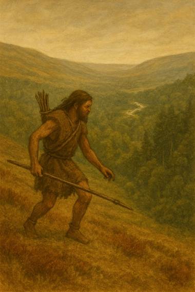
individuals from the Bronze Age strayed down into the forested dale in search
of game, but there is no evidence of settlement there.
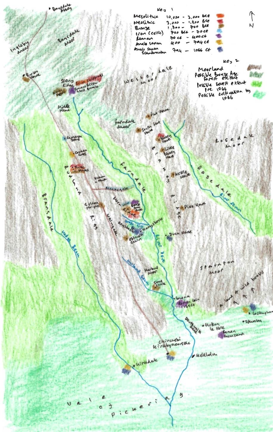
A representation of Farndale and its vicinity prior to
1066
Key 1 is a colour code for archaeological finds around
Farndale and the period of time with which they are associated, giving an
indication of settlement patterns around Farndale through time. Key 2 shows the
possible extent of moorland, woodland up to the Bronze Age and woodland up to
1066 and beyond, and the area of cultivation at the edge of the Vale of Pickering.
South of Farndale
Bronze age hoards of
axes cast in bronze have been found at Keldholme and Gillamoor.
East of the village of Hutton-le-Hole is a plateau of
Tabular Limestone formed by the Hutton Beck on the West and the River Seven on the
East. This plateau terminates in an escarpment at Spaunton, just over 600 feet
OD, and falls away gently for about 3 miles to Sinnington, about 300 feet OD.
In the centre a beck runs North-South forming a long shallow depression. In
this depression, about a mile S.E. of Hutton-le-Hole, on a line about half way
between the beck (here about 400 feet OD) and the top of the Hutton Beck valley
(about 460 feet OD) and on the middle of the three farms known collectively as
Ox Close, flints were found in 1943 and 1944 in quantities sufficient to
indicate settlement. For reasons of present cultivation, the flints could only
be collected in two places, but probably extend for an area about 200 yards
long (North-South) and 25 yards wide (East- West). In addition, isolated flints
were found near the farm buildings, in the lane to the West of the depression,
and in a field ¼ mile North of the main area. The flints are small, few
exceeding 1 ½ inches long. So far 62 have been found by the writer, of which 5
are cores, 29 wasters and 28 recognisable implements. Of these 62, about a
quarter are of honey-coloured flint, presumably of Wold origin, and the rest of
the blue and black flint associated with the Drift on the North Riding coast.
Most have a thick white patination. A few more have been found by local people,
but have been lost. The types form a range running from the Mesolithic to the
Early Bronze Age. They include several blunt backed scrapers or knife-blades of
the kind usually mounted in wood, three round scrapers, a core-scraper (with
steep face), a borer, several points and point-scrapers, and a tanged-and-barbed
arrow-head. One of the cores has probably been used as an implement. A high
proportion of the flints show signs of having been re-struck or reshaped once
or even twice. (Settlement Site at Hutton le Hole, North Riding, E S Wood,
Yorkshire Archaeological Journal, Volume 36, 1947, page 265)
Stony Rigg and
Burton Howe
At Stony Ridge, on the southern slopes of the bare moorland
ridge the peat is eroded away, leaving large areas of sandy shale and
outcropping boulders. Numerous water gulleys or channels scoop out their
courses throughout this area, especially after heavy winter storms. The height of
the ridge is 1350-1400 feet above sea level.
Looking for microliths in 1953 Mr. Walter Thornley from
Lancashire, an ardent collector of flints, saw what he thought was a blade
sticking out some 2 to 3 inches from the peat in a water channel (NGR NZ
632002). He was surprised to find that he had picked up a perfect barbed and
tanged arrow-head. He immediately uncovered three more, some 2 inches distant,
also in perfect condition. They look as though they were unused and may have
been lost, perhaps in a bag or sheath.
Flint arrow-heads of this type have been found on the north-east
Yorkshire moors and the square-ended barb is characteristic of the Beaker or
Food vessel period of the Early Bronze Age.
Professor G. W. Dimbleby took samples of peat at White Gill, half
a mile north-east of this site and proved beyond doubt that forest conditions
prevailed when the microliths were made and that, at Burton Howes, 2 miles west,
the forest was still thick in the Bronze Age (The Ancient Forest of Blackamoor, G W Dimbleby, Antiquity volume 35, no. 138, June 1961,
pages 123 to 129).
Another proof of forest conditions on this ridge is the discovery
by Messrs. Rowland Close, W. Thornley and the writer, of horn cases of bos
longifrons - the Celtic shorthorn. These were found in the peat of Stony Rigg.
Four were found in the area. Mr. Don. Bramwell of Bakewell, Derbyshire, who
identified three of the horns, said that they belonged to creatures of the
forest clearings, eating leaves as well as grass. Horn-cores of the same size
have been found in the Ryedale Windypits and they belong to the Beaker period
c. 1750 B.C. It seems possible therefore that the arrow heads were originally
lost in forest undergrowth (Stony Rigg, Farndale Slope, Raymond Hayes, Yorkshire Archaeological Journal, Volume
41, page 574).
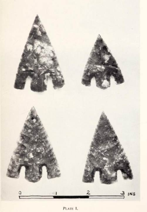
Tanged and barbed flint arrow heads of the early to mid Bronze Age
found by W Thornly 1954
At Burton Howe,
immediately northwest of the head of Farndale, the forest was still thick in
the Bronze Age. Raymond Hayes reported on the flint arrowheads and an urn at
Stony Rigg (NZ 62999 02823) on Farndale slope (Yorkshire Archaeological Journal Vol. 41, page
574 and page 581). He noted that Professor G. W. Dimbleby took samples of peat
at White Gill, half a mile north-east of this site and proved beyond doubt that
forest conditions prevailed when the microliths were made and that, at Burton
Howes, 2 miles west, the forest was still thick in the Bronze Age (G W Dimbleby, The Ancient Forest of Blackamoor, Antiquity, Volume
35/138,
June 1961, pages
123 to 129). Another proof of forest conditions on this ridge
is the discovery by Messrs. Rowland Close, W. Thornley and the writer, of horn
cases of bos longifrons - the Celtic shorthorn. These were found in the peat of
Stony Rigg. Four were found in the area. Mr. Don. Bramwell of Bakewell,
Derbyshire, who identified three of the horns, said that they belonged to
creatures of the forest clearings, eating leaves as well as grass. Horn-cores
of the same size have been found in the Ryedale Windypits and they belong to
the Beaker period c. 1750 B.C. It seems possible therefore that the arrow heads
were originally lost in forest undergrowth.
The Birch and Rowan found in peat at the head of gills, proved that
the woods, which are now in most cases restricted to the lower reaches,
formally extended almost to the sources of the streams, as may observed at an
elevation of 1,275 feet in Blakey Gill at Farndale Head, and at an elevation of
1,150 feet at Bluewath. The manner in which plantations of various trees
flourish on the steep escarpments of North Eastern Yorkshire is also indicative
of the former condition of these localities, and their ability to support
extensive woods which, in prehistoric times, also filled the dales.
To what cause must we ascribe the disappearance of most of the
natural woodland? To a very effective cause, man. Where tree remains are found
in peat, these have, of course been entombed and the woods destroyed by the
growth of peat bogs, but except in the slacks and at valley heads, this process
has been very limited, and of comparative insignificance in the history of the moors.
Nor does there appear to have been any replacement of wood by moorland through
impoverishment of the soil due to the action of rain, and the formation of pan,
which would prevent the new growth of young trees. Climatic changes are
scarcely likely to have operated within the period covered by this stage in the
history of the moors. Hence, we are driven to the conclusion that man has
largely been responsible for the deforestation.
Indeed even in modern times the woodland was much more extensive
than it is today.
(The
Moorlands of North Eastern Yorkshire,
Frank Elgee FGS, 1912, page 130)
(Querns: a survey of quern finds in North east
Yorkshire,
Raymond H Hayes, Ryedale Historian, Volume 7, 1974, page 22)
An urn was found on Stony Rigg by Rowland Close in 1955.
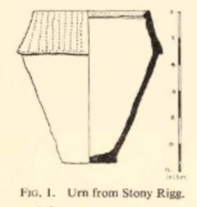
These sites are all on the high moorland ground which surrounds
Farndale. So it seems likely that early habitation from Neolithic through the
Bronze and Iron ages was on the high ground overlooking an impenetrable wooded
valley. There is no reason to suppose that the valley itself was a place of
settlement, even on a small scale.
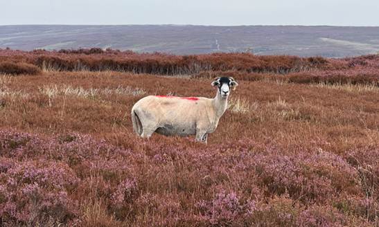
Sheep have been kept [around] Farndale and Ryedale
since Mesolithic times and perhaps earlier. Horns and skulls of a small breed
of sheep have been found with beakers dated to 3,750 years ago in the fissures
near Helmsley. Bulls and cows go back as far as this also. Oxen were used for
fraught animals and ploughing until the 18th and 19th
centuries. (Raymond Hayes,
Farndale, 1961, unpublished, page 20).
By this time we have some evidence of how the people lived, though
very few sites show signs of permanent dwellings. They had round and
rectangular huts of turf and wooden posts supporting thatched roofs. Pottery
was used; the oldest found near Farndale in the
Ryedale Windypits dating back to 3,750 years ago. Burial cairns or tumuli
of this period are abundant. They are often large mounds and dominate the
higher moorland ridges. Blakey Howe; Three Howes
between Farndale and Bransdale; Western Howes near Ralph Cross and Hobthrush
Rock are examples. (Raymond
Hayes, Farndale, 1961, unpublished, page 5).
There are barrows
on the high ground around Farndale. Round barrows are funerary monuments dating
from the Late Neolithic period to the Late Bronze Age, with most examples
belonging to the period 2,400 to 1,500 BCE. They were constructed as earthen
mounds, sometimes ditched, which covered single or multiple burials. They occur
either in isolation or grouped as cemeteries and often acted as a focus of
burials in later periods.
Round cairns are prehistoric funerary monuments dating to the Bronze
Age (c 2,000 to 700 BCE). They were constructed as stone mounds covering single
or multiple burials. These burials may have been placed within the mound in
stone-lined compartments called cists. In some cases the cairn was surrounded
by a ditch.
Other tumuli still exist on the moors, with double kerbs of stone
built to hold the mount together. A great turf mound, Botton Howe, on the
highest ridge of the moors, has concentric stone kerbs and a stone central cist.
This was robbed, but still, in 1956, contained part of an urn with burnt human
bones and a bead of green and brown fused clay. The burial urns of the late
Bronze Age, 1400 to 1000 BC, were frequently used for cremation. Ousegill Head,
a much earlier Mesolithic site, has three large tumuli or howes (Three Howes)
at its highest point on the Bransdale side. The urns are probably from here. A very
fine leaf shaped arrow or spear head was found in 1910 near these tumuli. (Raymond Hayes, Farndale, 1961, unpublished, page 6).
Horn Nab
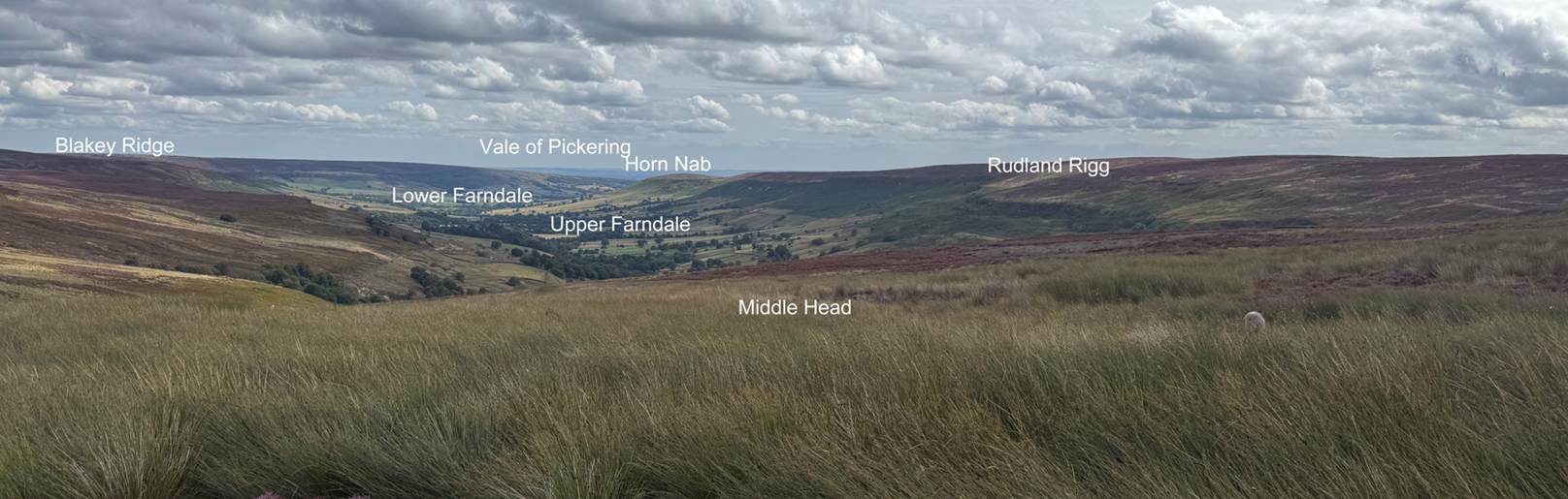
The main visible feature, the cross dyke is quite distinct.
According to Historic England it is over 250 metres long, formed by a bank
typically 2 metres high and 4m – 6m wide, with a mainly silted up ditch on its northern
side which is around 3m wide. It completely cuts off the end of the ridge.
At the approximate centre of this cut off area is a funerary round
cairn 15m in diameter and 0.8 m high.
The site provides extensive views over Farndale.
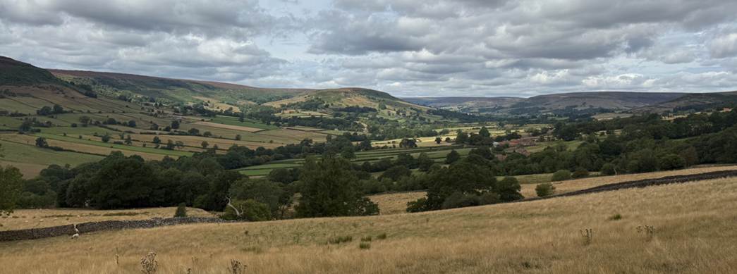
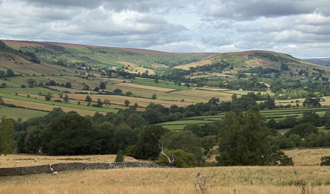
Looking across Farndale to Horn Nab to the north of the West Gill
valley, August 2025
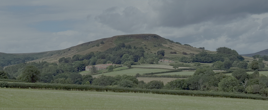
Horn Nab 2026
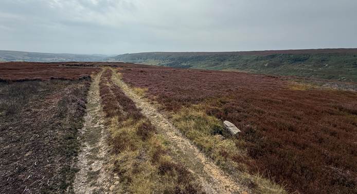
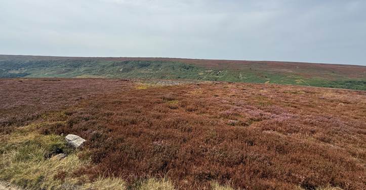
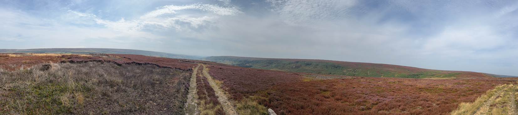
Horn Nab, August 2025
Horn Nab or Horn End is a bold crag projecting into the main dale between
West Gill and the middle portion of Farndale. The name is Celtic: cornu - nab;
horn - a nose or Ridge of land. The cross ridge dyke cuts off this southern
end. Below the crag are the farms of Knaysbeck and Keysbeck, old Norse
settlements 900 years ago, replaced by modern homes. Remains of old iron
smelting workings can be seen in West Gill.
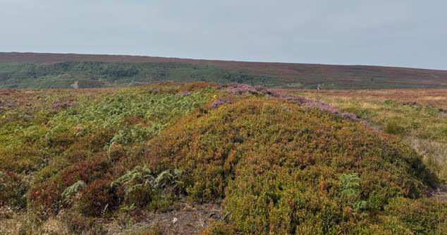
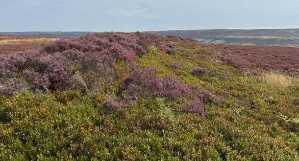
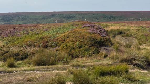
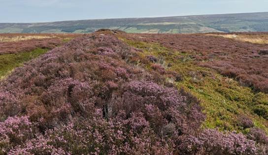
The Kesson Dyke, August 2025
The ditch had not been cut into the rock as are the late Iron Age and
Roman ditches. It was in places full of large stones which had slid from the
rampart which had a casing of them on both inner and outer faces in some
sections. The stonework was not carried right through the bank, rubble or
earthworks. Earth was used for the core.
Cross ridge works of this type can be seen on Danby Rigg, Eskdale,
Guisborough Moors, Glaisdale, John Cross Rigg, and several other ridges. They
usually defend or divide an area of high ground from the steep sided ridges or Riggs.
Groups of small Stony cairns, tumuli and circles or wallings are a feature of
these defended sites.
(Raymond Hayes, Farndale, 1961,
unpublished, page 40).
Larger ramparts of earth and stone can be found on Danby Rigg,
Castleton Rigg and Horn Nab at Farndale. The latter cross-ridge bank and ditch
(often called a dyke) was sectioned in 1959 to 1960 by Arthur Whitaker of
Leeds. This showed that the bank was constructed of rubble and earth faced by
stone in places, probably with a stone parapet.
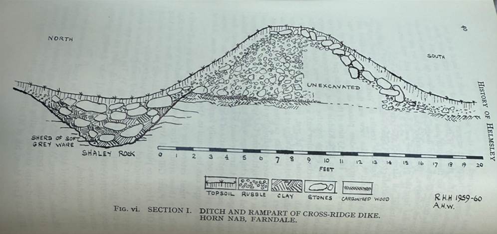
The Farndale rampart was some 24 feet wide, 8 to 9 feet high, and
300 yards in length, entirely crossing Horn Nab, with a flat bottomed ditch 6
to 8 feet wide to the north side. This ditch was U-shaped, was not cut into the
rock, and varies from 18 inches to 4 feet in depth. Apparently its builders did
not cut the rock as in Iron Age or Roman ditches. No relics, flints or any
indication of its period were found. Inside the defended area, with its sheer
crags to east and west, there is a 5o foor kerbed cairn. Outside the rampart
and ditch, about 400 yards to the northwest, lies a group of 30 small cairns
and one or two long examples. There are no signs of any dwellings on the top
where the stone is plentiful, though they could easily have been constructed,
and the absence of potsherds in the ditch makes it likely that these defensive
works did not guard regular settlements, but were places of refuge in times of
peril and were only occupied in such times. There is no absolute proof that these
settlements were the work of the urn folk, although barrows on them have
produced urns as at Danby Rigg, but also a food vessel and Iron Age potsherds
were found there in 1955. Apart from Horn Nab, no excavations of the defensive
dykes have taken place.
The people who occupied these settlements at intervals, probably
lived in more sheltered places in the crags or dale sides. No dwelling has yet
been excavated in northeast Yorkshire that can certainly be said to belong to
the Bronze Age.
(A History of Helmsley Rievaulx and District, editor, J McDonnell, 1963, page 41).
The larger tumuli, and Horn Nab has one of 50 feet in diameter,
maybe much earlier than the cross ridge dyke. Elgee, for instance, thought that
these dyked enclosures were settlements of the urn using folk, but a tumulus on
Danby Rigg excavated in 1956 contained a primary food vessel as well as later
urns, also the first bronze implements found on this site. On Horn Nab, the
group of about 30 cairns lies outside the rampart and ditch above Hawthorne
Crag to the northwest.
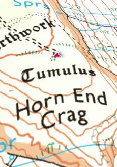
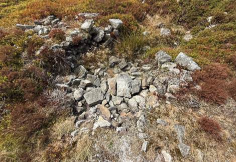
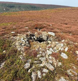
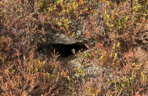
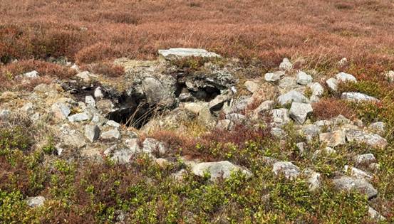
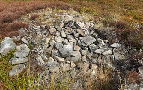
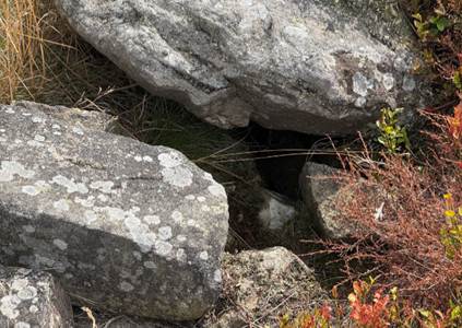
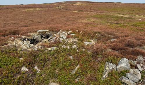
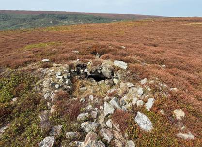
The
Horn Ridge Tumulus, August 2025
No relics were found in the sections taken at Horn Nab. We do not
know when the tumulus was dug open, probably many years ago like Hobthrush
Rook.
Flint chips and a long burin-like implement were found inside the
defended area.
The local inhabitants of the dale called the dyke Kesson Dyke and say
it was created to stop Scottish raids in 1322. Another version is that it was
put up for a rifle range during the Boer War. The fact is that it was there
before both of these events and was probably used only temporarily by the
people who made it. Like the barriers raised by the Army and the Home Guard in
1940 in the threat of a German invasion, it would only be used in time of
trouble by the natives and their flocks and herds, coming down to more
sheltered ground in the dale when things were quiet again. Kessen is a very
like the word casten, a name applied to dykes in the Hambletons. The early Iron
Age is a likely period for its erection when waves of invading Celts came over
from the continent into southeastern and eastern Britain, causing trouble to
the older settlers. Dykes and banks on Livisham Moor recently excavated by the
Scarborough and District Archaeological Society have proved to be of Late Iron
Age date, early or mid 1st century AD.
On the slopes of the Nab, a curious little stone implement like a
socketed bronze axe or, or imitation of one, in dogger ironstone was found by
Mr Hardesty in 1941. In Hull Museum is a fine bronze axe labelled Farndale, but
no exact locality is given. It is of the type known as a winged Celt, very
thin, and tapering from the cutting edge to a pointed end. It has no stop
ridges and the sides are hammered over. It is five and three eighths inches
long, two inches wide and three inches thick. It weighs 6 ¼ ounces. The period
assigned to it is the Early to Middle Bronze Age, 1400 to 1200 BC. Bronze
implements are extremely rare in the dales, though they have been found in
Bilsdale and in Cleveland stone and flint continued in use even in Roman times.
No doubt the early farms are originated in the Iron Age when
better tools were obtained to cultivate the moor soils and to cut the dense
forests which clothed the lower parts of the dale. The beehive shaped stone mills
of the first grain growers have turned up in Bransdale, Rosedale and
Westerdale, so there is no reason why they should not occur in Farndale.
The cross ridge dyke is a formidable defensive work some 295 yards
in length, 25 feet wide and from 6 to 10 feet in height above the ditch which
is 6 to 8 feet in width and which varies from 18 inches to four feet in depth.
Sections of this ditch were dug in 1959 to 1960 by Arthur Whittaker of Leeds
during his residence in Farndale for vacations. The sections varied
considerably in depth and filling.
(Raymond
Hayes, Farndale, 1961, unpublished, page 8 to 9, 7).
Blaise Vyner has more recently reconsidered the significance of
cross-ridge boundaries in northeast Yorkshire, including the cross ridge
boundary at Horn Ridge. He observed that cross ridge boundaries including on
the North York Moors are generally associated with Early Bronze Age burial
mounds, as at Horn Ridge. Radiocarbon dating has now placed the cross-ridge
boundaries as belonging to the Late Bronze Age or early Iron Age. He therefore
concludes that they are ritual boundaries for continued religious practice at
burial sites that had already been used for ritual purposes for a considerable
time, dating to the Early Bronze Age. They were intended to protect long
established Early Bronze Age funerary areas.
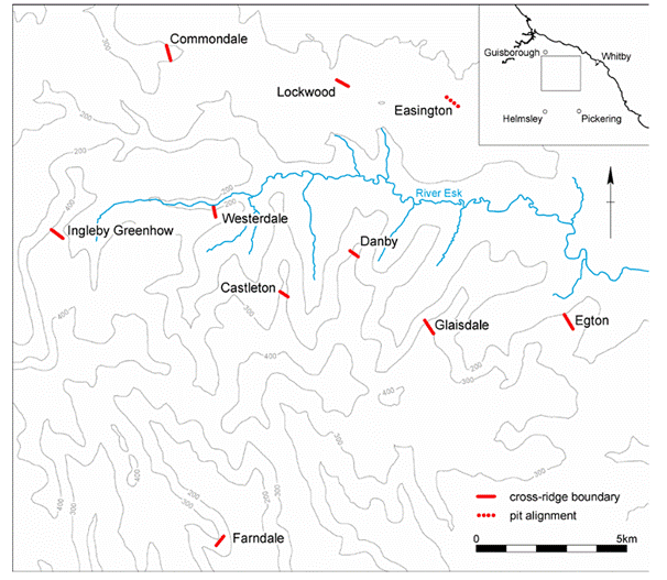
The
cross-ridge boundary at Horn Ridge is on its own, but with a group of similar cross-ridge
boundaries which are found to the north overlooking the River Esk. Raymond
Hayes excavated the Horn Ridge boundary in 1959 and found it to be 1.9 m high
with a ditch 1m deep.
He
concludes that they were not defensive works, nor for con troll of the movement
of people, nor agricultural boundaries such as for the management of sheep or
cattle or for protection of crops, as has previously been concluded. They
appear on high points. The conclusion that they were defensive does not bear scrutiny,
including for the reason that the bank and ditch were broken by causeways so
these are notably open boundaries. They are often associated with marshy areas
and streams to assist in the definition of the area.
The
Early Bronze Age Burial sites appear to date to 1930 to 1738 BCE, whilst the
boundaries post date the burial mounds.
(An Indication of Northern Souls: Revisiting the
‘Territory of Ritual’, Blaise Vyner, Offa’s Dyke Journal Volume 6, 2024, 10-53)
Historic Environment Record 26 (North York Moors HER Records), Prehistoric settlement and funerary landscape on Horn Ridge (Late
Neolithic), a prehistoric landscape including Horn Ridge cross dyke,
cairnfield, round cairn and hut circles.
Rudland Rigg
The eastern escarpment bounding Farndale is Rudland Rigg.
Along the moorland ridges ran the ancient roads, their origin last
in the dim past. It was natural for early men to use the exposed ridgeways to
travel from Ryedale to Cleveland. They were probably free from large forest
growth and gave wide views of the countryside. Traversing these tracks between
the dales, the early inhabitants raised their burial mounds on the highest
points. They also erected cairns or standing stones to mark the trackways. These
were later, in the Middle Ages, replaced by crosses or boundary stones. Several
of them still remained near Farndale. Best known of the two Ralph Crosses and
Fat Betty. (Raymond Hayes, Farndale, 1961,
unpublished, page 11).
Golden Heights
A round
cairn at the highest point of Golden Heights is a prehistoric burial mound.
It overlooks the prehistoric earthworks on Horn Ridge and is intervisible with
Obtrusch round cairn and Dicken Howe. It sat adjacent to the ancient route
across the moors which ran from Kirkbymoorside to Cleveland.
Three Howes
Three
Howes at Ouse Gill Head is a site where flint tools had been found by
the gamekeepers for a number of years before, in September 1973, Raymond Hayes
and others excavated the area. His small excavation yielded over 800 flints
from an area of 3.5 by 3 metres. The site was interpreted as a temporary
camping site in a forest clearing, probably being occupied by hunters following
red deer or other game. The monument includes the earthwork and associated
buried remains of the northern most of a group of four prehistoric burial
mounds known as Three Howes. The smallest and least prominent of the group lies
sixty metres to the southsoutheast and a closely spaced pair of barrows lie
centred one hundred and twenty metres to the south east, all of which are the
subject of separate schedulings.
All four round barrows are sited on the western, highest side of
the plateau forming the highest part of Rudland Rigg and the monument, like the
southern pair, is a prominent skyline feature. The monument is sited on level
ground, about 30m east of the break of slope down into Bransdale. It survives as
an 11m diameter mound 1.2m high with a 2m wide, 4m long and up to 0.5m deep
north-south weathered trench cut into its top
Frank Elgee suggested arrangements
of barrows on the moors sometimes reflected the shape of the Plough. He
suggested there are at least nine mounds at Three Howes. These groups may
owe their number to the circumstance that there are three stars in the handle
of the Plough … And it may be that the numerous Three Howes either form part of
larger Plough groups, the other barrows of which may have been destroyed or
have not yet been observed, or possibly in some cases three barrows became
symbolic of the larger group of seven. The curved groups of three more closely
resemble the handle of the Plough than those which are straight. Three, like
seven has ever been a mystic number; and it is therefore certain that the urb
people attached a deep significance to the erection of their barrows in groups
of three. (Early Man
in Northeast Yorkshire, Frank Elgee,
1930, page 124).

Three Howes from the main track, August 2025
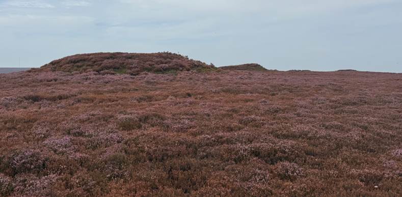
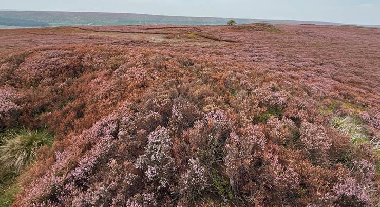
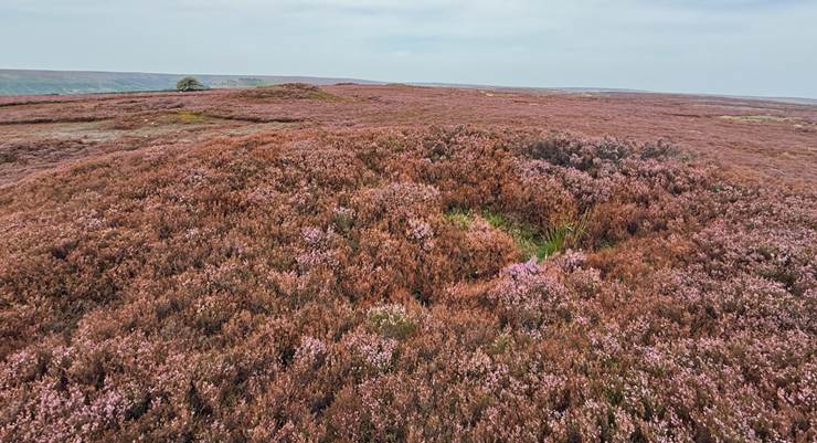
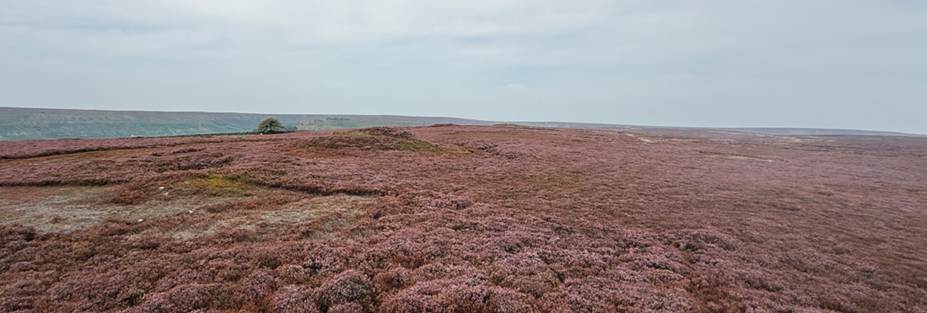
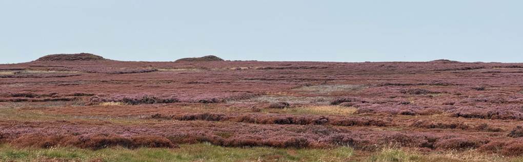
Three Howes
Obtrusch Cairn
Two round cairns
at Obtrusch Cairn
(“Hobthrush”) also sit on Rudland Rigg overlooking Farndale.
Another remarkable cist burial of
this age occurred in a large round barrow known as Obtrush Rook on Rudland Moor
between Farndale and Rosedale, excavated long ago by John Phillips, the great
pioneer Yorkshire geologist. At the centre of this barrow, and on the natural
surface, was a short stone cist devoid of bones, flint or pottery … In describing
the burial places of the food vessel people we noticed that many internments
were enclosed in stone circles under barrows, a striking instance being the
double circle round the cist in Obtrush Rook on Farndale Moors. These circles
may have represented huts within which could dwell the spirits of the dead. Or
they may have been magic boundaries beyond which the spirits could not pass and
within which they must for ever be confined. There can be little doubt that
these circles were derived from the stones with which Neolithic man often
surrounded his long barrows and circular chambered cairns. They have not been
found in the homelands of the Early Bronze Age invaders, who therefore must
have adopted them as they adopted the food vessel and cremation. (Frank Elgee, Early Man in North East Yorkshire, 1930).
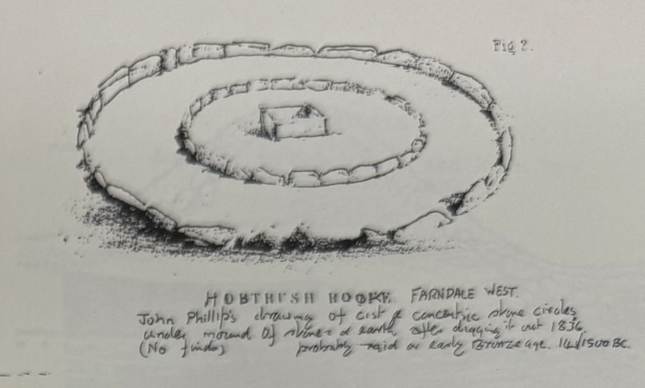
(Raymond Hayes, Farndale, 1961,
unpublished, page 39).
Hobthrush Rook is now called Obtrusch Cairn on
Rudland Rigg. The name derives from the old Norse hraukr which means a
pile or heap of anything. Obtrush or Hobtrush was the name of a local
supernatural being like an elf or hobgoblin, so the cairn is also identified as
goblin’s heap. Dr Frank Elgee in Early Man in
North East Yorkshire page 70 thought that this tumulus might have
been of the period when food vessels were often placed in cists alongside
contracted skeletons.
Tales of Hobs have a long history in and around the dale,
including the tale of the Farndale
Hob. The hob stories may be the last relics of the ancient folklore or
religion of the Celtic race. Canon J C Atkinson of Danby, 1840 to 1900,
collected many in his book Forty
Years in a Moorland Parish. (Raymond Hayes,
Farndale, 1961, unpublished, page 6).
Dickon Howe
Dickon Howe sits on the track
between Horn Nab and the main route across Rudland Rigg.
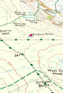
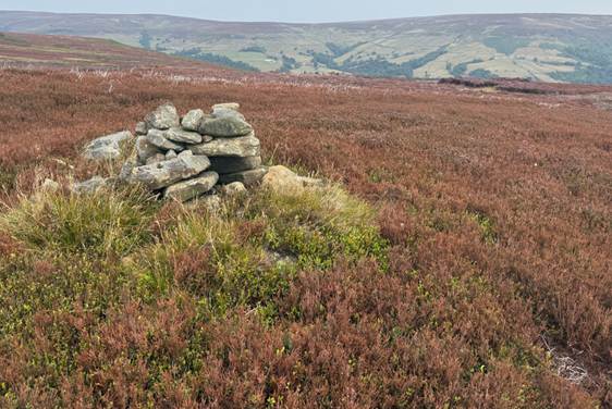
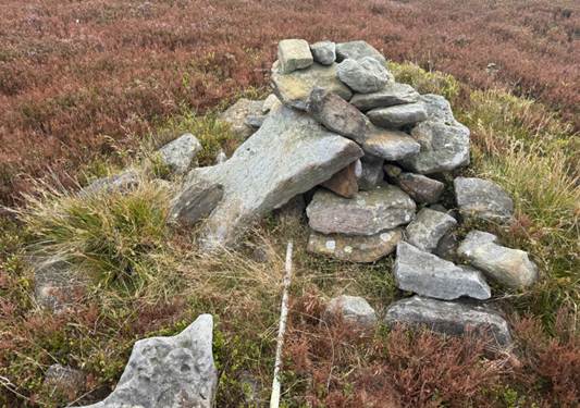
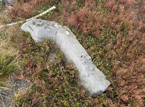
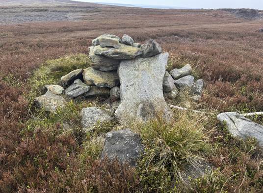
Dickon Howe, August 2025
Baysdale Moor
To the north of Farndale is a round barrow at Burton
Howe in Baysdale moor, the location which Professor Dimbleby identified as
forested until at least the Bronze Age. A medieval parish boundary marker now
sits in the barrow. The Bronze Age folk may have cut back the forest to create
grasslands for grazing or crops.
Blakey Ridge
There are a series of barrows atop Blakey Ridge.
The majority of the
large barrows and a few of the smaller run in irregular lines often with
considerable distances between them. Moreover most of these lines follow the
summit of ridges between the dales, and seem to lead from one group of small
mounds to another many miles away. (Early Man in Northeast
Yorkshire, Frank Elgee, 1930).
Blakey Howe
is a round barrow which includes buried and earthwork remains of a burial mound,
also known as Cockpit Hill, topped by an eighteenth century boundary stone. It
is located eighty metres from the Lion Inn. It survives in an area which was
later extensively worked for coal, an activity which has left behind several
spoil heaps along the ridge. Referred to as Blakenhow in a Charter of
Gisborough Priory in 1200, the round barrow sits on a natural rise on the spine
of Blakey Ridge and has line of sight to other prominently located barrows in
the area. Constructed of earth with some stone, it is just over twenty metres
in diameter and stands two metres high with an ancient excavation hollow six
metres in diameter and up to one and a half metres deep. This hollow is thought
to have been later used for staging cockfights, explaining the barrow's
alternative name.
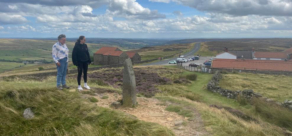
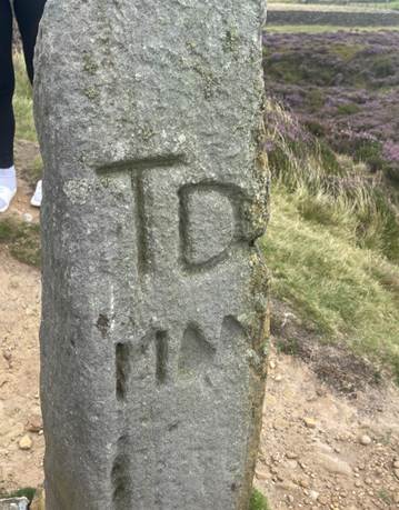
On
the rim of this hollow, on the southern side, there is a one and a half metre
high boundary stone which tapers towards its top. On its west face it is
inscribed with the initials TD above four more weathered characters.
This is a reference to Thomas Duncombe who owned the Duncombe Estate west of
Helmsley in the early eighteenth century. It is possible that this stone is a
redressed and reset prehistoric standing stone.
Little
Blakey Howe is only five hundred metres south of Blakey Howe.
A round
cairn at Kettle Howe is another kilometres to the south.
Another two kilometres to the south are round cairns at Pike
Howe.
Flat
Howe lies to the north of Blakey Howe on Farndale Moor, with a nearby round barrow at South
Flat Howe.
Frank Elgee referred to groups of pits on Blakey Ridge between
Rosedale and Farndale, which he felt was evidence of Urn people (Beaker
Folk) living in settled communities. (Early Man
in Northeast Yorkshire, Frank Elgee,
1930, page 120).
Harland Moor
A stone circle
and cairn field with a field system is close to the road on Harland Moor on the
southern approach to Farndale. Besides the kerbs or circles of
stone covered by cairns or tumuli, embanked or free standing circles are found
more rarely. One of the best examples was noticed by Mr R W Crosland of Hutton
le Hole on Harland moor, west of the quarry at Cross Top. It contains about
eighteen stones set in a slight bank six to eight feet wide and one and one
half to two feet high. Some have fallen and the tallest is about four feet in
height. These circles were both ceremonial or burial. Cremated bones and urns
have been found inside them. The Farndale circle is just over 70 feet in
diameter; turf roads cut across it and old ironstone bell pits have disturbed
part of the interior. Smaller circles which might be the outline of huts lie on
the moor to the south near Harland Beck Farm.
Many
flint implements have been found in the locality. Just west of the circle is a
group of small cairns, burial places of the late bronze or early iron gage.
Many have been removed for walling stones or roads, but very little evidence of
their purpose has been found in the small cairns apart from signs of cremation
in a few. Low banks of stone walling connected with them are thought to be the
remains of cultivation plots of small fields.
(Raymond Hayes, Farndale, 1961,
unpublished, page 7).
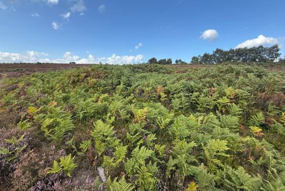
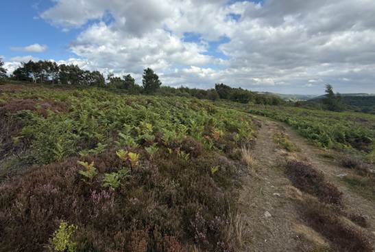
The Stone Circle on Harland Moor, August 2025
As well as the usual bowl shaped round barrows or
cairns of stones, circles of earth and stone often enclose cremation pits or
urn burials. These are termed burial circles or degenerate henge monuments.
Examples of these circles occur on Harland Moor, southwest of Farndale. Here a
larger embanked circle 70 feet in diameter has had upright stones set at
intervals. This is more like the stone circles of southwest Britain and
elsewhere. There is another doubtful example on a steep spur called Nab Ridge
between Bilsdale and Tripsdale. The burial
circles usually surround cremation pits, without any relic accompanying the
crem\ted bones. At times, however, several burials are found nearby always
cremated and sometimes placed in plain or ornamented cinerary urns. Another
noticeable feature is their situation in or near groups of small tumuli,
usually known as small, stony cairns.
The life of the people responsible for these cairns
was less nomadic than previously. Some groups of cairns are very large,
numbering some hundreds.
A group of eighty or more can be found on the moor
west of Bilsdale … There are several groups on Harland Moor, Farndale,
associated with circles, walling and shallow pits.
(A History of Helmsley Rievaulx and District, editor, J
McDonnell, 1963, page 36 to 39).
Go
forward to Iron Age
Yorkshire.
West Gill Beck
Historic Environmental Record 350 (North
York Moors HER Records), a Bronze age ironstone
axe hammer seen in the 1940s.
Bibliography
A History of Helmsley
Rievaulx and District, editor, J McDonnell, 1963.
The Discovery and exploration of the North Yorkshire Windypits, R
G Cooper, Ryedale Historian, Volume 9, 1978, page 10.
Early Man in Northeast Yorkshire, Frank Elgee, 1930.
A
Scheme for the British Bronze Age, CFC Hawkes, 1960, Antiquities Journal, Volume 49.
Bronze
Age Round Barrows and Adjacent Earthworks on the Hambleton Hills, Raymond A Varley, Yorkshire
Archaeological Journal, Volume 51, 1979, page 144.
An
Indication of Northern Souls: Revisiting the ‘Territory of Ritual’, Blaise
Vyner, Offa’s Dyke Journal Volume 6,
2024, 10-53.
Yorkshire
Archaeological and Historical Society – Bronze Age Yorkshire.
BBC History
Cold Cases - The Skeletons of the Windy Pits,
broadcast on 30 June 2003.
There is still a YouTube recording of the episode available.