Roman Yorkshire
(70 CE to 400 CE)
FAR00001G
|
Return to the Home
Page of the Farndale Family Website |
The story of one
family’s journey through two thousand years of British History |
The 83 family lines
into which the family is divided. Meet the whole family and how the wider family
is related |
Members of the
historical family ordered by date of birth |
Links to other pages
with historical research and related material |
The story of the
Bakers of Highfields, the Chapmans, and other related families |
Hyperlinks to other pages
are in dark blue.
Headlines are in brown.
References and citations
are in turquoise.
Context and local history
are in purple.
BCE - Before the common or current era. The contemporary equivalent of
BC.
CE - Common
or current era. The contemporary equivalent of AD.
Go back to Iron
Age Yorkshire.
It is clear that within a radius of some
15 to 20 km of Kirkdale there is complex archaeologically derived evidence of
secular and religious activity from at least the pre Roman
period (St Gregory’s Minster, Kirkdale,
North Yorkshire, Archaeological Investigations and Historical Context, Philip Rahtz and Lorna Watts, 2021, page 3). This was essentially a rural area, with non
nucleated settlements, with contact between the settlements by north to
south routes through the valleys on the sides of the moors and east to west
through the Vale of Pickering.
Conquest
55 BCE
Julius Caesar landed in Britain on 23 August 55 BCE, perhaps at Walmer Beach in
Kent, one possible landing place adopting the distances given in his account of
the landings in his Gallic Wars. The British leaders had declined
opportunities to surrender, clinging to their independence. 20,000 Roman
soldiers landed in a large fleet. However the 55 BCE
assault was a failure against a determined British resistance.
54 BCE
Julius Caesar therefore returned on 7 July 54 BCE with a larger force of
50,000 soldiers and 2,000 cavalry, in the territory of
the Cantiaci of modern Kent, aided by the
Essex Trinovantes who saw an opportunity for
the weakening of their more powerful rival Catuvellauni
by guiding the Romans to their territory. The British fought with the fearsome
long iron slashing sword, but were driven back to the
Thames where they were decisively beaten.
Yet after a complete victory, Caesar took oaths from the tribal
leaders and left after only three months. The invasion had
only impacted on a small part of Britain and to the north and west it was
unlikely to have been noticed.
25 BCE
However in the south of Britain, there was a lasting impact from the Roman
contact. After the Roman conquest, by about 25 BCE, the Atrebates
tribe developed the town of Calleva Atrebatum (Silchester)
founded by Britons, aligned to the midsummer sunrise and midwinter sunset, but
adopting a more grid like structure of Roman influence. It is the earliest
example of urban design in Britain. Caesar had taken elite hostages after his
Conquest, who may have returned from Rome, with Roman ideas. Coins and new
diets such as oyster eating all suggest strong Roman influence.
Across most of Britain though, the tribal traditions of Celtic Britain
continued. Giant hill forts continued to speak to Iron Age identity.
9 CE
Cunobelinus (Shakespeare’s Cymbeline)(ruled c 9 CE to 40 CE) had established a
formidable power base in southeast England.
41 CE
43 CE
In Virgil’s Aeneid, Jupiter
pronounced that I have set upon the Romans bounds neither of time nor space.
With distant memories of a half hearted invasion of Britain
by Julius Ceasar in 55 BCE, the Roman Empire by the early first century CE, had
adopted an aggressively imperialistic stance. The Romans came to Britain, to
stay, from 43 CE when the Emperor Claudius (41 to 54 CE), a stammerer with a
club foot, an unlikely invading emperor perhaps, rapidly annexed the south and
east of the country. Claudius’ invasion force was
massive for the period, about 40,000 troops. Claudius succeeded by a combination
of military ruthlessness with political pragmatism. He found support with
tribal groups who saw advantage, in the opportunities of Roman influence, to
see their enemies subdued. The Roman empire was primarily motivated by direct access to
Britain’s resources including wheat, slaves, copper, tin, lead, silver and
gold. Britain produces gold, silver, and other metals, the prize of
conquest (The Life of Julius Agricola, Tacitus, Chapter 12).
Initially the
Romans didn’t venture north of the Humber and Don, but traded with the Parisii, and followed a complicated political path
with the Brigantes.
49 CE
The Charterhouse Lead Mines in Somerset were in operation by at least 49 CE, evidencing the Roman
motivation to exploit Britain’s resources, the fruit of their invasion.
54 CE
Claudius’
successor was Nero (54 to 68 CE) who was less enthusiastic about the costs of maintaining
an army in Britain, so expansion slowed.
60 CE
Many Britons
became loyal to the new imperial regime. However the
Romans were violent to opposition. When Boudicca on the death of her husband
Prasutagus of the Iceni sought reconciliation with Nero, the local
administrator responded with arrogance and brutality, flogging her and raping
her daughters. Her subsequent revolt and the burning of Camulodunum
(Colchester) was a significant threat to the new imperial power. Her rebellion was
wiped out when Suetonius amassed a force of about 10,000 soldiers and defeated
the Iceni revolt in a narrow pass north of St Albans.
There
is an In Our Time podcast, Boudica.
69 CE
Nero was
succeeded by Vespasian (69 to 79 CE) at the end of the
Year of the Four Emperors. Vespasian was the commander of the Syrian Army, and had served in the army in Britain under Claudius.
He appointed Gneaus Julius Agricola (40 to 93 CE) as
his general. Agricola extended the Roman occupation across large swathes of
northern Britain, well into Scotland. Agricola’s biography, The
Agricola, was written by his son in law Tacitus.
Roman
experience around the Mediterranean was of city states and centralised groups, who
were susceptible to defeat on the death or subjugation of their leaders. However in northern Britain they encountered a region where
large stable political units were less usual. The Romans referred to the people
who lived in the Vale of York, the moors and the dales, and across the
Pennines, as the Brigantes. They appear to have treated them as a
centralised group, but this was probably a mistake. The Brigantes may
have been a loose grouping of Celtic hill people, which the Romans might
have mistaken as a tribal name.
Claudius had
formed an alliance with Queen Cartimandua, who
Tacitus referred to as Queen of the Brigantes. She and her husband Venutius were, according to Tacitus, loyal to Rome. They
seem to have had their base at an old iron age fortification at Stanwick near
modern Scotch Corner. In 51 CE, Caratacus,
leader of the Catuvellaunians and a son of Cunobelinus,
from territory in the area of modern Bedfordshire, had sought sanctuary with
Cartimandua, but she had handed him over to the Romans.
When
Cartimandua had a relationship with her armour Bearer, Vellocatus;
her husband Venutius began a civil war against her in
57 CE, but Cartimandua was protected by the Roman Ninth Legion. In 69 CE,
during a period of instability under Emperor Nero, Venutius
attacked again and Cartimandua fled, leaving Venutius
in control of the region and in conflict with Rome.
The centre
of Brigantes power was the large fortified oppidum at Stanwick,
west of Darlington. The Stanwick Hoard was found in the Melsonby area in 1845
and the more recent Melsonby
Hoard was found in 2021.
In 71 CE Vespasian sent an army under
Quintus Petillius Ceralius to march north and occupy Brigantes and Parisii territory. The Ninth Legion erected a large
camp near where Malton, northeast of York, stands today. They also built a fort
at Roecliffe, near to modern Aldborough, which was occupied between about 71
to 85 CE. Roecliffe was one of a string of forts
roughly along the line of the modern A1, which provided the main Roman
transport corridor.
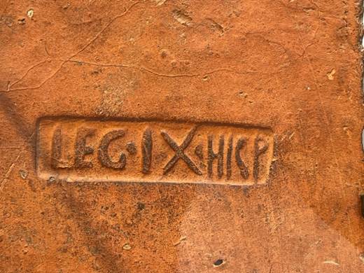
Legionary Tile, 70 to 120 CE (Yorkshire Museum)
The fighting which began when the cohorts went
to the rescue of Cartimandua developed and involved one of the legions,
possibly IX. “To Venutius was
left the kingdom, to us the war." So wrote Tacitus. Venutius
seems to have been still alive and still hostile in 69. Tacitus, indeed,
described Venutius as the ablest of the British
Generals after Caractacus. The restlessness following on the year of the four
Emperors probably decided Petilius Cerialis, who already had had experience of
the Brigantian frontier, “to rectify and pacify
it." A second motive may have been the Brigantian
leadmines. But although it is thus certain that the
object of Petilius Cerialis’ Campaign in 73-74 was to
subdue the Brigantes, and although it is probable that the headquarters of that
people were in southwest Yorkshire, yet the establishment of the Roman Fort at
Malton (northeast Yorkshire) must be placed in this campaign. There may be
reason, therefore, to place the foundation of Malton even before the foundation
of York. I am convinced that whether or not a contingent was at the same time
despatched from the direction of the Foss Way and Margidunum,
the IX legion moved directly up the Lincolnshire Wolds, crossed the Humber
(possibly at South Ferriby and Brough), and first setting a camp at Malton to
guard the natural frontier of the wold escarpment,
turned behind it to cross the vale of York by the old
flint route that I have had occasion to mention before. Thus
they would surround and outflank the Brigantes from the east by marching
through the territory of the Parisii. (Some Invasions of Yorkshire, Mary Kitson Clark, Yorkshire Archaeological Journal,
Volume 31, page 326).
A large
military camp was constructed by the Romans as Eboracum, modern day York, in 71 CE.
The strategic siting of York had lasting effects on the
subsequent history of Yorkshire, as it became a pivotal point of the all important northern road system when the conquest moved up country. York connected Ermine Street, coming up from the south, with the
most important forts: Calcaria (Tadcaster), Isurium Brigantium (Aldborough), Cataractonium (Catterick) and, in time, all marching camps
and forts established in the Pennines right up to Hadrian’s Wall. Roads from
York also went east, to Brindlington on the coast,
and to Delgovicia (probably Malton). (The Little History of Yorkshire, Ingrid Barton, 2024, page 27).
Following the military invasion which was carried forward by
Agricola to the extreme north, came the Romanisation of Yorkshire (Some Invasions of Yorkshire, Mary Kitson Clark, Yorkshire Archaeological Journal,
1934, Volume 31, page 327).
Urban settlements grew around the Roman fortifications at Eboracum
and Malton. Eboracum in time became the Roman provincial capital. The
Emperors Hadrian, Septimius Severus, and Constantius I all held court in Eboracum
during their various campaigns. Constantine the Great was proclaimed emperor
there. To the south Roman urban settlements grew around fortifications at Calcaria, Tadcaster, and Danum, Doncaster.
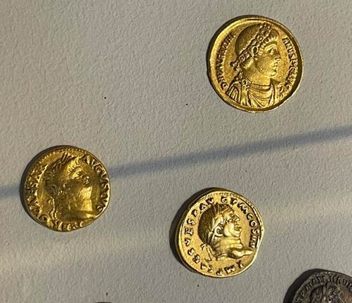
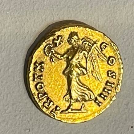
Roman coinage (The Yorkshire Museum)
The Roman York Beneath the Streets (“RYBS”) Project suggests that
there was a less marked division between the fort on the north side of the
river and the civilian settlement to the south and it may have been more fluid.
Above all, Yorkshire requires a
capital; and a capital distinguished by its unparalleled position as a road
centre in the plain. It is emphatically not a primitive citadel. Although the
civil development of Roman Yorkshire is a very modest thing compared to the full blown Romanization of the south, it should be disassociated
from the military conditions of further north. The presence of the army
undoubtedly provided a stimulus and a system of this communication; but civil
life in Yorkshire was not dependent on the army in the sense that it was unsafe
to live far from military protection. It is too widely spread for that. The best known villas lie all more than 10, and mostly over 20
miles from York. Although, in view of recent discoveries, it is hazardous to
argue that there are no military remains on the wolds
just because we can see none, still Millington, Kilham, Grindall, Harpham, and
Bishop Burton are at least 15 miles away from any known military sites, while
the band of small finds stretching along the mouths of the dales, far from the
forts in the interior, show that there was civil life on the low ground to the
west. (Some Invasions of Yorkshire, Mary Kitson Clark, Yorkshire Archaeological Journal,
1934, Volume 31, page 328).
During this period towns and cities appeared across Britain, laid
out in grid plans, with bathhouses, temples, monuments and basilicas. London
was enclosed by two miles of walls, defending an area of about 330 acres and
perhaps 5,000 inhabitants.
Within a short time the old Celtic ways
were replaced by revolutionary ideas including new forms of administration,
written records, and taxation.
Kirkdale is only about 25km north of the major Roman regional capital, Eboracum
(York), which would have become increasingly accessible from Kirkdale to the
south during the Roman period, with the construction of new roads.
Thurkilsti was a pre Roman
road from the North York Moors which passed close to the west side of Kirkdale
and on to Welburn, just south of the Kirkdale ford and to Hovingham where it
later joined the Roman roads (St Gregory’s Minster, Kirkdale, North Yorkshire,
Archaeological Investigations and Historical Context, Philip Rahtz and Lorna Watts, 2021, 3).
During the Roman
period, Kirkdale was in the Roman hinterland. By the late Roman period,
Kirkdale was probably part of a stable, well
regulated area with dispersed settlement, probably dependent on
major villa based estates such as at Beadlam and
Hovingham.
The significance
of Ryedale was reinforced by an extensive Roman road network.
· Wade’s Causeway ran
from Malton across Wheeldale Moor towards Whitby.
· A Roman road ran
from Malton to the Vale of York via the Coxwold Gilling gap where it joined
Hambleton Street which stretched from Bernicia to Lincoln.
There have been
structures in the area dating to the Roman period, such as the Roman
villa at Beadlam, only 2 km west of Kirkdale, discovered in the 1960s. The
region around Beadlam was
administered from the Roman town of Isurium
Brigantum (modern Aldborough, near
Boroughbridge).
77 CE
Agricola was
made consul and governor of Britannia in 77 CE.
81 CE
Domitian (81
to 96 CE), who succeeded Titus (79 to 81 CE), completed Agricola’s campaigns,
but was distracted by imperial interests elsewhere, so withdrew from the areas
furthest to the north, which would lead in time to the reconciliation of Roman occupation
to the wall which would later be fortified as Hadrian’s Wall.
Roman
domination was absolute. Tacitus’ imagined words of a defeated Caledonian
commander, perhaps best reflect the mastery of Rome over the subjugated.
We, at
the furthest limits both of land and liberty, have been defended to this day by
the remoteness of our situation and of our fame. The extremity of Britain is
now disclosed; and whatever is unknown becomes an object of magnitude. But there
is no nation beyond us; nothing but waves and rocks, and the still more hostile
Romans, whose arrogance we cannot escape by obsequiousness and submission.
These plunderers of the world, after exhausting the land by their devastations,
are rifling the ocean: stimulated by avarice, if their enemy be rich; by
ambition, if poor; unsatiated by the East and by the West: the only people who
behold wealth and indigence with equal avidity. To ravage, to slaughter, to
usurp under false titles, they call empire; and where they make a desert, they
call it peace.
(Tacitus, Agricola,
Chapter
30)
Legionary
fortresses were established at York, Chester and Caerleon and an extensive
network of garrison forts spread through the countryside.
After the shock
and awe of the first century CE, the years passed, and the lands of north east Britain settled into easy going provincial
domains, drawing on the benefits of international communications. The nightmare
years had passed. Urban settlement emerged where native folk could learn some Latin, and take some part in local government.
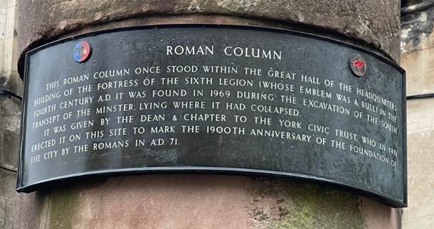
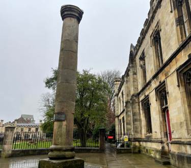
During the Roman period, most of Britannia remained rural, 80 per
cent of the population lived in over 100,000 small settlements and some 2,000
villas (Robert Tombs, The English and their
History, 2023, page 12).
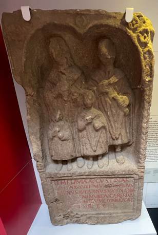
The veteran
soldier Caereslus Augustinus had lost his wife.
Flavia Augustina and his two children. This stone carving (119 to 410 CE) seems
to depict his idea of how they might have grown up as a family, had they lived.
(Yorkshire Museum)
Yorkshire was
attractive for its resources which included lead, ironstone, coal and clay for
pots. There were potteries at Crambeck, Knapton, and
Norton and tanneries at Catterick. There were iron foundries.
Although Britain was not a wealthy
province, an exceptionally large army was stationed there; over 40,000 men at
its height, costing about 1/16th of the total imperial budget. Large
sums were spent by the imperial administrators. There was a vast outlay of
state funding. The volume of trade reached a level not seen for another
millennium and a half. British towns were smaller (London peaked at about
30,000 compared to Rome’s million), but still had the same
amenities of grid planned streets, aqueducts, baths, amphitheatres and forums.
This
in turn created massive amounts of wealth.
This
first economy could not be sustained in the longer term. New threats on the
Rhine and Daube and from Pythia (Persia) caused a reduction in troop numbers
over time. Coastal piracy increasingly disrupted trade, including the Samian
pottery trade from Gaul and olive oil trade from Spain.
By
300 CE about two thirds of London’s early buildings had decayed or been demolished.
Yet urban life continued. York followed the same pattern. Eboracum at
its peak was both a military garrison town and a cosmopolitan centre. Second
century funerary inscriptions evidenced individuals in York from France,
Sardinia and Greece. Skeletons are of North African origin. Goods flooded into
York in the early third century, but over time this trade declined, even though
splendid houses and state building projects continued.
(Britain after Rome, The Fall and Rise, 400 to 1070, 2011, Robin Fleming, pages 1 to 6)
120 CE
122 CE
Hadrian’s
Wall
Hadrian’s Wall was begun in 122 CE and its length was 117 kilometres. Soldiers
were garrisoned along the line of the wall in large forts, smaller milecastles,
and intervening turrets. In addition to the wall's defensive military role, its
gates may have been customs posts.
142 CE
The Antonine Wall
was an attempt to take Roman territory to the line of the Forth to Clyde, and
spanned 63 kilometres with 16 forts with smaller fortlets between. It proved
too difficult to maintain their position so far north and the wall was
abandoned only eight years after completion, and the garrisons relocated to
Hadrian's Wall.
196 CE
By the beginning
of the third century CE, memories of invasion were in distant memory, and the middle
class and elite Romano-British population was thriving, part of the world’s
largest empire. By this time cities like Eboracum were cosmopolitan
places where languages would have been heard from across the empire. The common
tongue was Latin, with writing being introduced for the first time.
However life in rural Britain continued much as it had done for centuries
before the invasion. The Romano British village at Chysauster in Cornwall by about 200 CE may exemplify
the life of ordinary rural folk continuing to live Iron Age lives.
Septimius Severus
In the winter of 196 to 197 CE, D Clodius
Albinus, governor or Britain, crossed to Gaul in a bid to obtain the imperial
throne; with him he took a large part of the army of Britain. His defeat in
February 197 at Lugdunum (Lyons) gave control of Britain to his rival, L Septimius
Severus, whose new appointment to the governorship of Britain was L Virius Lupus whose governorship should probably
be dated c 197 top 200 CE, and epigraphic evidence attests rebuilding south of
Hadrian’s Wall at this period. The fact that activity at this period appears to
have been concentrated in the Pennines might suggest that York also would received attention. (Septimius
Severus and the Defences of York,
Michael G Jarrett, Yorkshire Archaeological Journal, Volume 41, 1966, page 517).
200 CE
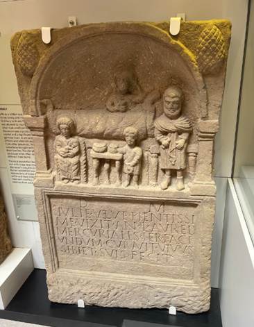
Tombstone (200 to 300 CE) of Julia
Velva. Her heir
Aurelius Mercurialis would gather at the tomb on the anniversary of her death
and would have believed she could take part. (Yorkshire
Museum).
208 CE
The RYBS Project suggests that whilst we know
Severus was in York and died there, this did not necessarily mean that he had
established an imperial presence and built a palace. Yet he took his court and
the imperial family, his wife Julia Domna and his sons Caracalla and Geta.
Fragments of about 50 head pots have been found in York, perhaps modelled on the
glamorous Julia Domna. The focus of the Roman Empire must have been on York at
this time.
During his stay 208 to 211 CE, the Emperor
Severus (reigned 193 to 211 CE) proclaimed York capital of the province of Britannia
Inferior (‘the lower’), and it is likely that it was he who granted York
the privileges of a colonia or city.
In 208 Severus himself arrived in
Britain with his two sons, Caracalla and Geta, in order to prosecute more vigorously the campaigns
against the northern tribes (and also, we may guess,
to make a final decision about the northern frontier). They remained until the
death of Severus at York in February 211, when his sons returned to Rome. The
record of an imperial palace at York, if it is to be believed, suggests that
this was probably the headquarters for the campaigns in Scotland, though both
Corbridge and South Shields were important as supply-bases. In these
circumstances it would scarcely be surprising if the neglected fortress at York
had its defences refurbished on the arrival of the emperors or, even more
probably, in preparation for their visit. There is no real indication that
there was a plan to re-occupy Scotland before 208, and if Caerleon was being
rebuilt by 209, as seems likely, it would be logical to expect similar activity
at York. (Septimius Severus and the
Defences of York, Michael G Jarrett,
Yorkshire Archaeological Journal, Volume 41, 1966, page 519).
In
208 CE, the ‘African Emperor’, Septimius Severus, a
warrior emperor who had built his reputation in his Pythian and North African
campaigns, rushed to Britain to quash rebellion there. He divided Britain for
the first time into Britannia Superior and Britannia Inferior to the north,
with its capital at Eboracum. From Eboracum, he planned a
campaign to strengthen Hadrian’s Wall and to invade Caledonia. With a ruthless
force of 57,000 soldiers, he marched north and established forward camps at
Cramond near Edinburgh and beyond. His campaign of 209 CE was followed by a
genocidal campaign in 210 CE. However
when he died in York in 211 CE, his sons rushed back to Rome and his gains
north of Hadrian’s Wall were lost. (The
African Emperor: The Life of Septimius Severus, Dr Simon Elliott).
For the African Emperor whose interests stretched from North Africa and
Parthia to bring the imperial court to Britain must have been caused by a
significant event. It seems probable that it was preceded by difficulties
defending the line of Hadrian’s Wall and possibly even a string of Roman
defeats. That in turn might have arisen from a depletion in Roman army strength
in recent years. Septimius Severus had defeated his rival Decimus Clodius
Albinus at the Battle of Lugdonum (Lyon)
in 197 CE when Albinus, as Governor of Britian, had mobilised the British
legions in an attempt to seize the empire. It may be
that the Roman military strength in Britain had not been replenished in the
intervening period. This may also have been a period of coastal raiding, which
later led to the construction of Roman coastal signal stations.
A Severan Coin was found near Helmsley (A Severan Coin Hoard from the Helmsley Area, Jennifer J Harris and Andrew R Woods, Ryedale Historian,
Volume 28, 2016 to 2017, page 6).
210
CE
By
210 CE Severus was so ill that he was carried on a litter and his son Caracalla
commanded the troops.
211 CE
Severus died in York in February 211 CE and Caracalla and Geta
became co-emperors.
On Severus’ death the idea of a northern
conquest was dropped and the army fell back to Hadrian’s Wall.
After a bloody succession squabble in Rome, Caracalla
had Geta killed and reigned from 211 to 217 CE.
216 CE
Marcus Antonius Gordianus, who would later become the short
lived emperor Gordian I, served as the governor of Britannia Inferior,
based in Eboracum. Inscriptions found in Concangis
(Chester-le-Street), dated to 216 AD,
bear his name and provide epigraphic evidence of his governorship, and also his involvement in the construction of a bath-house and aqueduct. Some inscriptions from his time as governor
were later erased, suggesting some form of imperial displeasure after he left
the post.
We don’t know much about the governors who
followed.
235 CE
The impact must have been felt in Roman
Yorkshire.
c 250 CE
270 CE
284 CE
Life in towns and cities continued and new
villas were built. Some of the grandest villas were built in the early fourth century.
By the third century CE, whilst the bulk of the rural population continued to
speak Celtic tongues, a new often urban nobility had emerged, speaking and
writing in Latin. Once educated they could find careers in urban government as curiales (councillors) and inhabit houses with
engineered water supplies not seen again after the empire ended until the
nineteenth century. Well into the early fourth century, the empire in Britain
seemed everlasting.
The network of forts were
built by legionaries but staffed by auxiliary troops. Caracalla had granted
full citizenship to everyone within the boundaries of the Roman empire,
possibly as a means to spread the tax net. The nature
and status of auxiliaries was therefore changing from when forts were first
built.
Derventio (Malton) was the largest fort in the area of
Yorkshire. It was defended through the second and third centuries with no
abandonment. In the mid second century it significantly expanded. There was substantial
manufacture of metal and pottery work. There was a
large vicus and a town house with the Four Seasons mosaic. There was an
inscribed building stone from a goldsmith.
Catteractonium (Catterick) on Dere Street on the River Swale was one of the most
enduring settlements. It seems to have been regarrisoned and rebuilt as the
frontier became less predictable. There was a substantial mansio,
or large residential building, possibly with ornate gardens. It was one of the most
substantial forts in Yorkshire.
Olicana (Ilkley) was a significant upland fort, probably a cavalry fort.
There was a significant vicus or small town.
Petuaria (Brough) on the Humber was a strategically important fort, naval
base, port, and potential tribal capital of the local Parisi tribe. Its precise
status has been a subject of ongoing archaeological debate.
In rural areas, archaeological sites have
tended to focus around known Roman roads, but probably
spread more widely. Many settlements would have started as round houses and in
third to fourth centuries, Roman architecture appeared.
Life for ordinary farming people in
Roman Yorkshire was far less influenced by the occupation than further South,
where large slave run farms provided huge amounts of grain for the army. Field
systems remained much the same as before and the traditional round houses, some
of them hundreds of years old, remained in use. A few villas were built,
notably those at Rudston and Langton, but there is curiously little evidence that typical Roman goods
like glass, kitchenware and amphorae of wine found their way down to ordinary
people. (The Little History of Yorkshire, Ingrid Barton, 2024, page 29).
Roman villas were probably
the centres of great estates, especially close to Roman roads. They probably
had contracts with the army. Some may have employed slaves and although there
is no evidence there may have been communities in servitude in the north
especially around Eboracum. The villas would have produced food well above
subsistence levels.
As well as Hovingham and Beadlam,
there are examples such as the winged and corridored
villa at Rudston
in East Yorkshire (with exhibits in Hull museum); Dalton
Parlours
villa, near Collingham, West Yorkshire; and Holme House
at the Tees crossing of Dere Street near Darlington. Although villas may have
sometimes been the residences of veterans, these Yorkshire villas were more
likely to have been native landowners, living and dining in the Roman way.
286 CE
Carausius, a Menapian from Belgic Gaul, was a skilled sailor who rose to command the Classis
Britannica, the Roman Channel fleet, tasked with eliminating Frankish and Saxon
pirates. In 286 CE, he declared himself emperor of a breakaway Britannic
Empire, encompassing Britain and parts of northern Gaul, which he ruled for
seven years. His usurpation is known as the Carausian
Revolt (286 to 296 CE). He fell in league with the pirates and ran his
Britannic Empire as a pirate kingdom.
By 286 CE the Roman empire was so vast that it
was split into two (the Diarchy, 285 to 293 CE) and with a couple of exceptions
there were always two emperors, with two separate armies. The western empire
comprised Italy, Spain, Gaul and Britain. The eastern empire comprised the
Balkans, Greece, Palestine and Egypt.
293 CE
It became advantageous to begin succession planning during an
emperor’s lifetime and the practice began of the Emperors of each of the
western and eastern empires, to carve out a junior territory, ruled by junior
emperors, marked for succession. The two empires therefore further divided to
the territories of four rulers (the Tetrarchy, 293 to 305 CE).
The senior emperors tended to style themselves
Augustus, and the junior emperors as Caesar.
In the west, Marcus Aurelius Valerius
Maximianus (Maximian, ‘Augustus’), who had been Diocletian’s subordinate
emperor, appointed Constantius I Chlorus (‘Caesar’), as his junior emperor
based in Eboracum.
Diocletian was Augustus in the east and
Galerius was Caesar in the east.
c 300 CE
Sandstone
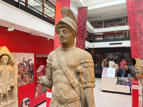
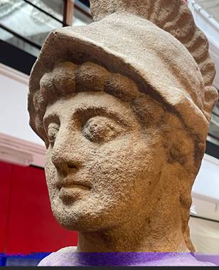
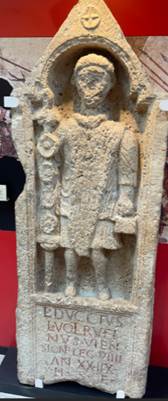
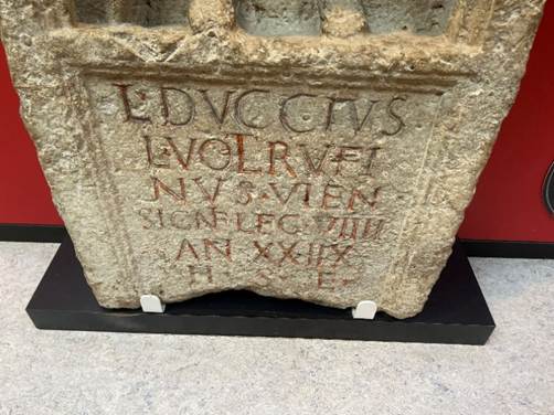
statute of Mars 300 to 400 CE (Nunnery Lane, York, now at The Yorkshire Museum) Lucius Duccius Rufinus, a 28 year old standard bearer from Viennes,
France (Mickelgate, York, now the Yorkshire Museum)
Constantine the Great
Constantius I Chlorus (of
Serbian origin) was junior emperor or Caesar in the west to Marcus
Aurelius Valerius Maximianus, his Augustus. He had control as Caesar
over Britannia and parts of Gaul. He may have visited Eboracum a number of times during his reign as Caesar.
In 305 CE
Maximianus and Diocletian suddenly abdicated, within three days of each other,
which must have been a coordinated plan. It was an unprecedented event. Diocletian,
who was severely ill, was the driving force behind the dual abdication, aiming
to set a precedent for non-violent, planned succession. It was expected that as
Constantius rose to be Augustus, the senior emperor of the western Roman
empire; his son Constantine would be Caesar, the junior emperor. However Constantine was passed over, and two henchmen of
Galerius, the eastern emperor, were made Caesars instead. This seems to
have been a political move by the eastern empire.
However Constantius had already called for Constantine to
join him in Britannia. There seem to have been continued problems in
northern Britannia because of Pictish raiding, which
explains Constantius’ presence there. Constantine managed to get to his father
from Greece, to reach Eboracum just in time. We don’t know for certain
that the events happened in Eboracum, but they probably did.
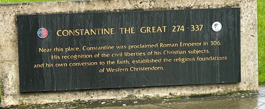
306 CE
As Constantine arrived, Constantius died on 25 July 306 CE. Constantius
Chlorus became the second emperor to die in York. He had visited Britain
several times during his lifetime. Although
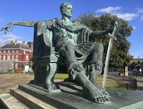
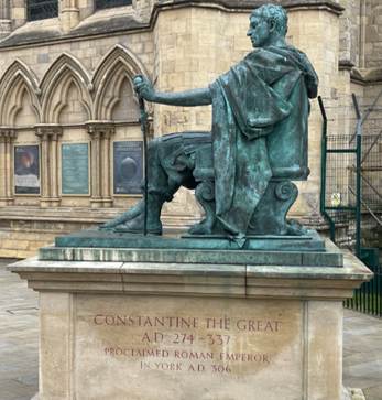
Constantine had been passed over, his father’s troops proclaimed him as emperor
there and then, also on 25 July 306 CE, immediately following the death of his
father, and not as Caesar under the Tetrarchy system, but as a full
emperor, Augustus of the western empire. Constantine (reigned 306 to 337
CE) was hailed as Imperator and Augustus, an act of military acclamation.
The soldiers who made the proclamation were probably the soldiers of the 6th
Legion, but probably also including auxiliaries, possibly and surprisingly
including German mercenaries who may have served with Constantine’s father. The
proclamation may have been within the walls of the fortress at Eboracum,
perhaps around the principia, or headquarters building, though there is
no direct evidence of that.
Whilst there is no direct evidence of
the proclamation of Constantine in York, there is evidence that it was the
legion in York and other troops in the north who declared for Constantine.
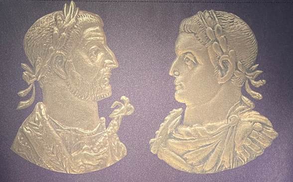
Constantius
and Constantine (Yorkshire Museum)
Constantine would have a profound impact on
the city of York, the path of Britannia, and on global politics.
312 CE
Galerius had been a key
instigator of the Diocletianic Persecution
of Christians in 303 CE. A pivotal moment came in 312 CE when Constantine
defeated Maxentius near Rome at the Battle at the Milvian Bridge, a victory he attributed
to the Christian God after a reported divine vision, leading to his conversion.
There is a story of vision in sky of a Christian symbol, which he told his
troops to paint the sign onto their shields. This may have been part of a
political move to consolidate the emperor under his control. It was a political
strategy that gave him significant power and legitimacy. Many historians argue
it was a calculated move to unify the Roman Empire under a single, powerful
religion, using the support of a growing Christian population to cement his
authority. He was a ruthless commander and emperor. While he was only baptised
on his deathbed, his reign initiated the evolution of the empire into a
Christian state and pushed Christianity into the mainstream of Roman culture.
He elevated the status of Christianity throughout the Roman world.
313 CE
A religious hierarchy was created that could
support Roman administration.
314 CE
In 314 CE, after
Constantine had gained Rome, a Council of the Church was held in Arles (not yet Nicaea), which referred to the attendance of
Eborius, Bishop of Eboracum. This evidences
that there was a bishop and church in York. Besides
this written record, there is no written evidence of Christianity in Britain
until Bede. The Council was held to resolve a dispute about the church in North
Africa and also referred to the presence of Restitutus of London and Adelfius
of Lincoln or Colchester.
In York,
there is very limited evidence of Roman Christianity. Indeed
there is only fragmentary evidence of Christianity in northern Britain during
the Roman period. A roof tile (tegula) found under York minster, with
the Roman Christian Chi-Rho symbol, from fourth century York is one of
the earliest known examples of the Chi-Rho symbol being used,
potentially predating the official acceptance of Christianity in the Roman
Empire. There is an example of a possible, though debated, Christian burial
identified under Sycamore Terrace in York. The Ivory Bangle Lady’s
burial is dated to the late Roman period. The evidence for possible Christian belief
comes from an openwork mount found in her stone coffin that reads Hail,
sister, may you live in God, and the tentative link to Christianity rests
on the reference to a single God.
324 CE
325 CE
330 CE
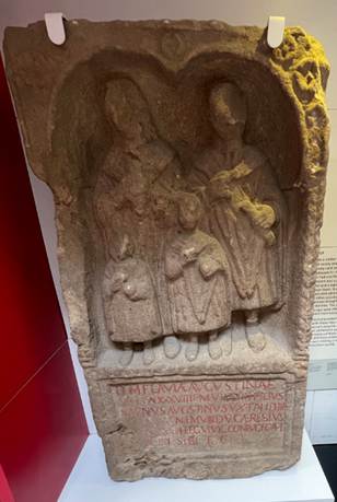
The veteran
soldier Caereslus Augustinus had lost his wife.
Flavia Augustina and his two children. This stone carving (119 to 410 CE) seems
to depict his idea of how they might have grown up as a family, had they lived.
(Yorkshire Museum)
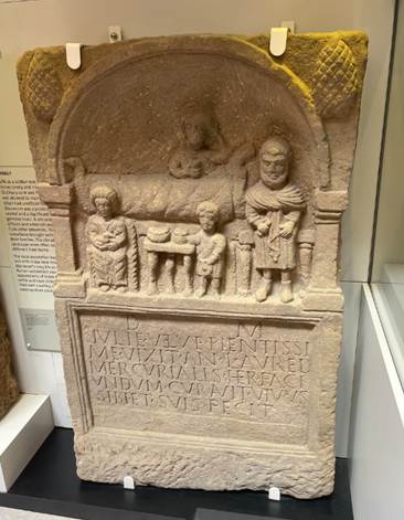
Tombstone (200 to
300 CE) of Julia Velva. Her heir Aurelius Mercurialis would gather at the tomb
on the anniversary of her death and would have believed she could take part.
(Yorkshire Museum).
Roman Ryedale and the road network
There
is an In Our Time podcast, Roman
Britain.
Roads connected
the new urban centres and the agricultural hinterlands, crossing bridges over
major rivers, with rivers sometimes linked by canals. They were built for
military purpose, but soon supported extensive trade.
Ships arrived in Britain from across the empire.
The lands
around Kirkbymoorside and Kirkdale are only about twenty five kilometres north
of the Roman regional capital, Eboracum
(York). Eboracum would have become increasingly
accessible from these lands during the Roman period, with the construction of
new roads. The significance of Ryedale was reinforced by an extensive Roman
road network (Roman Roads
Research Association including Itinera Publications and particularly the Roads of Roman Britain Gazeteer). Wade’s Causeway ran from Malton across Wheeldale Moor towards Whitby.
A Roman road ran from Malton to the Vale of York
via the Coxwold and Gilling Gap where it joined Hambleton Street which
stretched from Bernicia to Lincoln.
The
Itinerary of Antoninus Augustus listed fifteen routes in Britain among its
empire-wide network of 225 roads (G Parthey and M. Pinder (editors), Itinerarium Antonini Augusti et Hierosolymitanum, Berlin, 1848).
Route I (conventionally so labelled in Britain) ran ' from the frontier,
from the waif, as it claims, to a place called Praetorium/Pratorium,
praetor's headquarters', 'commander's centre'. This name is found several times
in the continental part of the Itinerary, and is a
description of function rather than a place-name. The one
in Britain is normally located at the Roman military base and town at
Brough-on-Humber. The road passed through eight intermediate stations, in most
cases also towns, in the English counties, Northumberland, Durham and
Yorkshire. These towns are named, and distances are given in Roman numerals
between them, as well as an overall total given at the beginning of the route.
The road's general direction is not in doubt; it is down the Rede Valley to the
Tyne, then south across the interfluves of Tyne, Wear and Tees, before
following the Swale and Ure to York and then swinging eastward to the Yorkshire Derwent and, probably, south again
across the Wolds to the Humber.
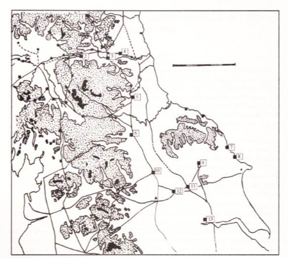
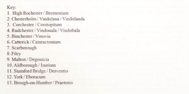
The situation east and south of Eboracum is rather different. There are
only three stations, but the location of each is disputed. Derventio
is represented by the Iter as seven miles (VII) from Eburacum,
Delgouicia as 1 3 miles (XIII) from Derventio, and Praetono as 25
from Delgouicia (XXV). The most common way of placing
them on the map has been to locate Derventio at
Malton (on the River Derwent and a major Roman site, certainly a road-hub), Delgouicia as either at Millington or Wetwang
(near or on one or other Roman road from Malton to the Humber) and Praetorio (Brough, an important Roman naval-station and
township on the Humber).
(Route 1 in Roman Britian: From the frontier to the Humber, JGF Hind, Yorkshire Archaeological Journal,
Volume 79, 2007, page 55).
Thurkilesti was an ancient travellers route
from Cleveland across the North York Moors which passed close to the west side
of Kirkdale and on to Welburn, just south of the Kirkdale ford and to Hovingham
where it later joined the Roman roads. It ran parallel to Waingate
which followed the line of Rudland Rigg. It was later referred to in Roger de
Mowbray’s grants of land to Rievaulx.
The lands around Farndale were a peripheral region, but with connections to the
wider political world. They came to be part of the Roman hinterland. By the
late Roman period, these lands were probably part of a stable, well regulated area with dispersed settlement, probably
dependent on major villa based estates such as at Beadlam and Hovingham, only
a short distance south of Farndale (Ryedale Historian Vol
3, 1967, page 10).
Hovingham was a
Roman villa, perhaps on a palatial scale, about ten kilometres southwest from
Kirkdale. Hovingham might have had very extensive holdings, which could have
embraced a wider estate including Beadlam and Kirkdaleland.
Villas at
Appleton le Street, Blandsby Park and Langton
indicate that Ryedale was a major agricultural producer in the Roman period. The
landscape of the Vale of Pickering was also likely to have been well settled.
Agricultural produce would have been required at significant scale to support
the northern Roman army.
After the
Roman conquest, the region was administered from the newly built Roman town of Isurium Brigantum, modern Aldborough, near Boroughbridge. Isurium was a strategic regional capital on the main
transport corridor of Dere Street and along that transport corridor to the
south was Calcaria, Tadcaster; Lagentium, Castleford; and Danum, Doncaster.
The Ivory
Bangle Lady is a high-status young adult female, potentially of North
African descent, who died in York in the fourth century CE. This was a multi cultural world. She was buried with fantastic wealth
including bangles of African elephant ivory. The most famous object from the burial
is a rectangular openwork mount of bone, possibly from an unrecorded wooden
casket, which reads Hail, sister, may you live in God, indicating she
may have had Christian beliefs.
Rome’s first economic cycle was
followed by a second, smaller economy, based on private wealth. As imports
became scarce in the face of barbarian threats and piracy, local goods started
to take their place. Beer drinking replaced wine and very slowly British potters
started to substitute for Samian wear. This was a very different economy to
before. A new provincial economy emerged, which in turn gave rise to a wealthy
and Romanicised elite. Whilst we don’t know the name of any of the owners of
villas of this period, this new elite class had large villas built and took
opulent houses in the towns, even though the towns were in decline. It was
these private spaces that came to dominate the new social structure.
The new Roman-native oligarchy saw deep
social stratification along with phenomenal prosperity. Villas developed large
entertainment rooms to impress friends and allies. Lavish private display
allowed the elite to flaunt lovely wall paintings and tendered gardens.
The economy shifted from the core to
the periphery. Alongside the older urban centres, smaller and less pretentious
smaller towns emerged. They were grubbier manifestations of empire and
housed workshops manufacturing and extractive industry.
Agriculture saw a simultaneous revolution
and estate owners invested significantly in their rural properties. This was a
period of the reorganisation of rural buildings, enclosures and fields. Coins
and mass produced ceramics appeared in rural villas in
greater quantities than previously. There was a shift in cropping techniques.
Cereals including the Roman staple spelt were more intensively farmed. Bread
wheat first appeared. Agricultural innovations included a heavier plough.
Larger plough beasts were imported. There was a proliferation of barns and
granaries.
This was an unequal society. An
archaeological site near Dorchester at Poundbury led to the excavation of about 1,200 fourth century Britons. Despite the
prosperity evidenced by villas, many of these skeletons showed signs of hard
physical labour, with injuries caused by wear and strain and spines and
shoulders evidencing heavy work.
The period between about 290 to 360
CE saw the high water mark of romanitas in
Britain. It was the most Roman period of British history. Most people had
access to Roman style goods. Although there were local variations across the
empire, there was a common Roman culture from North Africa to York.
This prosperity was founded on the
ability of a substantial part of the population to purchase and sell large
amounts of often low value goods.
(Britain after Rome, The Fall and Rise, 400 to 1070, 2011, Robin Fleming, pages 6 to 21)
Evidence has been found at Crambeck, North Yorkshire of pottery industry in the
mid fourth century, about 350s CE. Pottery kilns along the route from York (24
km away) to Malton (8 km away) seem to have been
making pottery of a utilitarian nature. There might have been a contract to
supply the Roman army. Whilst this was a period of instability in towns, rural
industry and villa estates persisted. Produce seems to have become more localised rather than the importing of goods such as Samian
ware from Gaul. Yet for a while the region was stable enough for this type of
industry, which was pleasant enough, but not very ornate.
The Roman Villa at Beadlam
For much of the population life was
not so easy. The extreme wealth depended upon the exploitation of the majority of the population. For every winner under
Roman rule there were a hundred losers (An Imperial Possession: Britain in the Roman Empire 54 BC
to AD 409, 2006, David Mattingly, page
20). Yet slavery was not new and had been
part of Celtic society. The Roman economy arguably brought benefits to
everyone. Agricultural productivity was improved by the introduction of a heavy
plough that turned the soil replacing an inferior model which simply scratched
the surface. The population grew to between 2 and 6 million. Roman towns had
better sanitation, with drains and sewers. Literacy became more widespread; at
one time every soldier in the army was literate, though the requirement was
dropped in time. The empire and its benefits seemed eternal.
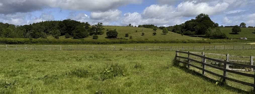
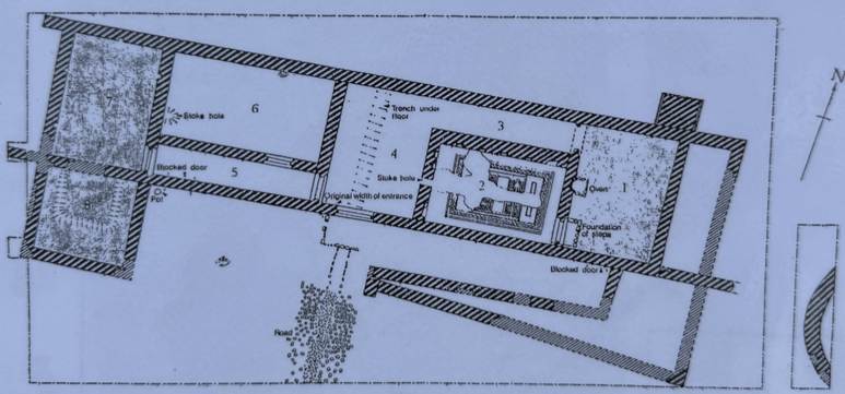
The Roman
villa at Beadlam, only two kilometres west
of Kirkdale, was discovered in the 1960s. It was excavated between 1966 and
1978.
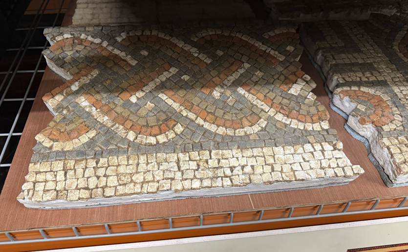
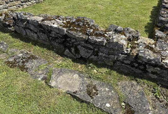
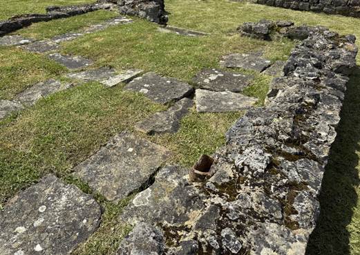
The villa
comprised three ranges, and included a well preserved mosaic and a bath house suite.

The North
Range is seen as originally to have been a winged corridor building with
roughly symmetrical wings at each end perhaps for two families, linked by large
barn-like rooms with painted plaster and cement floors, and a south-facing
veranda. The central area was subsequently subdivided into rooms, one of which
had a mosaic, and was heated by a hypocaust. There was probably an upper story, and there were
glazed windows. Numerous coins date through to issues of the latest 4th and
earliest 5th centuries, the last Roman coinage to reach Britain.
The West
Range was also of winged corridor plan. The southern wing is an elaborate bath-house, with warm and hot baths, a plunge bath, and
dressing-exercise areas. Two other rooms at the east end were heated, and this
was presumably a living area. This range seems to have gone out of regular use by
the middle of the fourth century. The water for the bath-house
drained out to the south-west towards the river.
The East
Range was of several phases, with a variety of buildings, mostly within an
enclosure wall, of apsidal, circular and ovoid plans. Many coins were found
here.
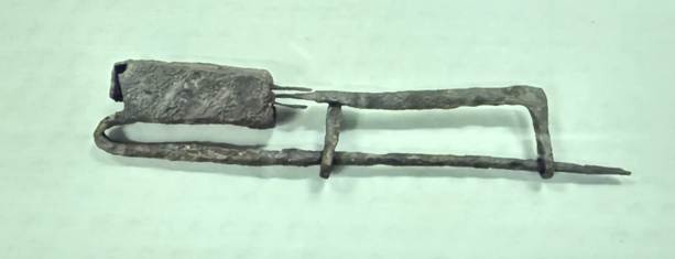
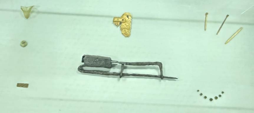
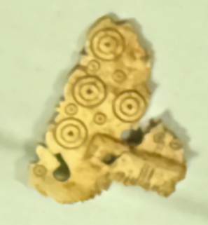
A padlock suggesting the security of
valuable items Artefacts
from the villa
Part of a comb
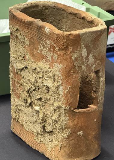
Hypocaust flue
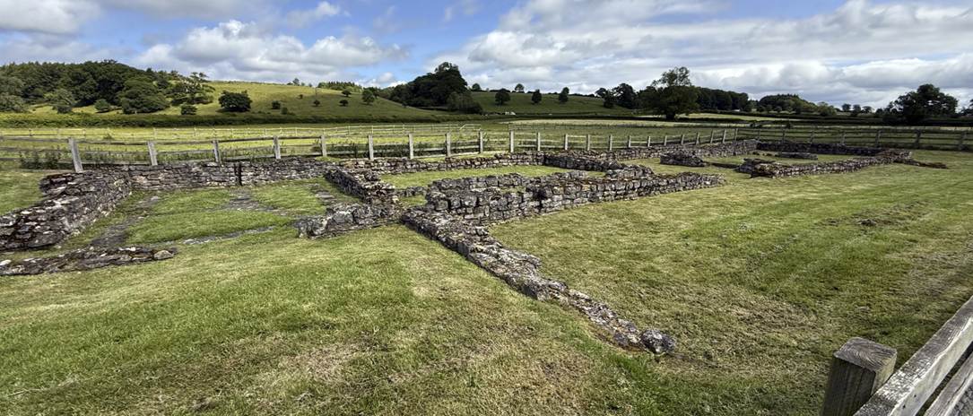
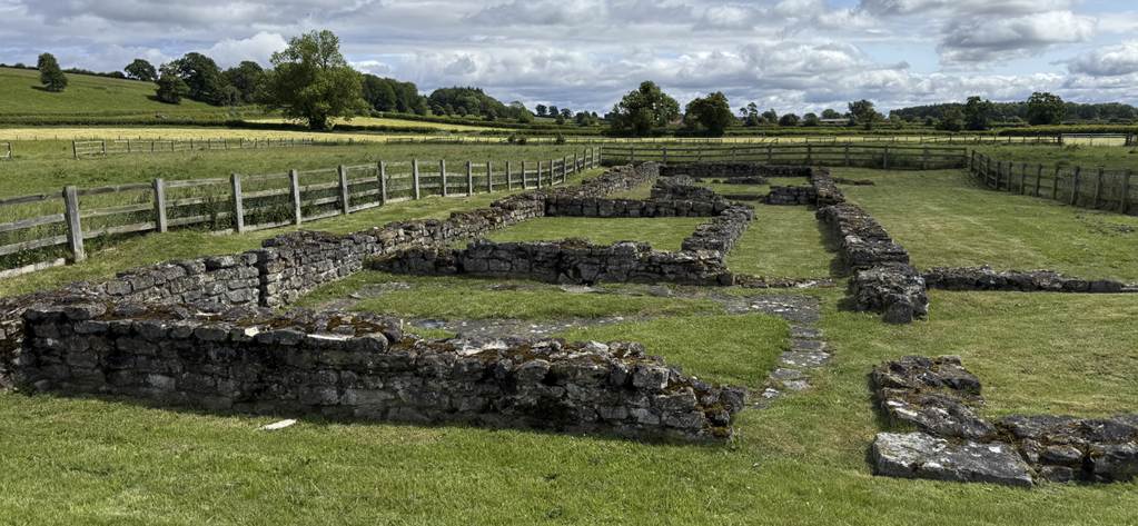
The main villa building
The
wealth of the villa inhabitants is clear from the buildings, mosaic and finds,
implying an agricultural surplus: ‘an essentially rural class quite happy in
their life-style, reserving the mosaic room for
special gatherings, but making full use of the other rooms and buildings for living
and working (even with earth floors) in some comfort’. The remarkably high
proportion of coins of the later fourth century, extending to around AD 400
with issues of Honorius and Arcadius (and this is true too of Langton and the
hoard at Hovingham) hint at a certain feeling of security due to the signal
stations, and, perhaps links with the possible housing at Malton of a unit of
the Imperial Household Cavalry (witnessed at Beadlam by a spur, spear, and the
ballista bolt). The supply
of food to these military forces may have provided economic security.
Beadlam is the only villa in the north
of England where the remains are visible and is the size of a major farm. (Excavations
Roman Villa at Beadlam, Yorkshire, D S Neal, 1996, Yorkshire Archaeological Report No 2, The excavation at Beadlam Roman
Villa, Philip Rahtz, Ryedale Historian, Volume 19,
1998 to 1999, page 24).
Since the excavation of the villa at Langton, it has been
recognised that agricultural pursuits were carried on in Roman times in those
parts of the country which had previously been described as the military, as
opposed to the civil zone. Indeed it is natural to find the production
of cereal crops being carried on in suitable areas near to the great military centres.
Few villas in Yorkshire have received full excavation; there are, however,
sites where fragmentary remains have been noticed at various times, which point
more to a civil than to a military occupation; it is now permissible to assume
that these represent a fairly widespread farming community, serving primarily
the needs of the garrison based on the legionary fortress at York. (Roman Villas in Yorkshire, C H Berry, Yorkshire Archaeological Journal, Volume 38,
1955, page 257).
At nearby Hovingham
what seemed to be the
bath-building of a villa was found, part of a significant villa perhaps on palatial scale. A
mosaic pavement was found at Oulston, 15 km west of
Hovingham. (Roman Villas
in Yorkshire, C H Berry, Yorkshire
Archaeological Journal, Volume 38, 1955, page 258).
A Roman Arm Purse Above Farndale
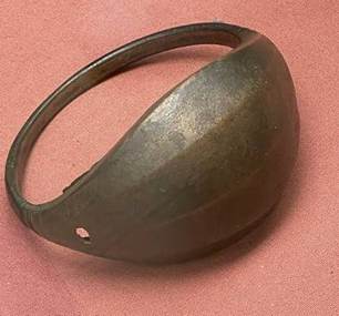
One day in the second or third century CE, a Roman
soldier dropped his arm purse, close to a prehistoric cairn, above and
overlooking Farndale. It was later found in 1849 and is currently to be seen
displayed in the British Museum. When the Roman legionary looked over Farndale
it remained a wild forested place.
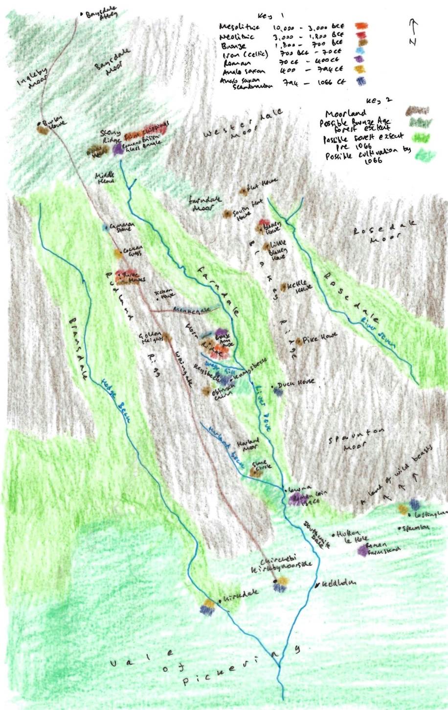
A
representation of Farndale and its vicinity prior to 1066
Key 1
is a colour code for archaeological finds around Farndale and the period of time with which they are associated, giving an
indication of settlement patterns around Farndale through time. Key 2 shows the
possible extent of moorland, woodland up to the Bronze Age and woodland up to
1066 and beyond, and the area of cultivation at the edge of the Vale of
Pickering.
An interesting find was made in the neighbourhood in 1849 by a
labourer engaged in removing stones for walling from a cairn on the moor to the
west of the dale. He found near the bottom of the cairn a bronze arm purse with
a corroded lid. The spring or bolt were lost, but the adjustment holes
remained. The purse contained nothing but a sort of decayed paper ash. Examples
of these purses have been found near the Roman wall containing Roman coins of
the 1st century AD. The Farndale specimen, now in the British Museum, may have
been lost from a Roman villa or, perhaps more likely, it was the treasured
possession of a local whose ashes were placed in it and buried in the can. No
dwelling of these early days has yet been found on Horn Nab, though three trial
trenches were dug in likely places. (Raymond Hayes, Farndale, 1961,
unpublished, page 8).
The Roman arm purse was probably
found in the cairn on Horn Nab. Roman copper alloy arm-purses were
worn by soldiers. British examples include finds from Corbridge, South Shields,
a site near Housesteads on Hadrian’s Wall,
Colchester, and this one found at Farndale.
As it was found above Farndale,
it doesn’t evidence Roman activity within the dale, but it does suggest
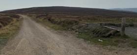
patrolling across high moorland tracks, overlooking the dale. Go and see this
purse in the British Museum and you’ll be in direct contact with the land of
our ancestors, two millennia ago.
Raymond
Hayes suggested the only other Roman artefact from the vicinity of Farndale was
a single coin of Antonius Pius, AD 139, found in Douthwaite at the Lowna end of the dale. (Raymond
Hayes, Farndale, 1961, unpublished, page 9).
Frank Elgee commented
that except for a bronze arm purse from Farndale, I know of no Roman object,
not even coins, from the greater part of Blackamore and its dales. The
absence of Roman remains becomes all the more impressive
when we remember that the district adjoins some of the chief centres of Roman
life in the north. York, of course was the military capital of Roman Britain,
the headquarters of the Sixth Legion for these centuries, a colonia and the
centre of a great road system. One road ran northwards to Thirsk and east of
Northallerton, the site of a small station, to the Tees at Middleton one Row
through County Durham to Hadrian's Wall at Newcastle. Another ran to the
important station Malton on the southern margin of the Vale of Pickering, a
powerful fortress, certainly the base of the coast guard system, and the centre
of a large civil population in an area rich in residences, as at Langton, Rowborough, Musley Banks,
Settrington, Harpham, Hovingham and Newburgh. No greater contrast can be
imagined than this wealth of Roman remains of all periods around Malton, and
their scarcity in the lower Tees Valley and their general absence from the Moors
and the Dales. It proves beyond question, what has been urged again and again
in this book, that Blackamore and its dales were shunned by peoples who could
live in more genial and fertile regions; that their sterility was the cause
which determined their non settlement by so many people; and that the urn
people who had originally lived amidst them had done so under compulsion. (Early Man in Northeast Yorkshire, Frank Elgee, 1930, page 198).
|
The ancient
routes across the moors
Wade’s Causeway - The Roman
Road to the coastal signal stations |
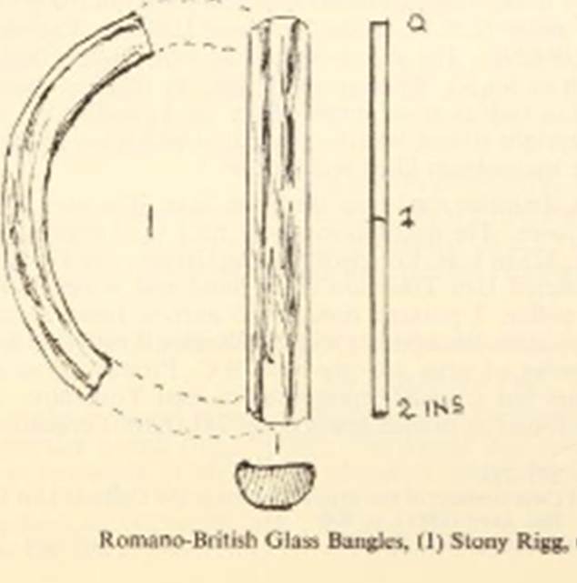
A Blue Glass Bangle at Stony Ridge
Yet
there is evidence of some limited settlement on the high ground above Farndale.
Raymond Hayes reported on the find of a Romano-British glass bangle at
Stony Rigg (NZ 636032) in 1967 (A
Romano-British glass bangle from Stony Rigg, R H Hayes, Yorkshire Archaeological Journal, Volume
42, page 125). In 1967 William Best of Pickering found half
of a blue glass bangle with fine threads of white in the texture. Native Roman
British, first and 2nd centuries AD copper, it came from Stony Rigg, Farndale
Head at 1400 feet in peat. It is now in the Ryedale Folk Museum.
Stony Rigg
bangle, though isolated and high in what was a forest clearing, was only just
over a mile from Eskletts, where beehive querns
occur, and several querns have been found in Westerdale and Danby. Elgee also mentions a blue glass bead from the Gallow Howe
area, near Castleton. (Early Man, page 191).
All these point to occupation, trading, and travellers
in the dales and on the high moors. We are already coming to accept intensive
Romano-British occupation on the limestone hills, therefore it is unlikely the
dales remained uninhabited, for recent work in Kildale and Eskdale shows
otherwise.
He
wrote that this find and the occurrence of beehive querns in Westerdale and
Danby (see also Raymond Hayes on querns in Ryedale Historian, 1974,
Volume 7, page 22)
point to occupation, trading, and travellers in the dales and on the high
moors. We are already coming to accept intensive Romano-British occupation on
the limestone hills, therefore it is unlikely the dales remained uninhabited,
for recent work in Kildale and Eskdale shows otherwise.
Romano British settlements at Spaunton
On lower
ground to the south, close to the entrance to Farndale, between Hutton-le-Hole
and Spaunton and Lastingham, Roman remains (Excavation Report: A Romano-British Site near
Hutton le Hole, Raymond
Hayes, Ryedale Historian Vol 2, 1966, page
12) suggest that Romano-British people were living in a clearing between
tracts of forest and moorland, on a site which may have been occupied in
Neolithic through to Iron Age periods.
The site is on the north side of a field
called 'Cooper's Riccal', SE 717894, close to the
boundary between Hutton-le-Hole and Spaunton. This
plateau of high ground, 500 feet above sea-level, was cultivated from very
early times. We have evidence of Neolithic and Bronze Age people in the
vicinity. Lingmoor, to the south of the site, implies
moorland surviving into medieval times, and Appleton Common is a modern
survival. Some of the land was wooded, and the Romano-British people were probably
living in clearings between tracts of forest and moorland.
The site was discovered in 1962 when pot
sherds were found. There was evidence of a domestic
hearth or oven and animal bones of ox, pig, horse, goat and red deer.
There were some similarities to finds at a villa at Langton. These
were likely to have been smallholder farmers producing for themselves, but subject
to Roman tax levies in corn or hides.
These sites were the dwelling floors of huts,
circular, oval, or in some cases rectangular, maybe with a few lower courses of
dry stone wall and turf with timber above, capped by
turf or thatch. The inhabitants were smallholders or peasant farmers producing
for themselves and to supply the demands of Roman tax levy of corn or hides.
They brought iron from Rosedale West Side, already smelted into small "'blooms',
which they re- heated and hammered into tools and weapons.
A larger farmstead (The excavation of a Romano British villa
at Spaunton, Arthur H Whitaker, Ryedale Historian Vol 3, 1967, page 12) was found nearby, which included primitive hypocausts.
In the adjacent fields sherds of
Romano-British pottery have been frequently unearthed by the plough as well as
flint implements of a more ancient period.
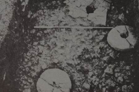
Area to east of Wall 2 showing Post-hole 10 and quern stones in situ. It was on this floor
that the coin of Allectus, the bronze bracelet and
the decorated spindle-whorl were found. Underneath the floor was a large
filled-in pit.
As usual on a site of this kind the pottery
gives the clearest and most reliable evidence for the date of its occupation, and makes a 4th century A.D. dating almost
certain. The single Samian sherd dating from the early 3rd century is too meagre
as evidence for an earlier occupation, though it must be admitted that some of
the sherds of calcite-gritted ware were very reminiscent of lron
Age pottery.
From the quantity of bones and pottery found
in this area, the presence of the quern in situ and the location of the
ash-filled pit (whatever its purpose), the conclusion must be reached that this
building was the farmhouse the centre of the family life of this little
community. The spindle whorls and the loom weight show that spinning and weaving
were carried on, and the presence of iron slag in fairly large quantities
suggests that the iron tools or implements necessary to the work of the
community were made on the spot.
After three centuries of Roman rule, despite
its brilliant achievements in many fields of human endeavour, there must have
been scattered over the country at large, and perhaps particularly in the
north, small communities such as that which lived at Spaunton,
whose daily life varied little if at all from that of their early Celtic
ancestors.
In all there were four isolated farms. These
were probably small families of native Britons in touch with Roman culture,
but whose daily life probably varied little, if at all, from that of their
early Celtic ancestors.
Grouse Hall
Excavations in summer
2024 at Grouse Hall near Lowna at the entrance to Farnmdale hace revealed
industrial activity centred on fire and smelting from Mesolithic to the Roman periods.
There is slag evidence of Romano-British smelting at the site. There is
suggestion of a possibility of a furnace in Roman times which may have possibly
supported a fort in the area. (Ryedale –
somewhere a fort? Roman Yorkshire,
newsletter of the Roman Antiquities Section, 2026).
Skiplam
Roman coins from
Skiplam (SE 631915) were kept at Welburn Hall (A History of Helmsley Rievaulx and District, editor, J McDonnell, 1963, page 407).
The Roman Camps at Cawthorn
It was believed that the nearby Roman military fortification at Cawthorn was built for practice rather than for
operational military use, although no evidence exists to prove that the
Forts were simply practice works and the scale of the remains alone would tend
to disprove this, although sufficient enigmatic issues remain to be resolved. It
dates to the late first or early second century CE.
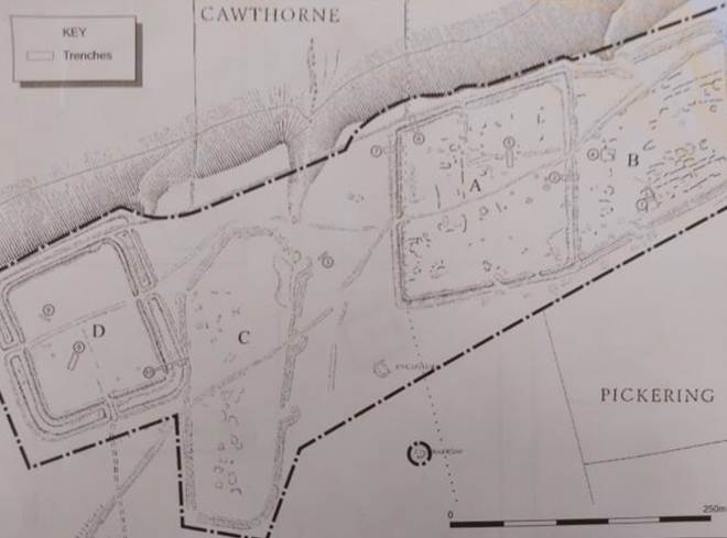
Camp D seems to have
been constructed first and may have been more temporary. The scale of the
surviving earthworks and the sequence of development suggested here make it
unlikely that it was anything other than a true fort - whether the troops were
actively engaged in warfare, a demonstration of strength, or on manoeuvres.
Camp C may have been a
construction camp for building Camp A.
Camp A was the more
substantial fort. A prehistoric burial mound in the centre may have become a tribunal
from where Roman officers addressed their troops. Fort A is clearly not a
practice work given the evidence of the finely finished rock-cut ditch (Richmond 1932, The Four Roman Camps at
Cawthorn in the North Riding of Yorkshire, Archaeological Journal Volume 89, pages 17-78, page 22) and the extensive use of timber in the rampart. Even after the sighting
of these defences at the end of the first occupation the ditch was still
substantial enough during the secondary occupation of A/B to be left as found,
the defences being strengthened with the sole addition of a new turf capping to
the existing rampart.. Camp A was later enlarged by the annex, Camp B.
The Camps are likely
to have had a principia (headquarters) in the
centre, a praetorium (commander’s accommodation), horrea
(granaries) and tented troop accommodation.
(Cawthorne Roman Military Complex, an update, Graham Lee, Ryedale Historian, Volume 19, 1998 to 1999, page
6, Cawthorne Camps, trial excavations
1999, Pete Wilson, Ryedale Historian,
Volume 20, 2000 to 2001, page
5, also Roman Camps at Cawthorne, Yorkshire Archaeological Journal, Volume 28, pages 25, 332 and 421, Volume 29, pages 90, 225 and 327).
There were certainly Roman military routes
which passed over the moors.
The Ryedale Hoard
The Ryedale
Hoard, dating to the later second century CE, discovered near Ampleforth is
a collection of bronze objects which includes a 1,800-year-old bust of Emperor
Marcus Aurelius.
Kildale
Three
Romano-British sites have been discovered in the vicinity of Kildale at Pale End
(NZ 611100), Lonsdale Valley (NZ613107), and Crag Bank. An earth terrace or lynchet
and the commencement of arable cultivation probably dated to the Iron Age. The
three Romano British sites are the largest concentration of Romano-British
settlements in the North York Moors. Kildale was an important location on the
eastern route into the Esk valley. The location was sheltered and a good place
for cultivation in the lower ground of the dale. There is evidence that during
the Roman period the indigenous population were able to move from the
increasingly unfertile slopes down into the more fertile lower ground. In
Romano-British and later times the farmers were obliged to clear and till the
lower ground because the uplands had become of little agricultural value.
There
is now evidence that before the Roman occupation there was a sizeable Iron Age
population in the North Yorkshire Moors in and to the north of the Esk Valley and extending south east to Levisham Moor. This was probably a sept or clan of the
Brigantes, and the building of a fort at Eston Nab in the Iron Age (palisade c
500 BC and later rampart and ditch) seems to suggest some turbulence within the
tribe.
At all events, Roman policy seems to have been one of pacification. Hayes
and Rutter (Wade’s Causeway, RH Hayes and JG Rutter, Scarborough and District Archaeological Society
Research Report No. 4, 1964, page 89) have shown that the Ninth Legion at
Malton carried this out by constructing the military road from Malton to Lease
Rigg near Grosmont starting the work early in the
occupation about AD 80. In this one move they took command of the Lower Esk, thereby effectively seizing strategic control of the
territory of the presumed Brigantian clan.
That this policy, coupled with economic advancements, was successful in
pacifying the area is indicated by the virtual abandonment of the road after a single
generation, in about AD 120, and by the apparent abandonment of the Eston fort
in Roman times. The effect of this pacification is clearly to be seen in the
upland farms at Crag Bank and Pale End. The mixed farming settlements
originated in pre-Roman times but there was no ‘harrying of the north’ by the
Romans, and life continued uninterrupted during their occupation. This
continuity can be seen on other Iron Age/Romano-British settlements in
Yorkshire.
The introduction of trade into the area is evident when we compare the
Percy Rigg Iron Age Site with the Romano-British farms. Whereas the Iron Age
pottery was crude in the extreme, the Romano-British farmer could afford mortaria and other well-fired
kitchen ware, even a little decorative samian at Lounsdale. The Romano-British wife could wear a necklace of
blue beads, to be compared with the homely jet bangle for the Iron Age wife at
Percy Rigg. And the domestic chore of grinding the corn was made easier by the use of better designed and imported querns.
The excavation at Crag Bank provides an example of continuity between Iron
Age and Romano-British settlement. The settlements in the Kildale area together
show that even these remote farms were influenced by the Roman policies of
pacification and trade, and the introduction of new methods enabled farming to
be continued at the lower altitudes after the early abandonment of the higher
settlements.
(Romano British Settlements at Crag Bank and Lounsdale, near Kildale, RS Close, RH Hayes and DA Spratt, Yorkshire
Archaeological Journal, Volume 47, 1975, page
61).
There are two helpful contemporary sources relating to
the later Roman Empire:
· The Later Roman Empire 354
to 378, by Ammianus
Marcellinus, was written under Honorius’ rule in early
fifth century. It is more about the eastern empire than the west, but it fills
some gaps.
· The Notita Dignitatum is also dated from the early fifth century, but
may be derived from earlier sources. It comprises a list of all army officials
in the Roman empire.
The Notita Dignitatum suggests that governorship roles in the
empire started to pass over to the military. Dux Britanniarum
literally means the Duke of Britain (the title comes from Latin Dux), but in
late Roman Britain a Dux was not a noble but a military title. Comes Britanniarum referred to the Count of Britain and
probably refers to Stilicho, who revived the command around 395 CE.
This list went down to legionary level and confirms
that the 6th Legion was still at York, with a Prefect in charge, though it
seems likely these units would have been smaller. They were no longer equipped
with standard Roman army kit, and auxiliaries
particularly wore more Barbarian local type kit.
During the reign of Constantius II (337–361 AD), Constantine’s second
son, Britain had begun to face broader political instability and civil wars
within the Roman Empire, culminating in a period of intense political purging
and administrative change.
Threats to the Empire
343 CE
The third
century had been a hard one throughout the empire and when the empire
stabilised at the start of the fourth century, the emperors had become powerful
military strongmen (Britain after Rome, The Fall
and Rise, 400 to 1070, 2011, Robin
Fleming, page 1).
During the fourth century the empire faced a new threat from
the warlike Picts in the north. At first this amounted to no more than the odd
incursion. In 343 CE, after repeated repairs to Hadrian’s Wall, the emperor
Constans led an expeditionary force to confront the Picts. There is an In Our
Time podcast, The Picts.
353 CE
The political instability
that severed Britain from the Roman Empire in the first decade of the 5th
century can be traced at least as far back as the year 350, when Britannia’s
governors declared their support for a usurper, Magnentius. His defeat by
Constantius II the following year, in a battle in the Balkans, was followed by
savage reprisals against Britannia’s property classes and the suicide of its
vicarious or prefect. (Northumbria AD 367-867,
Max Adams and Colm O’Brien, 2025, page 7)
After defeating Magnentius at the
Battle of Mons Seleucus in 353 CE, Constantius II became the sole ruler of the
entire Roman Empire. To consolidate his rule and root out Magnentius's
supporters, Constantius II sent his chief imperial notary, Paulus Catena, Paulus
the Chain, to Britain. Paulus's mission devolved into a brutal and
indiscriminate purge, involving widespread accusations and arrests of the
administrative and military elite.
354 CE
The vicarius
(governor) of Britain, Flavius Martinus, attempted to intervene against
Paulus's excessive cruelty. In a dramatic confrontation in London, when Paulus
accused Martinus of treason, Martinus attempted to assassinate Paulus but
ultimately killed himself.
360s CE
By the 360s there was a further threat to Britain from the
Scots and Atacoti (a Germanic tribe originally from the Rhine area) of Ireland. The Scots
come from Ireland, in future to settle in Scotland giving their name to it. So these must have been seaborne raids. The wild tribes
of the Scots and Picts broke their undertaking to keep peace, laid waste to the
country near the frontier and caused alarm among the provincials, who were
exhausted by the repeated disasters they had suffered (Res Gestae of Ammianus Marcellinus, Book 20, Chapter 1).
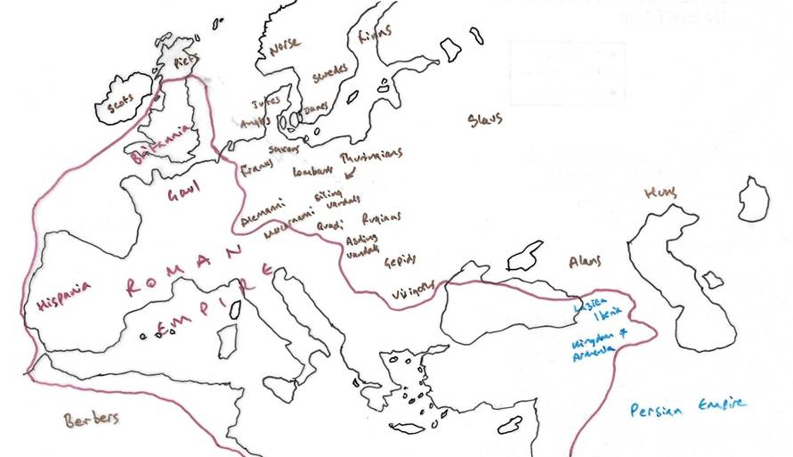
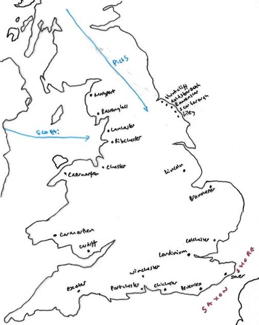
367 CE
In 367 CE during the reign of Emperor Valentinian I (364–375
CE) there was a coordinated attack, a barbarian conspiracy, from the Saxons
and Franks across the North Sea, the Picti, the ‘painted people’, from Scotland, and the Gaelic Dál Riata or Scotii from Hibernia, Ireland (res Gestae.
Villas were burned. Towns were cut off. There was widespread looting. A number of commanders were killed or captured including the
Comes Nectaridus, commander of the Saxon
Shore, who was killed, and the Dux Britanniarum Fullofaudes who was captured. The Roman military
structure in Britain temporarily collapsed, with some soldiers deserting and the
countryside fell into anarchy with widespread looting.
There was an army mutiny in the face
of increased threats to the empire. Order was restored by a force from the
Continent, but Britain never really recovered from this crisis.
Alarmed by the near loss of Britain,
Valentinian, who was campaigning against the Alamanni in Gaul,
dispatched a series of generals to stabilize the situation. The initial
attempts by Severus and Jovinus were ineffective, prompting Valentinian to appoint
the highly capable general Theodosius, later known as Count Theodosius and
father of the future emperor, to the command in 368 CE.
The archaeological evidence of these
raids is limited. It was thought that there was evidence of raiding destruction
around Malton with extensive abandonment late fourth century, but it is now
believed this might simply be evidence of more gradual abandonment.
However at Traprain Law, East Lothian, there are
significant finds of Pictish activity. The treasure trove is likely to be tribute paid by the Romans or booty from a raid on
Lowland Britannia. There is an example of a Chi Roh monogram, so the
hoard includes some Christian evidence. The hoard, buried in the side of the
hill also includes Germanic war gear (including Germanic buckles and strap
ends) which suggests that by the late fourth or early fifth century Germanic mercenaries
were engaged with the Roman army, their war gear being taken in battle by the
Picts, or perhaps that some were mercenaries working with the Picts. Indeed we know that the troops who proclaimed Constantine as
emperor in 306 CE included Germanic soldiers.
Theodosius’s forces rounded up
looters and army deserters, restored property and disbanded the scouting core.
He was also said to have restored cities and garrisons, reinforced guard posts and
offences and brought order to the province. Nevertheless, the shocking speed
and ferocity of this incursion, the failure of the frontier defences and the
exposure of fatal weaknesses in Britain’s political leadership and military
intelligence, reverberated long afterwards. Historians have seen in the events of 367
to 369 a pivotal marker of the eventual rend of Britain as a Roman province two
generations later. (Northumbria AD 367-867, Max Adams and Colm O’Brien, 2025, page 8)
In other words
by the mid fourth century, Germanic people were regularly travelling to Britain
to serve as mercenaries. The indication is that the threat to northern Britain
came from the Picts and Scots, not from Germanic invaders.
The Picts were likely to have been
raiding down the east coast as well, which may explain the extensive coastal
fortifications.
The coastal fortifications on the Saxon shore
were enhanced and there were defensive coastal forts and signal stations off
the Yorkshire coast at Flamborough (fourth century CE), Filey (late fourth century CE), Scarborough, Ravenscar (constructed about 370 CE), Whitby (Dictium)(late fourth century CE), Goldsborough (late fourth century CE), and Huntcliff (constructed about 367 CE).
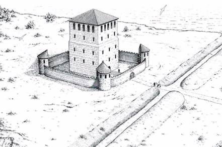
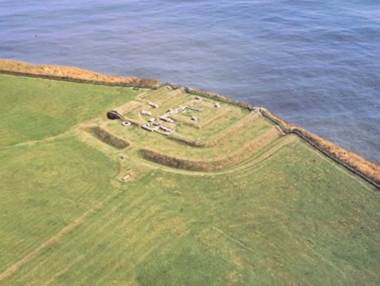
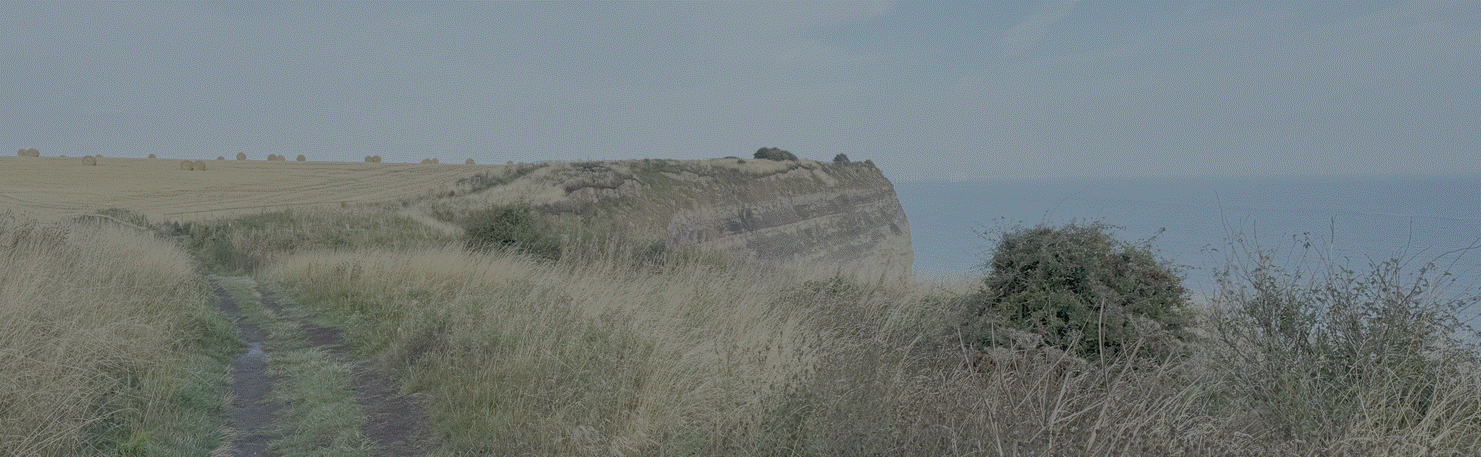
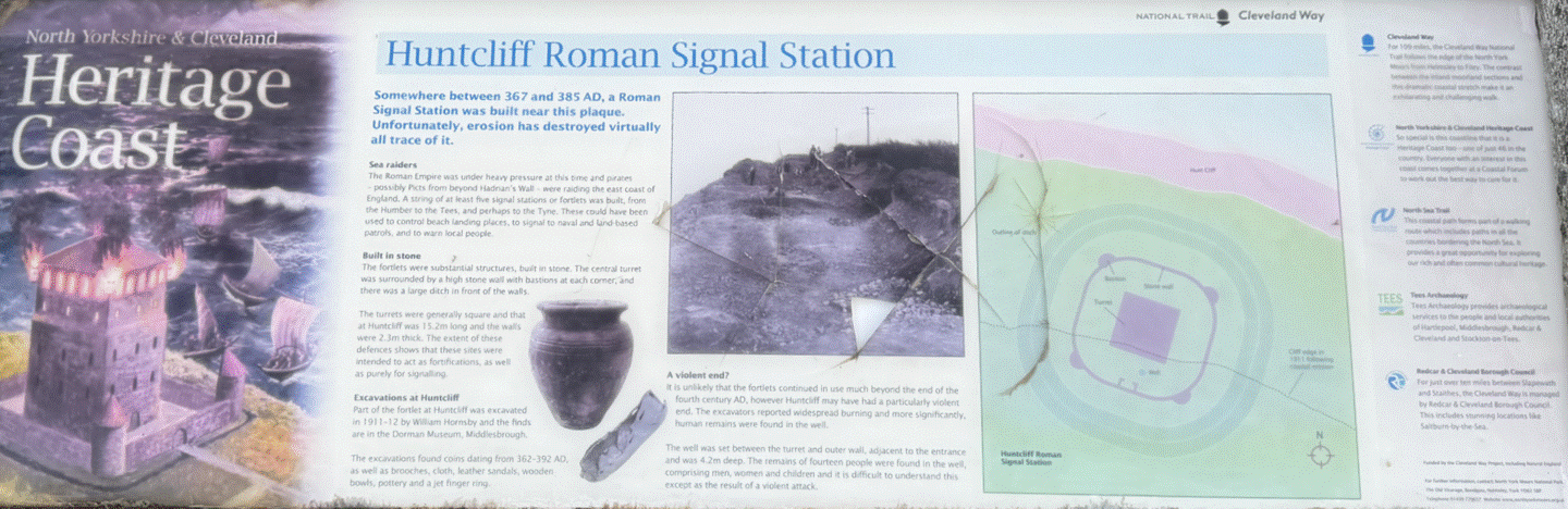
Roman coastal Signal Station at Huntcliff (by the author, 2026)
Other signal stations not yet found (or
corroded into the sea) may have gone down to the Humber and
also further north.
There is also evidence of signal stations
across the moors through the Pennines along the Staymore
Road, such as the Bowes Moor Signal Station, keeping
communication routes alive.
368 CE
Theodosius landed
in Rutupiae, Richborough
with an army composed of the Batavi,
Heruli, Jovii, and Victores legions and
marched to Londinium, London. He restored order in the south and rebuilt
fortifications across Britannia. By 369 CE, he had restored Roman control. He
renamed the northern province of Britain Valentia, after the emperor.
375 CE
The nomadic Huns from central Asia posed a threat to the
wider Roman empire, a wild race, moving without encumbrances, and consumed
by a savage passion to pillage the property of others (Res Gestae,
Ammianus Marcellinus).
376 CE
In 376 AD, a large number of Goths, a settled people of
the eastern frontier, who were fleeing the Huns, requested entry into the Roman
Empire. They were given refuge from the Huns in imperial territory, but Roman
officials mistreated the Goths, stealing from them. The Visigoths were
the Germanic people who emerged from the Gothic tribes in the Balkans and moved
into the Roman Empire.
378 CE
Tensions led to a full scale battle at Adrianople when two thirds
of the eastern Roman army, about 10,000 men, were killed along with the eastern
emperor Valens. The loss of the army at Adrianople severely weakened Roman
military strength and manpower.
Western troops were sent eastwards to
fill gaps in the eastern defences. Grain was shipped from Britain to feed imperial
troops. The draining of resource away from Britain had begun.
Theodosius I then allowed the larger
scale settlement of the Goths within the empire's borders, and many were
conscripted into the Roman army. This created a large, powerful, and often
unreliable barbarian element within the military. One Gothic survivor, who
survived these years but felt embittered toward Rome, was Alaric.
BBC Civilisations: Rise and Fall, Episode 1, follows the Gothic refugee crisis
to the Fall of Rome in 410 CE.
383 CE
In 383 CE the Roman army in Britain revolted and the Spanish
military commander of Britain, Magnus Maximus became leader of a breakaway
western emperor at Trier. He lasted five years but was defeated by the eastern
emperor Theodosius. Maximus took many soldiers from Britain to fight with him
on the Continent. So by this time the Roman military force in Britain was being depleted and
reposted to the Continental theatre of operations.
393 CE
395 CE
Theodosius I had been Western Roman Emperor
since 379 CE, through the Gothic War and ruled the Eastern and Western Empires
for three years, but died in 395 CE dividing the
empire again. His son Arcadius succeeded him in the Eastern Empire, and
Honorius in the Western Empire.
Flavius Stilicho was a powerful
Vandal-Roman general and de facto ruler of the Western Roman Empire
between 395 and 408 CE, serving as regent for Emperor Honorius. He successfully
defended Italy against barbarian invasions, defeating Gothic leader Alaric, but
his Vandal heritage and ambition led to accusations of treason, culminating in
his execution in 408 CE, which hastened Rome's decline and led directly to the
Visigoths' sack of the city two years later.
It is difficult to reconstruct the
state of Eboracum at the end of the fourth century. The road inside the
walls, the intervallum, was being repaved and
refurbished at end of fourth century, but not to the same quality. The Via Principalis
and Via Praetoria were similarly repaired during this late period. Sections
previously full of barrack blocks had become open spaces, which suggests a
reduction in the size of the garrison. Even if there was still reference to the
6th Legion, it may not have been of its former size and quality. The walls were
probably falling into disrepair and there is evidence of hasty repair work. The
multangular tower and the bulky towers along the walls would have been
difficult to maintain, with constant masonry work required. The repair of the
previously collapsed ‘Anglian’ Tower is probably misnamed and dates to the late
stage of Roman occupation.
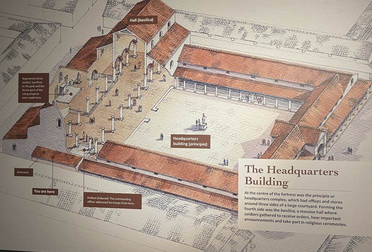
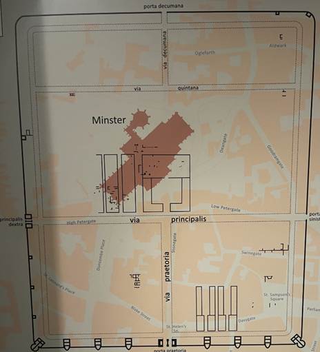
At the heart was of the Roman camp was the principia,
the central headquarters building and the most important structure, housing the
military unit's standards, shrine, pay office, and strongroom for funds. It
served as the administrative and spiritual heart of the garrison and was located
at the intersection of the fort's main roads.
Facing at the rear of the courtyard was the biggest building, the basilica,
a large tall aisled hall for public meetings. The whole body of a legion could
probably have assembled to hear an address within. The column outside York
Minster is one of the columns of this aisled hall. The basilica was
certainly still in use at end of fourth century, but hard to say who by. Animal
bones found at corners of the hall might evidence butchery or feasting. The
evidence suggests that by the end of the fourth century, the basilica
was not used for original intention. By the beginning of the fifth century, the
evidence shows no further activity. It is not known how long it stood. The
columns might have fallen quickly, or lasted to the
sixth century.
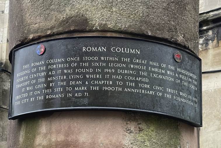
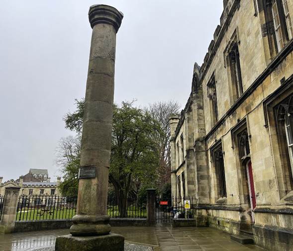
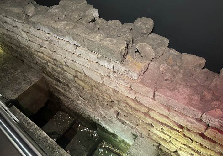
End of Empire
The Rome which fell in Britain at the beginning of the fifth
century was only a distant relative of the Rome that had conquered and
colonised it (Britain after Rome, The Fall and Rise, 400 to 1070, 2011, Robin Fleming, page 1).
There
is an In Our Time podcast about the causes and events leading to the fall of the Roman Empire in the
5th century which
assesses the role of Christianity, the Ostrogoths, the Visigoths and the
Vandals.
396 CE
There was another coordinated and sustained attack by Picts,
Scots and Saxons between 396 to 398 CE.
There were economic consequences of
the military crisis. Generations of farmers who had produced food for town
markets, faced violence, looting and cattle and sheep droving. By the early
fourth century urban life ceased completely. The ruined and empty city of York
reverted to marshland, evidenced by fossils of beetles, wetland froghoppers and
field mice.
401 CE
Italy itself
was invaded by the Goths in 401 CE.
402 CE
Emperor Honorius moved the Western
Roman Empire's capital from Milan to Ravenna in 402 CE due to severe threats
from invading Gothic tribes, particularly King Alaric. Ravenna, surrounded by
marshes and connected by sea, offered better defensibility and naval access to
the East. It became the seat of power for the Western Empire until its fall in
476 CE, and served as a crucial political and cultural
hub.
406 CE
At the end of 406 CE the Vandals,
Alans and Sueves crossed the Rhine and invaded Gaul.
Constantine set off from Britain to help, but after a disastrous campaign he
was executed by loyalist imperial forces.
407 CE
In 406-407 CE, Germanic tribes including Vandals, Alans, and
Suebi crossed the frozen Rhine into Gaul, creating a major crisis for the
Western Roman Empire. British troops, eager to fight these
invaders on the continent, proclaimed their own emperor, Constantine III.
Constantine III then took nearly all available mobile Roman soldiers from
Britain to Gaul to bolster his forces, effectively stripping the province of
its primary defence. This mass departure left Britain
militarily exposed, leading to increased barbarian incursions from Picts and
Scots and local Britons eventually taking charge of their own defence around 410
CE, as confirmed by Emperor Honorius's famous letter telling them to look to
your own defences.
408 CE
By 408 CE Britain was facing invasion
by Saxons. The exasperated Britons themselves rose to revolt from Roman rule
and live on their own, no longer obedient to Roman laws. They armed themselves, and ran many risks to ensure their own safety
(Historia Nova, the Greek Historian Zosimus).
The Barbarians beyond the Rhine made
such unbounded incursions over every province, as to reduce not only the
Britons, that some of the Celtic nations also, to the necessity of revolting
from the empire, and living no longer under the Roman laws but as they
themselves pleased. The Britons therefore took up arms, and incurred many dangerous
enterprises for their own protection, until they had freed their cities from
the Barbarians who besieged them. (Historia
Nova, Zosimus, Book 6)
Britanniae Saxonum incursionae devastatae (Chronica
Gallica).
Yet the severing of its links with
the Roman empire put Britain into free fall. The archaeological record is clear.
Quality pottery and ironmongery such as nails disappeared. Society collapsed.
It was probably the most dramatic period of social and economic collapse in
British history (Britain
after Rome, the Fall and Rise 400 to
1070, Robert Fleming, 2011, page 27). As the state failed, civil
society dissolved. The population was subject to pillaging, looting and
robbery.
The Hoxne hoard, discovered in Suffolk in 1992, comprised
silver tableware, animal and human figures, bowls, dishes, pepper pots, 584
gold coins and over 14,000 silver coins. The coins were minted between 407 and
408 CE. 98.5% of the silver coins had been clipped. They were buried in about
408 CE in a climate of fear, but with some hope that one day they could be
retrieved.
Military weakness led to economic
crisis, reflected by an increase in cattle and sheep rustling.
410 CE
The English translation of the Rescript of Honorius,
passed down by the sixth century Byzantine historian Zosimus, is that Honorius
advised Britons to look after their own defence. The Rescript repealed the law which prohibited citizens in Britain from
carrying arms in demilitarised lands where the people relied upon the Pax
Romana. In effect the Rescript rescinded Roman rule over Britain. It was
issued in the same year as the sack of Rome by the Goths.
John Everett Millais depicted a
romantic image of the Romans Leaving Britain, as a tortured Roman soldier saying farewell to his Celtic lover. It is
unlikely to be representative of the reality.
The Romano-British kingdom rapidly
broke up into smaller kingdoms. In time, Ebrauc
(York) would become the capital of a new kingdom.
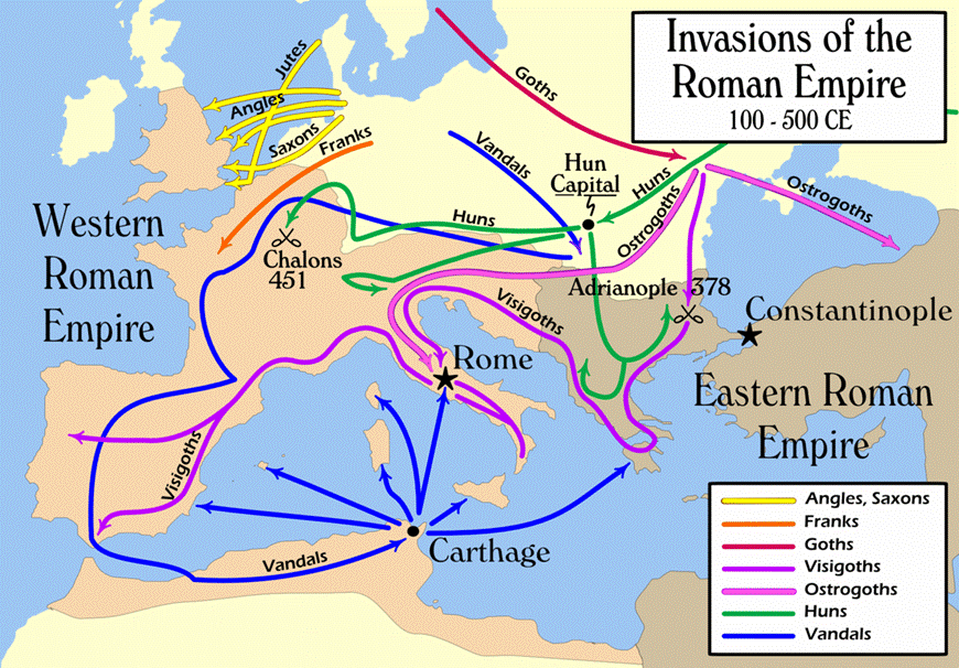
420 CE
Some of the
villas across Britain may still have been functioning after 410 CE. Many areas of
Yorkshire, away from Roman settlements, were probably not particularly
Romanised. A mile or two into the country and little probably changed. The bypass excavations at Catterick (Roman Cataractonium) suggest that while the Roman military
garrison may have ceased formal operations around 410 CE, the site was not
immediately abandoned. Instead, the civilian settlement continued to be occupied
into the fifth and sixth centuries, with evidence of a transition to a
post-Roman, possibly Anglo-Saxon, community. There is some evidence of
continuity at Malton. The coastal signal stations which were probably
constructed after 367 CE were robust structures and there is no evidence of
their destruction in the early fifth century. The remains of barn owls, who are
not found in places of human habitation, suggest that they were abandoned with no
troops stationed there. The archaeology doesn’t evidence a sudden cataclysmic
invasion.
However by 420 CE Britain’s villas were mostly abandoned and
towns were empty. There were still people living amongst the ruins who had been
born in a world ordered by Roman material culture. However
there was no longer a Roman Britain in which to live. (Britain after Rome, The
Fall and Rise, 400 to 1070, 2011, Robin Fleming, page 28 to 30).
The
Roman Fort at Malton on the Derwent had a civilian population and occupation
continued beyond 400 CE, but we don’t know for how long. Roman villas in the
Howardian Hills on the Wolds near Driffield and around Brough on the Humber
were also in use around 400 CE, but it is difficult to say for how long. Over
time villa sites may have been abandoned and Anglian settlements may have been
deliberately sited away from older centres. (Northumbria AD 367-867,
Max Adams and Colm O’Brien, 2025, page 48).
The Anglo Saxon poem, The Ruin, describes the remains of a Roman town, during the chaotic centuries which
followed.
Wondrously ornate is the stone of this wall, shattered by fate, the
precincts of the city have been crumbled and the work
of giants is rotting away. The roofs have rushed to earth, towers in ruins. Ice
at the joints has unroofed the barred gates. Sheared, the scarred storm walls have
disappeared; the years have gnawed them from beneath. A grave grip holds the
master crafters, decrepit and departed, in the ground’s harsh grasp, until one
hundred generations of human-nations have trod past. Subsequently this wall,
lichen-grey and rust-stained, often experiencing one kingdom after another,
standing still under storms, high and wide, it failed. The wine halls moulder
still, hewn as if by weapons penetrated.
In the humorous minds of Sellar and Yeatman, the withdrawal
of the Roman legions left Britain defenceless and subjected Europe to that long
succession of Waves of which History is chiefly composed (1066 and all that, Walter Sellar and Robert Yeatman, 1930).
Go forward to the Anglo-Saxon
Period.
Bibliography
Roman
Villas in Yorkshire,
C H Berry, Yorkshire Archaeological Journal, Volume 38, 1955, page 257.
The Anglo
Saxons, A History of the Beginnings of England, Marc Morris, 2021, Chapter 1, The
Ruin of Britain.
Britain
after Rome, The Fall and Rise, 400 to 1070, 2011, Robin Fleming.
Roman
Yorkshire: People, culture and landscape, Patrick Ottaway, 2019. *
The
Archaeology of Roman York, Adam Parker, 2019. *
The Roman
Camps at Cawthorne, Yorkshire Archaeological Journal, Volume 28, page 332 and 421.
In Our Time podcasts, the fall of the Roman
Empire in the 5th century and Roman Britain.
See also Roman Kirkdale.