Leeds
Historical and geographical information
|
Return to the Home Page of the Farndale Family
Website |
The story of one family’s journey through two
thousand years of British History |
The 83 family lines into which the family is divided.
Meet the whole family and how the wider family is related |
Members of the historical family ordered by date of
birth |
Links to other pages with historical research and
related material |
The story of the Bakers of Highfields, the Chapmans,
and other related families |
Introduction
Dates are in red.
Hyperlinks to
other pages are in dark
blue.
Headlines of the
history of the Leeds are in brown.
References and
citations are in turquoise.
Contextual
history is in purple.
This webpage about
the Coatham has the following section headings:
· The Farndales of
Leeds
· Leeds, an overview
·
Timeline of
Leeds
·
Barkston Ash
The Farndales of Leeds
The Leeds 1 Line were the descendants of
John Farndale (FAR00293)
who married Sarah Brittain in Leeds in 1856 and was a cordwainer in the
Bramley, Hunslet area of Leeds by 1861. A cordwainer is a
shoemaker who makes new shoes from new leather. The cordwainer's trade has been
distinguished from the cobbler's trade, according to a tradition in Britain
that restricted cobblers to repairing shoes. That said, the word cobbler has
become widely used for folk who make or repair shoes The Oxford English
Dictionary says that the word cordwainer is archaic, "still used in the names
of guilds, for example, the Cordwainers' Company"; but its definition of
cobbler mentions only mending, reflecting the older distinction. The
family lived in the Bramley and Hunslet areas of
Leeds. They worked variously as shoemakers, cart men, labourers, and rag metal
dealers and Joseph and Alfred Farndale both served in the Army in the First
World War.
The Leeds 2 Line were the descendants of
Charles Farndale (FAR00738)
who settled in Leeds in 1947 after he married Lilian Atack.
Norman Farndale (FAR00782) had
moved to Barkston Ash by 1948. His older sister
Lillie Farndale (FAR00752B)
died in a tragic accident in Leeds in 1933. Elieen Farndale (FAR00914)
was married at Barkston Ash in 1973. William Farndale
(FAR00651)
eventually settled in Leeds with his son Cyril Farndale (FAR00872) who
moved to Leeds after the Second World War.
Leeds
Leeds is a
city in West Yorkshire about 170 miles north of central London.
Leeds was a small
manorial borough in the 13th century. In the seventeenth and eighteenth
centuries it became a major centre for the production and trading of wool. In
the Industrial Revolution it became a major mill town. Wool was
still the dominant industry, but flax, engineering, iron foundries,
printing, and other industries were also important.
From being a
market town in the valley of the River Aire in the 16th century,
Leeds expanded and absorbed the surrounding villages to become a populous urban
centre by the mid-twentieth century. It now lies within the West Yorkshire
Urban Area, the United Kingdom's fourth-most populous urban area, with a
population of 2.6 million.
Leeds Timeline
Anglo
Saxon
Leeds originated
as an Anglo-Saxon township on the north bank of the Aire.
1086
By the time of
the Domesday Book Leeds had a population of around 200, which was comparatively
large.
1207
The Lord of the
Manor, Maurice De Gant, founded a new town at Leeds. He created a new street of
houses west of the existing village and he divided the land into plots for
building. Then craftsmen built houses and paid rent. The new street was called
Brigg Gata (gata is an old word for a street and brigg is an old
word for a bridge so it was the bridge street). Soon the town of Leeds was
flourishing. In Medieval Leeds, there were butchers, bakers, carpenters, and
blacksmiths.
1552
A grammar school
was founded in Leeds.
1626
Leeds grew as a
local market centre and was incorporated in 1626. By then the town was a
cloth-finishing centre for a wide area where domestic weaving, introduced by
14th-century Flemish weavers, was pursued. By the 16th century Leeds was able
to challenge the supremacy of York and Beverley in the woolen-manufacturing
trade.
1801
In 1801, 42% of
the population of Leeds lived outside the township, in the wider
borough. The population of Leeds had reached 30,000.
Residential
growth occurred in Holbeck and Hunslet from 1801 to
1851, but, as these townships became industrialised new areas were favoured for
middle class housing. Land south of the river was developed primarily for
industry and secondarily for back-to-back workers' dwellings.
1816
The completion in
1816 of the Leeds and Liverpool Canal stimulated Leeds’s growth.
1832
Cholera outbreaks
in 1832 and 1849 caused the authorities to address the problems of drainage,
sanitation, and water supply. Water was pumped from the River Wharfe, but by
1860 it was too heavily polluted to be usable.
1834
Leeds was
connected to Selby by railway. Then in 1839, it was connected to York. In 1848
it was connected to Derby.
1836
The first modern
police force was formed.
1851
The population of
Leeds reached 101,000.
When pollution
became a problem, the wealthier residents left the industrial conurbation to
live in Headingley, Potternewton and Chapel Allerton
which led to a 50% increase in the population of Headingley and Burley from
1851 to 1861. The middle-class flight from the industrial areas led to
development beyond the borough at Roundhay and Adel. The introduction of
the electric tramway led to intensification of development in
Headingley and Potternewton and expansion outside the
borough into Roundhay.
1857
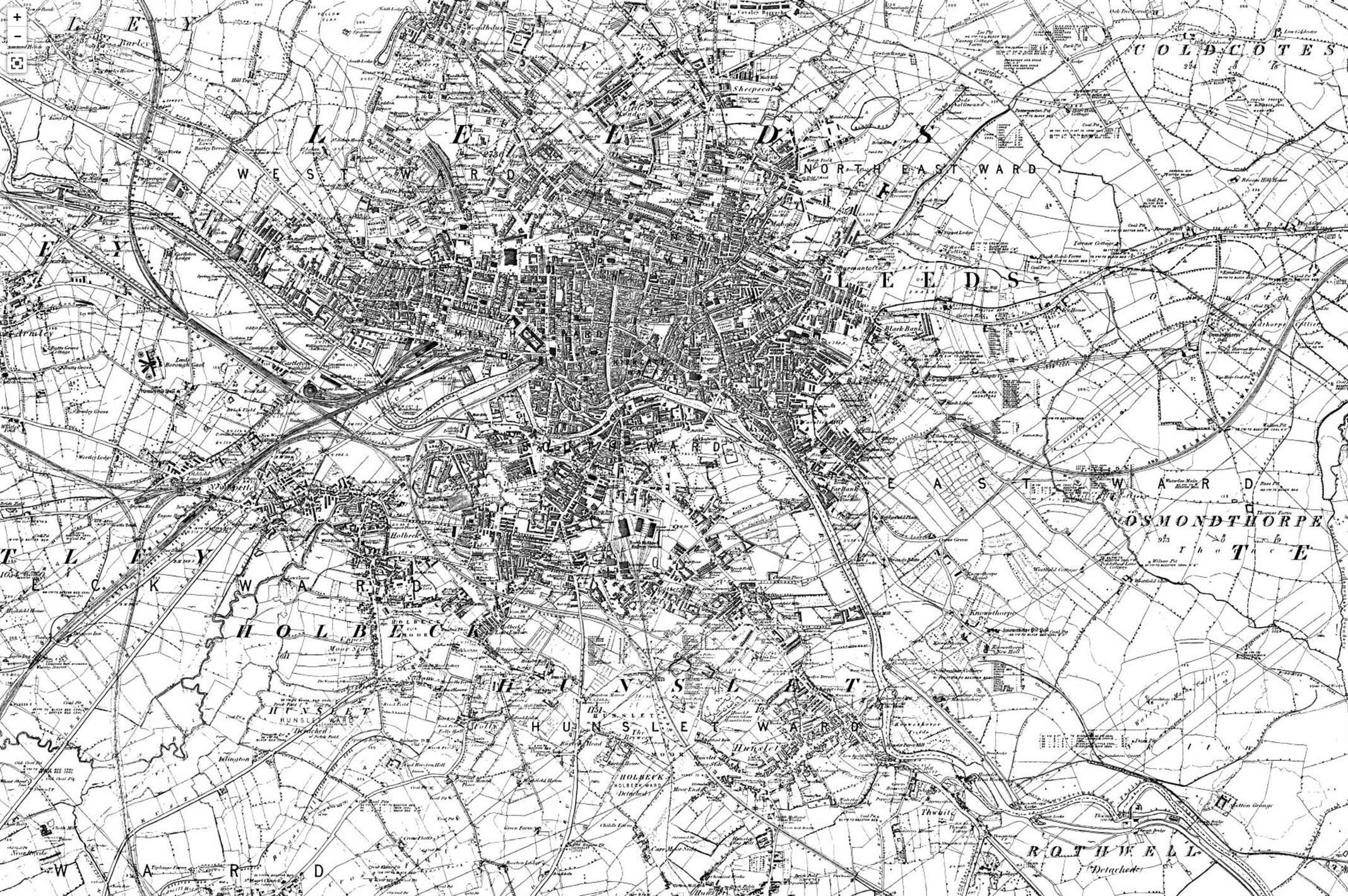
1858
Holbeck and Leeds
formed a continuous built-up area by 1858, with Hunslet
nearly meeting them. In the latter half of the nineteenth century,
population growth in Hunslet, Armley, and Wortley
outstripped that of Leeds.
1864
Leeds United was
founded.
1866
The Leeds
Improvement Act 1866 sought to improve the quality of working class housing by
restricting the number of homes that could be built in a single terrace.
1867
Following the
Leeds Waterworks Act of 1867 three reservoirs were built at Lindley Wood, Swinsty, and Fewston in the Washburn Valley north of Leeds.
1870
Two private gas
supply companies were taken over by the corporation in 1870, and the municipal
supply provided street lighting and cheaper gas to homes.
1880
From the early
1880s, the Yorkshire House-to-House Electricity Company supplied electricity to
Leeds until it was purchased by Leeds Corporation and became a municipal
supply.
1893
In 1893 Leeds had
been granted city status.
The industries
that developed in the industrial revolution had included making machinery for
spinning, machine tools, steam engines and gears as well as other industries
based on textiles, chemicals and leather and pottery.
Coal was
extracted on a large scale and the still functioning Middleton Railway,
the first successful commercial steam locomotive railway in the
world, transported coal into the centre of Leeds. The track was the
first rack railway and the locomotive (Salamanca) was the first to
have twin cylinders.
Various areas in
Leeds developed different roles in the industrial revolution. The city
centre became a major centre of transport and commerce, Hunslet and Holbeck became major engineering
centres. Armley, Bramley and Kirkstall became milling
centres and areas such as Roundhay became middle class suburbs, the
building of the Leeds Tramway allowing them better connections with
the rest of the city.
1900
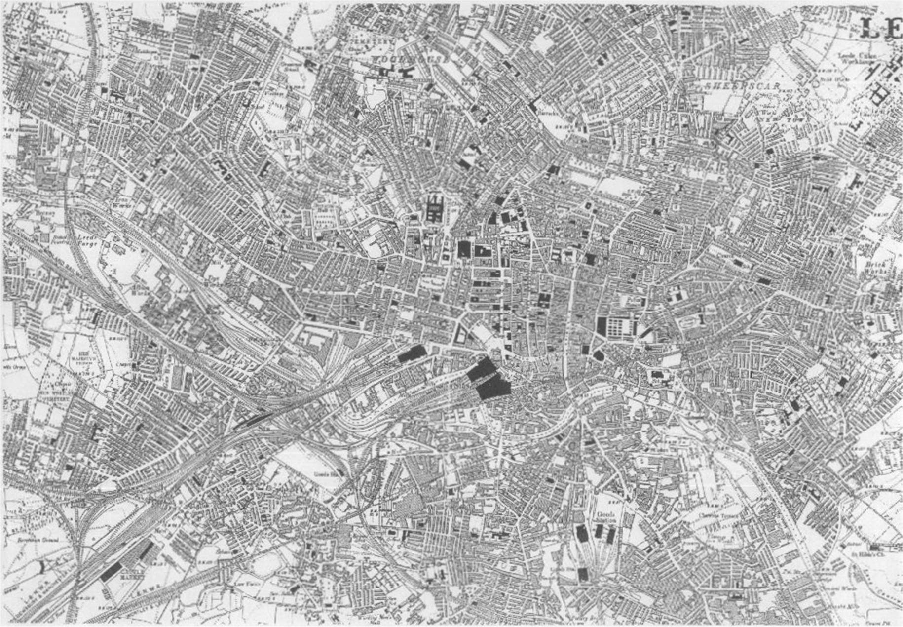
Leeds in 1900
1930
Slum
clearance and rebuilding began in Leeds during the interwar
period when over 18,000 houses were built by the council on 24 estates
in Cross Gates, Middleton, Gipton, Belle Isle and Halton Moor.
Barkston Ash
To the east of
Leeds is Barkston Ash.
The village dates
back to at least 1090, when it was spelled Barcestone.
Now part
of Selby district, the village previously gave its name to the
former wapentake of Barkston
Ash. The Ash part of the name comes from a large ash tree said
to be at the approximate centre of the ancient county of Yorkshire, where
meetings for the wapentake would be held.
What is now
the A162 London Road was a turnpike constructed in 1769.
The Main Street and the major part of the village goes east from the junction
with this.
The ash tree that
stands on the top of Main Street in Barkston Ash was
often said to mark the centre of Yorkshire. It was replaced in the 1980s
because of age and disease and a new tree was planted in its place. A section
of the original tree was kept and is still available to see. According to a
legend concerning Barkston's eponymous ash tree,
anyone who spits at the tree is destined to be struck by lightning a year and a
day later; an apocryphal figure, known as Jack Foll, is supposed to have
suffered this fate. It is also said that until the eighteenth century the Barkston Ash folly (a form of medieval football involving
pigs’ bladders and lighteners or wooden staves) was played by young men of the
village. The game is supposed to have been commemorating Jack Foll.
Barkston Ash was also the name of the local parliamentary
constituency of Barkston Ash until
1983, when its boundaries were redrawn to divide the area
into Elmet and Selby.