|
|
Egton
Historical guide to Egton with a focus on the aspects relative to the Farndale family history
|
|
Introduction
Dates are in red.
Hyperlinks to other pages are in dark blue.
Headlines of the history of the Egton
are in brown.
References and citations are in turquoise.
Contextual history is in purple.
This webpage about the Egton has the following
section headings:
- The
Farndales of Egton
- Egton,
an overview
- Timeline
of Egton
- Links, texts and
books
The Farndales of Egton
As early as 1275 De Johanne de Farndale,
1275 (FAR00014)
moved out of Farndale to Egton.
The Farndale family group mostly
associated with Egton is the Whitby
5 Line. The following Farndales lived at Egton or were otherwise associated
with Egton: De Johanne de Farndale (FAR00014)
was born in 1275 and was one of the early inhabitants of Farndale, who moved
further afield to Egton. William Farndale (FAR00257) was an
inn keeper and agricultural labourer in Egton. Others were Ann Farndale (FAR00354); Hannah
Farndale (FAR00372);
William Farndale (FAR00378);
John Farndale (FAR00387)
was a miner of Egton; Samuel Saunders Farndale (FAR00410);
Hannah Farndale (FAR00462);
Thomas William Farndale (FAR00587).
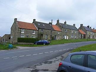
Egton, an Overview
Egton is a village and civil
parish in Yorkshire, about 8 km west of Whitby, and located within
the North York Moors National Park.
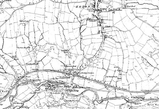
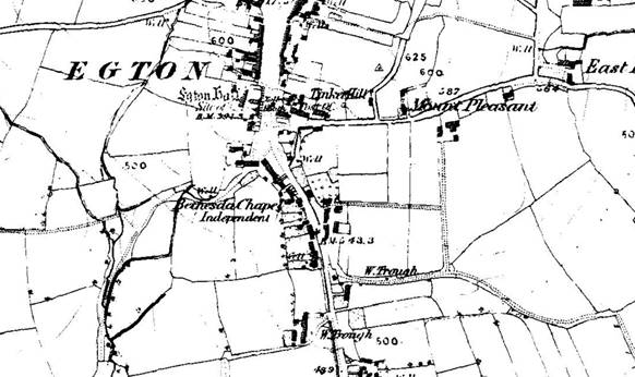
Egton 1857
Egton was variously
called Ectune, Egetune (eleventh century); Eggeton
(teelfth to fifteenth centuries); Egintona, Eggenton (twelfth
century); Ecton, Eketon (thirteenth and fourteenth cventuries).
Victoria
County History – Yorkshire, A History of the County of York North Riding:
Volume 2 Parishes: Egton, 1923:
Egton is a parochial
township, formerly in the parish of Lythe. It contains the small market town of
Egton and the hamlet of Egton Bridge, which has a station on the North
Yorkshire and Cleveland branch of the North Eastern railway. Westonby, Lealholm
and Sletholm in its area were villagess in the 12th century, as were Westonby
and Sletholm, the site of which is not known, in 1284–5.
In 1438–9 the lord of
Egton received £10 from the hamlet of Westonby, no longer in existence by 1538.
The name survives in Westonby House, Lodge and Moor. Egton was assessed for the
subsidy in 1301–2 as 'Egton with Leaserigg (Lecerigge), and Westonby and
Cocket.'
Part of Egton,
including Newbiggin, and lands in the parishes of Whitby and Pickering were
formed in 1852 into the ecclesiastical parish of Grosmont.
The area of the present
parish is 18,378 acres, of which 66 acres are covered by water, 2,005 acres are
arable land, 4,621 acres permanent grass, 1,405 acres woods and plantations and
the rest moorland. The cultivated land varies from 300 ft. to 600 ft., the
moors from 800 ft. to over 1,000 ft. above ordnance datum, the village of Egton
lying at an elevation of about 600 ft.
The subsoil is inferior
oolite and middle and upper lias, the soil being very varied.
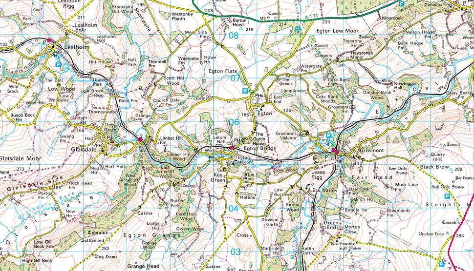
There is a nearby village
called Egton Bridge, which is home to Egton railway station.
Egton is an important local centre for family
history. Prior to 1880, many important Birth, Marriage and Death records were
administered from Egton parish. The church in Egton holds detailed
transcriptions of parish records. The cemetery is half a mile west, at the old
church site. After 1870 many parishioners were buried at nearby Aislaby.
Egton timeline
1060
Before the Conquest Swen had 3 carucates
at Egton as a 'manor'.
1086
The manor of Egton in 1086 measured 4
'leagues' by 2 'leagues,' the pasturable woodland 3 'leagues' by 2 'leagues.'
In 1086 the Count of Mortain was overlord of Egton.
Niel Fossard
was under-tenant in 1086.
This woodland district formed a forest
appurtenant to the manor of Egton from the 12th to the 16th century, but no
later mention of it has been found.
William Earl of Albemarle, who usurped
royal authority in the north in the reign of Stephen, is said to have destroyed
the vills of Westonby, Lealholm and Sletholm in making a
chase. Like the manor, it was in his hands in the reign of Henry II, as his
ward William Fossard, having committed a serious
offence against him, had been forced to fly the country.
1180
Egton was in the king's hands from 1180
to 1194, but later in the reign of Richard I was restored to Joan Fossard, wife of Robert de Turnham.
1222
Henry III in 1222 granted to Peter de
Mauley his forest of Egton, as his father-in-law Robert de Turnham had held it
in the reign of Richard I.
Sletholm was partly in the forest in 1272.
1544
'The forest called Egton Wood' is
mentioned in 1544.
1878
The old church of St Hilda stood on high
ground on the road to Glaisdale. It was pulled down in 1878 and a cemetery
chapel now occupies a portion of the site. The churchyard continued to be used
for burials.
Links, texts and books